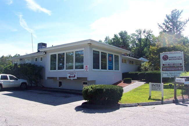
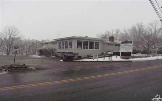
Property Record
325 Thompson Rd, Webster, MA 01570


Property Detail
325 Thompson Rd
Medicalbuilding
Worcester
GB-5 W
Massachusetts
AE The base floodplain where base flood elevations are provided. AE Zones are now used on new format FIRMs instead of A1-A30 Zones.
0.75 AC
2025
Outlying Worcester
2025
Boston
754100
Worcester, MA
4,554 SF
WEBS-000047-A000000-000004
NEARBY LISTINGS FOR SALE OR LEASE
DEMOGRAPHICS near 325 Thompson Rd
1 mile
3 mile
5 mile
2025 Total Population
1,539
23,480
37,163
2030 Population
1,587
23,914
37,995
Pop Growth 2025-2030
+ 3.12%
+ 1.85%
+ 2.24%
Average Age
48
43
43
2025 Total Households
686
10,064
15,232
HH Growth 2025-2030
+ 3.21%
+ 1.95%
+ 2.32%
Median Household Inc
$104,366
$72,224
$84,059
Avg Household Size
2.20
2.30
2.40
2025 Avg HH Vehicles
2.00
2.00
2.00
Median Home Value
$428,666
$365,227
$372,925
Median Year Built
1979
1962
1965
Nearby Places
Map Layers
Map Styles
 Street
 Aerial
Layers
 Traffic
 Biking
Places
Listings with unknown addresses are not visible on the map
- Restaurants
- Banks
- Shops
- Fitness
- Groceries
PUBLIC TRANSPORTATION
AIRPORT
Worcester Regional
Drive
Walk
Distance
Worcester Regional
32 min
19.4 mi
Freight Ports
Port of Boston
Drive
Walk
Distance
Port of Boston
77 min
58.5 mi
Nearby Properties
Address
Land Use
TOTAL SIZE
Lot Size
Zoning
Address
Land Use
TOTAL SIZE
Lot Size
Zoning
60.14 AC
Address
Land Use
TOTAL SIZE
Lot Size
Zoning
95,274 SF
10.18 AC
Address
Land Use
TOTAL SIZE
Lot Size
Zoning
9.05 AC
INDUST
Address
Land Use
TOTAL SIZE
Lot Size
Zoning
131,686 SF
14.60 AC
INDUST
Address
Land Use
TOTAL SIZE
Lot Size
Zoning
4.87 AC
INDUST
Address
Land Use
TOTAL SIZE
Lot Size
Zoning
10.09 AC
Address
Land Use
TOTAL SIZE
Lot Size
Zoning
101,227 SF
8.48 AC
Address
Land Use
TOTAL SIZE
Lot Size
Zoning
2.15 AC
GB-4 W
Address
Land Use
TOTAL SIZE
Lot Size
Zoning
102,704 SF
31 AC
GB-4 W
Address
Land Use
TOTAL SIZE
Lot Size
Zoning
164,660 SF
15.40 AC
INDUST
Address
Land Use
TOTAL SIZE
Lot Size
Zoning
Address
Land Use
TOTAL SIZE
Lot Size
Zoning
123,910 SF
10 AC
INDUST
Address
Land Use
TOTAL SIZE
Lot Size
Zoning
52,677 SF
15.17 AC
Address
Land Use
TOTAL SIZE
Lot Size
Zoning
8.96 AC
GB-5 W
Address
Land Use
TOTAL SIZE
Lot Size
Zoning
54,273 SF
8.94 AC
INDUST
Address
Land Use
TOTAL SIZE
Lot Size
Zoning
3.60 AC
Address
Land Use
TOTAL SIZE
Lot Size
Zoning
21,111 SF
1.71 AC
GB-4 W
Address
Land Use
TOTAL SIZE
Lot Size
Zoning
37,907 SF
28.50 AC
Address
Land Use
TOTAL SIZE
Lot Size
Zoning
18.60 AC
GB-5 W
Address
Land Use
TOTAL SIZE
Lot Size
Zoning
5.24 AC
GB-4 W
Address
Land Use
TOTAL SIZE
Lot Size
Zoning
33,063 SF
1.96 AC
Address
Land Use
TOTAL SIZE
Lot Size
Zoning
6.08 AC
MR-12,
Address
Land Use
TOTAL SIZE
Lot Size
Zoning
60,233 SF
4.09 AC
GB-4 W
Address
Land Use
TOTAL SIZE
Lot Size
Zoning
47,692 SF
1.89 AC
SFR-12
Address
Land Use
TOTAL SIZE
Lot Size
Zoning
29,360 SF
0.38 AC
Address
Land Use
TOTAL SIZE
Lot Size
Zoning
4,993 SF
4.38 AC
MR-12,
Address
Land Use
TOTAL SIZE
Lot Size
Zoning
3.42 AC
GB-4 W
Address
Land Use
TOTAL SIZE
Lot Size
Zoning
5,353 SF
38.95 AC
Address
Land Use
TOTAL SIZE
Lot Size
Zoning
23,435 SF
1.54 AC
Address
Land Use
TOTAL SIZE
Lot Size
Zoning
45,614 SF
1.79 AC
The World's #1 Commercial Real Estate Marketplace
Connect with us
© 2026 CoStar Group
The information above has been obtained from sources believed reliable. While we do not doubt its accuracy we have not verified it and make no guarantee, warranty or representation about it. It is your responsibility to independently confirm its accuracy and completeness. Any projections, opinions, assumptions, or estimates used are for example only and do not represent the current or future performance of the property. The value of this transaction to you depends on tax and other factors which should be evaluated by your tax, financial, and legal advisors. You and your advisors should conduct a careful, independent investigation of the property to determine to your satisfaction the suitability of the property for your needs.