Property Record
3250 Hwy 70 Se, Newton, NC 28658


NEARBY LISTINGS FOR SALE OR LEASE
Property Detail
3250 Hwy 70 Se
3721127651100000
3250 HWY 70 SE
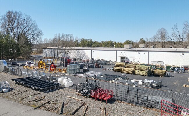
Storebuilding
Catawba
X
North Carolina
3710372100J
5.44 AC
2024
Catawba County
2025
Charlotte
011701
Hickory-Lenoir-Morganton, NC
62,600 SF
DEMOGRAPHICS near 3250 Hwy 70 Se
1 Mile
3 Mile
5 Mile
2024 Total Population
447
15,581
59,259
2029 Population
471
16,278
61,997
Pop Growth 2024-2029
+ 5.37%
+ 4.47%
+ 4.62%
Average Age
39
40
40
2024 Total Households
158
6,267
23,853
HH Growth 2024-2029
+ 5.06%
+ 4.37%
+ 4.58%
Median Household Inc
$33,863
$55,202
$53,845
Avg Household Size
2.40
2.40
2.40
2024 Avg HH Vehicles
2.00
2.00
2.00
Median Home Value
$117,500
$156,222
$166,901
Median Year Built
1977
1985
1980
Nearby Places
Map Layers
Map Styles
 Street
 Aerial
- Restaurants
- Banks
- Shops
- Fitness
- Groceries
SALE & LEASE HISTORY
LISTING DATE
SALE/LEASE

Sep 25, 2016
For Lease
Nov 19, 2019
For Sale
May 03, 2019
For Lease
May 03, 2019
For Sale
Jan 28, 2021
For Sale
Aug 26, 2020
For Sale
Apr 28, 2021
For Sale
Apr 20, 2017
For Sale
Nearby Properties
Address
Land Use
TOTAL SIZE
Lot Size
Zoning
Address
Land Use
TOTAL SIZE
Lot Size
Zoning
83,982 SF
96.78 AC
OI
Address
Land Use
TOTAL SIZE
Lot Size
Zoning
30,725 SF
17.17 AC
PD
Address
Land Use
TOTAL SIZE
Lot Size
Zoning
502,665 SF
53.28 AC
EM-1-CD
Address
Land Use
TOTAL SIZE
Lot Size
Zoning
57.59 AC
OI
Address
Land Use
TOTAL SIZE
Lot Size
Zoning
29,600 SF
19.05 AC
PD
Address
Land Use
TOTAL SIZE
Lot Size
Zoning
219,033 SF
32.95 AC
IND-CZ
Address
Land Use
TOTAL SIZE
Lot Size
Zoning
31,111 SF
8.79 AC
PD
Address
Land Use
TOTAL SIZE
Lot Size
Zoning
14,125 SF
16.76 AC
PD
Address
Land Use
TOTAL SIZE
Lot Size
Zoning
14,140 SF
15.26 AC
PD
Address
Land Use
TOTAL SIZE
Lot Size
Zoning
7,164 SF
45.82 AC
OI
Address
Land Use
TOTAL SIZE
Lot Size
Zoning
94,152 SF
14.46 AC
IND
Address
Land Use
TOTAL SIZE
Lot Size
Zoning
19,444 SF
8.84 AC
PD
Address
Land Use
TOTAL SIZE
Lot Size
Zoning
326,813 SF
37.87 AC
IND
Address
Land Use
TOTAL SIZE
Lot Size
Zoning
31,854 SF
24.55 AC
PD
Address
Land Use
TOTAL SIZE
Lot Size
Zoning
353,092 SF
35.72 AC
IND
Address
Land Use
TOTAL SIZE
Lot Size
Zoning
7,684 SF
11.85 AC
R-20-CD
Address
Land Use
TOTAL SIZE
Lot Size
Zoning
300,990 SF
30.42 AC
IND-CZ
Address
Land Use
TOTAL SIZE
Lot Size
Zoning
125,920 SF
19.53 AC
C-3
Address
Land Use
TOTAL SIZE
Lot Size
Zoning
191,040 SF
25.30 AC
IND-CZ
Address
Land Use
TOTAL SIZE
Lot Size
Zoning
234,541 SF
9.07 AC
C-3
Address
Land Use
TOTAL SIZE
Lot Size
Zoning
123,778 SF
19.99 AC
C-3
Address
Land Use
TOTAL SIZE
Lot Size
Zoning
248,173 SF
53.73 AC
B-4
Address
Land Use
TOTAL SIZE
Lot Size
Zoning
201,590 SF
20.31 AC
C-3
Address
Land Use
TOTAL SIZE
Lot Size
Zoning
31,778 SF
2.53 AC
OI
Address
Land Use
TOTAL SIZE
Lot Size
Zoning
385,204 SF
14.33 AC
C-3
Address
Land Use
TOTAL SIZE
Lot Size
Zoning
103,090 SF
36.13 AC
R-9
Address
Land Use
TOTAL SIZE
Lot Size
Zoning
39,752 SF
11.46 AC
PD
Address
Land Use
TOTAL SIZE
Lot Size
Zoning
150,498 SF
11.27 AC
M-1
Address
Land Use
TOTAL SIZE
Lot Size
Zoning
82,969 SF
19.30 AC
C-3
Address
Land Use
TOTAL SIZE
Lot Size
Zoning
8.96 AC
OI
The World's #1 Commercial Real Estate Marketplace
Connect with us
© 2026 CoStar Group
The information above has been obtained from sources believed reliable. While we do not doubt its accuracy we have not verified it and make no guarantee, warranty or representation about it. It is your responsibility to independently confirm its accuracy and completeness. Any projections, opinions, assumptions, or estimates used are for example only and do not represent the current or future performance of the property. The value of this transaction to you depends on tax and other factors which should be evaluated by your tax, financial, and legal advisors. You and your advisors should conduct a careful, independent investigation of the property to determine to your satisfaction the suitability of the property for your needs.