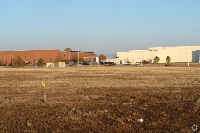
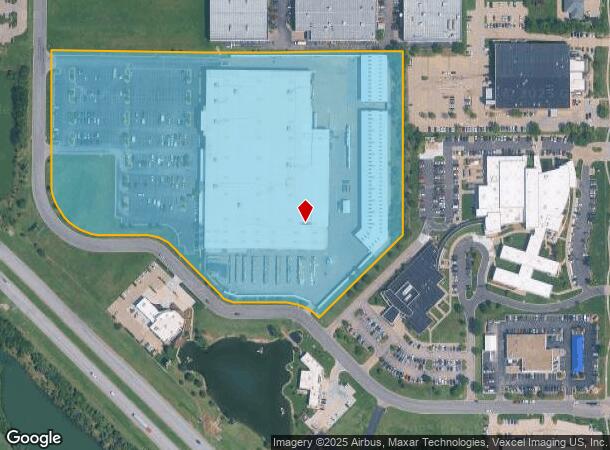
Property Record
3250 N Toben St, Wichita, KS 67226
NEARBY LISTINGS FOR SALE OR LEASE
Property Detail
3250 N Toben St
Wichita, KS
Firepoint Add
109-32-0-41-02-002.00
LOT 2 BLOCK A FIREPOINT ADDITION
Storebuilding
Sedgwick
X
Kansas
20173C0376G
2
2024
16.71 AC
2025
Northeast
010802
Wichita
184,034 SF
DEMOGRAPHICS near 3250 N Toben St
1 Mile
3 Mile
5 Mile
2024 Total Population
1,993
41,449
102,235
2029 Population
2,027
41,972
104,128
Pop Growth 2024-2029
+ 1.71%
+ 1.26%
+ 1.85%
Average Age
41
40
39
2024 Total Households
884
17,332
40,732
HH Growth 2024-2029
+ 1.70%
+ 1.18%
+ 1.74%
Median Household Inc
$73,916
$74,664
$69,760
Avg Household Size
2.20
2.30
2.40
2024 Avg HH Vehicles
2.00
2.00
2.00
Median Home Value
$311,926
$242,344
$223,737
Median Year Built
1993
1990
1982
Nearby Places
- Restaurants
- Banks
- Shops
- Fitness
- Groceries
PUBLIC TRANSPORTATION
AIRPORT
Wichita Dwight D Eisenhower Ntl
DRIVE
WALK
Distance
Wichita Dwight D Eisenhower Ntl
26 min
18.3 mi
Freight Ports
Tulsa Port Of Catoosa
DRIVE
WALK
Distance
Tulsa Port Of Catoosa
214 min
198.9 mi
Nearby Properties
Address
Land Use
TOTAL SIZE
Lot Size
Zoning
Address
Land Use
TOTAL SIZE
Lot Size
Zoning
340,322 SF
32.82 AC
SF-5,B
Address
Land Use
TOTAL SIZE
Lot Size
Zoning
256,570 SF
53.92 AC
R3
Address
Land Use
TOTAL SIZE
Lot Size
Zoning
243,768 SF
5.42 AC
LI
Address
Land Use
TOTAL SIZE
Lot Size
Zoning
366,272 SF
332.54 AC
LI
Address
Land Use
TOTAL SIZE
Lot Size
Zoning
169,134 SF
18.97 AC
SF-5
Address
Land Use
TOTAL SIZE
Lot Size
Zoning
79,739 SF
10.11 AC
R6
Address
Land Use
TOTAL SIZE
Lot Size
Zoning
69,125 SF
16.79 AC
MF-29,MF-1
Address
Land Use
TOTAL SIZE
Lot Size
Zoning
102,200 SF
8.77 AC
R6
Address
Land Use
TOTAL SIZE
Lot Size
Zoning
138,233 SF
23.01 AC
SF-5
Address
Land Use
TOTAL SIZE
Lot Size
Zoning
136,627 SF
27.46 AC
SF-5
Address
Land Use
TOTAL SIZE
Lot Size
Zoning
88,652 SF
21.92 AC
SF-5
Address
Land Use
TOTAL SIZE
Lot Size
Zoning
146,863 SF
14.24 AC
SF-5
Address
Land Use
TOTAL SIZE
Lot Size
Zoning
74,242 SF
23.99 AC
GC
Address
Land Use
TOTAL SIZE
Lot Size
Zoning
67,067 SF
8.36 AC
SF-5
Address
Land Use
TOTAL SIZE
Lot Size
Zoning
99,325 SF
17.83 AC
SF-5
Address
Land Use
TOTAL SIZE
Lot Size
Zoning
74,265 SF
15.01 AC
LC
Address
Land Use
TOTAL SIZE
Lot Size
Zoning
41,526 SF
17.52 AC
LC
Address
Land Use
TOTAL SIZE
Lot Size
Zoning
121,541 SF
47.63 AC
LI
Address
Land Use
TOTAL SIZE
Lot Size
Zoning
40,267 SF
10.55 AC
R6
Address
Land Use
TOTAL SIZE
Lot Size
Zoning
92,735 SF
7.28 AC
R4
Address
Land Use
TOTAL SIZE
Lot Size
Zoning
184,788 SF
19.75 AC
M-1
Address
Land Use
TOTAL SIZE
Lot Size
Zoning
116,114 SF
53.39 AC
SF-5
Address
Land Use
TOTAL SIZE
Lot Size
Zoning
70,447 SF
29.66 AC
SF-5,LC
Address
Land Use
TOTAL SIZE
Lot Size
Zoning
69,383 SF
9.53 AC
GO
Address
Land Use
TOTAL SIZE
Lot Size
Zoning
60,868 SF
4.17 AC
LI
Address
Land Use
TOTAL SIZE
Lot Size
Zoning
154,691 SF
8.40 AC
SF-5
Address
Land Use
TOTAL SIZE
Lot Size
Zoning
47,631 SF
13.66 AC
SF-5
Address
Land Use
TOTAL SIZE
Lot Size
Zoning
72,002 SF
11.81 AC
LC
Address
Land Use
TOTAL SIZE
Lot Size
Zoning
71,556 SF
19.67 AC
MF-18,MF-2
Address
Land Use
TOTAL SIZE
Lot Size
Zoning
70,357 SF
4.19 AC
SF-5
The World's #1 Commercial Real Estate Marketplace
Connect with us
© 2025 CoStar Group
The information above has been obtained from sources believed reliable. While we do not doubt its accuracy we have not verified it and make no guarantee, warranty or representation about it. It is your responsibility to independently confirm its accuracy and completeness. Any projections, opinions, assumptions, or estimates used are for example only and do not represent the current or future performance of the property. The value of this transaction to you depends on tax and other factors which should be evaluated by your tax, financial, and legal advisors. You and your advisors should conduct a careful, independent investigation of the property to determine to your satisfaction the suitability of the property for your needs.