Property Record
3257 Lawrenceville Hwy, Lawrenceville, GA 30044

This Property Is For Sale
NEARBY LISTINGS FOR SALE OR LEASE
Property Detail
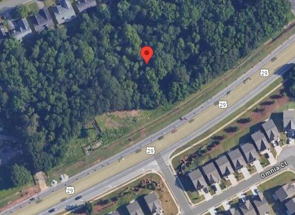
3257 Lawrenceville Hwy
Atlanta-Sandy Springs-Roswell, GA
Brookside Plantation
6-153-060
HWY 29
Commercialacreage
Gwinnett
X
Georgia
13135C0100F
8
2025
5.16 AC
2025
Lawrenceville/Lilburn
050554
Atlanta
DEMOGRAPHICS near 3257 Lawrenceville Hwy
1 Mile
3 Mile
5 Mile
2024 Total Population
9,796
107,807
252,897
2029 Population
10,313
111,527
262,229
Pop Growth 2024-2029
+ 5.28%
+ 3.45%
+ 3.69%
Average Age
35
36
37
2024 Total Households
2,905
35,934
84,216
HH Growth 2024-2029
+ 5.47%
+ 3.54%
+ 3.74%
Median Household Inc
$62,106
$60,360
$63,645
Avg Household Size
3.20
2.90
2.90
2024 Avg HH Vehicles
2.00
2.00
2.00
Median Home Value
$246,980
$260,231
$281,522
Median Year Built
1992
1991
1991
Nearby Places
Map Layers
Map Styles
 Street
 Aerial
- Restaurants
- Banks
- Shops
- Fitness
- Groceries
PUBLIC TRANSPORTATION
AIRPORT
Hartsfield - Jackson Atlanta International
DRIVE
WALK
Distance
Hartsfield - Jackson Atlanta International
49 min
33.8 mi
Freight Ports
Georgia Ports - Savannah
DRIVE
WALK
Distance
Georgia Ports - Savannah
302 min
265.6 mi
Nearby Properties
Address
Land Use
TOTAL SIZE
Lot Size
Zoning
Address
Land Use
TOTAL SIZE
Lot Size
Zoning
594,977 SF
47.90 AC
RM13
Address
Land Use
TOTAL SIZE
Lot Size
Zoning
563,525 SF
47.80 AC
RM13
Address
Land Use
TOTAL SIZE
Lot Size
Zoning
628,779 SF
97.15 AC
M1
Address
Land Use
TOTAL SIZE
Lot Size
Zoning
357,946 SF
30.92 AC
RM
Address
Land Use
TOTAL SIZE
Lot Size
Zoning
444,605 SF
37.43 AC
RM
Address
Land Use
TOTAL SIZE
Lot Size
Zoning
348,681 SF
35.52 AC
RM10
Address
Land Use
TOTAL SIZE
Lot Size
Zoning
440,998 SF
35.04 AC
RM
Address
Land Use
TOTAL SIZE
Lot Size
Zoning
464,756 SF
33.96 AC
RM13
Address
Land Use
TOTAL SIZE
Lot Size
Zoning
584,576 SF
38.60 AC
RM13
Address
Land Use
TOTAL SIZE
Lot Size
Zoning
419,855 SF
29.83 AC
RM13
Address
Land Use
TOTAL SIZE
Lot Size
Zoning
483,912 SF
43.10 AC
OI
Address
Land Use
TOTAL SIZE
Lot Size
Zoning
470,856 SF
34.99 AC
RM13
Address
Land Use
TOTAL SIZE
Lot Size
Zoning
314,338 SF
28.83 AC
RM13
Address
Land Use
TOTAL SIZE
Lot Size
Zoning
316,443 SF
30.15 AC
RM13
Address
Land Use
TOTAL SIZE
Lot Size
Zoning
265,226 SF
18.05 AC
RM
Address
Land Use
TOTAL SIZE
Lot Size
Zoning
336,554 SF
30.40 AC
RM
Address
Land Use
TOTAL SIZE
Lot Size
Zoning
412,644 SF
23.17 AC
RM
Address
Land Use
TOTAL SIZE
Lot Size
Zoning
313,246 SF
17.15 AC
RM13
Address
Land Use
TOTAL SIZE
Lot Size
Zoning
364,994 SF
34.06 AC
RM13
Address
Land Use
TOTAL SIZE
Lot Size
Zoning
409,542 SF
35.94 AC
RM13
Address
Land Use
TOTAL SIZE
Lot Size
Zoning
331,159 SF
35.49 AC
RM8
Address
Land Use
TOTAL SIZE
Lot Size
Zoning
420,759 SF
33.62 AC
RM13
Address
Land Use
TOTAL SIZE
Lot Size
Zoning
371,383 SF
29.56 AC
RM13
Address
Land Use
TOTAL SIZE
Lot Size
Zoning
287,502 SF
43.15 AC
R1
Address
Land Use
TOTAL SIZE
Lot Size
Zoning
206,297 SF
25.06 AC
RA200
Address
Land Use
TOTAL SIZE
Lot Size
Zoning
306,330 SF
26.20 AC
RM
Address
Land Use
TOTAL SIZE
Lot Size
Zoning
300,402 SF
24.55 AC
RM13
Address
Land Use
TOTAL SIZE
Lot Size
Zoning
283,958 SF
23.75 AC
RM13
Address
Land Use
TOTAL SIZE
Lot Size
Zoning
517,654 SF
28.39 AC
RM
Address
Land Use
TOTAL SIZE
Lot Size
Zoning
290,652 SF
35.67 AC
RM8
The World's #1 Commercial Real Estate Marketplace
Connect with us
© 2025 CoStar Group
The information above has been obtained from sources believed reliable. While we do not doubt its accuracy we have not verified it and make no guarantee, warranty or representation about it. It is your responsibility to independently confirm its accuracy and completeness. Any projections, opinions, assumptions, or estimates used are for example only and do not represent the current or future performance of the property. The value of this transaction to you depends on tax and other factors which should be evaluated by your tax, financial, and legal advisors. You and your advisors should conduct a careful, independent investigation of the property to determine to your satisfaction the suitability of the property for your needs.