Property Record
3261 E Pecos Rd, Gilbert, AZ 85295
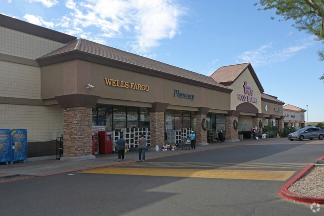

Property Detail
3261 E Pecos Rd
304-51-963A
FRYS AT SEC PECOS ROAD AND HIGLEY ROAD MCR 677-27
Regionalshoppingcenterormallwithanchorstore
Maricopa
C-C
Arizona
C and X Area of minimal flood hazard, usually depicted on FIRMs as above the 500-year flood level.
1
2025
8.64 AC
2025
Gilbert
815700
Phoenix
65,380 SF
Phoenix-Mesa-Chandler, AZ
NEARBY LISTINGS FOR SALE OR LEASE
DEMOGRAPHICS near 3261 E Pecos Rd
1 mile
3 mile
5 mile
2024 Total Population
14,942
112,826
235,378
2029 Population
16,114
123,215
255,766
Pop Growth 2024-2029
+ 7.84%
+ 9.21%
+ 8.66%
Average Age
34
35
35
2024 Total Households
4,465
36,610
74,256
HH Growth 2024-2029
+ 7.86%
+ 9.49%
+ 8.82%
Median Household Inc
$122,166
$107,739
$117,217
Avg Household Size
3.30
3.00
3.10
2024 Avg HH Vehicles
2.00
2.00
2.00
Median Home Value
$442,307
$445,941
$467,091
Median Year Built
2005
2007
2005
Nearby Places
Map Layers
Map Styles
 Street
 Aerial
Transit
 Traffic
 Biking
Places
Listings with unknown addresses are not visible on the map
- Restaurants
- Banks
- Shops
- Fitness
- Groceries
PUBLIC TRANSPORTATION
AIRPORT
Phoenix-Mesa Gateway
Drive
Walk
Distance
Phoenix-Mesa Gateway
9 min
4.9 mi
Phoenix Sky Harbor International
Drive
Walk
Distance
Phoenix Sky Harbor International
37 min
27.5 mi
Freight Ports
Port of San Diego
Drive
Walk
Distance
Port of San Diego
409 min
371.8 mi
Nearby Properties
Address
Land Use
TOTAL SIZE
Lot Size
Zoning
Address
Land Use
TOTAL SIZE
Lot Size
Zoning
837,332 SF
55.22 AC
PF
Address
Land Use
TOTAL SIZE
Lot Size
Zoning
Address
Land Use
TOTAL SIZE
Lot Size
Zoning
93,214 SF
10.60 AC
PF
Address
Land Use
TOTAL SIZE
Lot Size
Zoning
862,568 SF
420.15 AC
PS
Address
Land Use
TOTAL SIZE
Lot Size
Zoning
22.83 AC
PF
Address
Land Use
TOTAL SIZE
Lot Size
Zoning
604,432 SF
56.74 AC
PF
Address
Land Use
TOTAL SIZE
Lot Size
Zoning
2.91 AC
Address
Land Use
TOTAL SIZE
Lot Size
Zoning
298,703 SF
57.08 AC
PF
Address
Land Use
TOTAL SIZE
Lot Size
Zoning
479,727 SF
14.25 AC
MFM
Address
Land Use
TOTAL SIZE
Lot Size
Zoning
245,425 SF
205.62 AC
I-1
Address
Land Use
TOTAL SIZE
Lot Size
Zoning
412,581 SF
21.15 AC
MFM
Address
Land Use
TOTAL SIZE
Lot Size
Zoning
430,700 SF
63.32 AC
PF
Address
Land Use
TOTAL SIZE
Lot Size
Zoning
254,314 SF
23.55 AC
R-43
Address
Land Use
TOTAL SIZE
Lot Size
Zoning
396,754 SF
46.84 AC
PF
Address
Land Use
TOTAL SIZE
Lot Size
Zoning
348,668 SF
8.97 AC
R3
Address
Land Use
TOTAL SIZE
Lot Size
Zoning
238,386 SF
40.25 AC
BP
Address
Land Use
TOTAL SIZE
Lot Size
Zoning
387,535 SF
15.80 AC
C-G
Address
Land Use
TOTAL SIZE
Lot Size
Zoning
380,383 SF
14.79 AC
C-G
Address
Land Use
TOTAL SIZE
Lot Size
Zoning
323,064 SF
15.90 AC
MFM
Address
Land Use
TOTAL SIZE
Lot Size
Zoning
362,701 SF
9.77 AC
R3
Address
Land Use
TOTAL SIZE
Lot Size
Zoning
335,464 SF
13.41 AC
Address
Land Use
TOTAL SIZE
Lot Size
Zoning
583,955 SF
34.92 AC
LI
Address
Land Use
TOTAL SIZE
Lot Size
Zoning
278,044 SF
19.98 AC
PF
Address
Land Use
TOTAL SIZE
Lot Size
Zoning
308,343 SF
13.90 AC
MFM
Address
Land Use
TOTAL SIZE
Lot Size
Zoning
266,467 SF
47.47 AC
PF
Address
Land Use
TOTAL SIZE
Lot Size
Zoning
332,112 SF
15.44 AC
M-M
Address
Land Use
TOTAL SIZE
Lot Size
Zoning
275,813 SF
24.90 AC
R-CH
Address
Land Use
TOTAL SIZE
Lot Size
Zoning
316,979 SF
17.26 AC
MF/M
Address
Land Use
TOTAL SIZE
Lot Size
Zoning
283,393 SF
6 AC
GVC
Address
Land Use
TOTAL SIZE
Lot Size
Zoning
317,739 SF
14.05 AC
MF/M
The World's #1 Commercial Real Estate Marketplace
Connect with us
© 2026 CoStar Group
The information above has been obtained from sources believed reliable. While we do not doubt its accuracy we have not verified it and make no guarantee, warranty or representation about it. It is your responsibility to independently confirm its accuracy and completeness. Any projections, opinions, assumptions, or estimates used are for example only and do not represent the current or future performance of the property. The value of this transaction to you depends on tax and other factors which should be evaluated by your tax, financial, and legal advisors. You and your advisors should conduct a careful, independent investigation of the property to determine to your satisfaction the suitability of the property for your needs.