Property Record
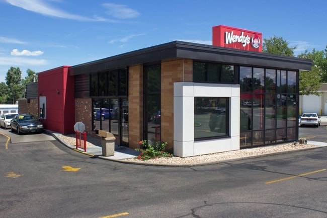
3267 W 10Th St, Greeley, CO 80634


Property Detail
3267 W 10Th St
R8957222
PT SW4SW4 1-5-66 COMM SW COR SEC N88D46E 466.70 N30 N88D46E 494.17 N0D51W 10 TO TRUE POB N0D51W 199.97 S88D48W 26.38 N01D13W 19.93 S88D48W 162 S01D13E 219.99 N88D46E 187.10 TO POB EXC COMM S4 SEC COR TH N89D09W 1726.93 S00D29E 11.2 S89D08W 187.1 N00D
Miscellaneous
Weld
B and X Area of moderate flood hazard, usually the area between the limits of the 100-year and 500-year floods.
Colorado
2024
0.88 AC
2025
Greeley
001300
Denver
2,846 SF
Greeley, CO
NEARBY LISTINGS FOR SALE OR LEASE
DEMOGRAPHICS near 3267 W 10Th St
1 mile
3 mile
5 mile
2024 Total Population
17,577
104,814
155,333
2029 Population
19,236
115,831
171,350
Pop Growth 2024-2029
+ 9.44%
+ 10.51%
+ 10.31%
Average Age
38
37
36
2024 Total Households
6,363
38,509
55,387
HH Growth 2024-2029
+ 9.76%
+ 11.29%
+ 10.92%
Median Household Inc
$65,090
$63,026
$67,950
Avg Household Size
2.70
2.60
2.70
2024 Avg HH Vehicles
2.00
2.00
2.00
Median Home Value
$353,423
$377,566
$383,086
Median Year Built
1975
1984
1992
Nearby Places
Map Layers
Map Styles
 Street
 Aerial
Transit
 Traffic
 Biking
Places
Listings with unknown addresses are not visible on the map
- Restaurants
- Banks
- Shops
- Fitness
- Groceries
Nearby Properties
Address
Land Use
TOTAL SIZE
Lot Size
Zoning
Address
Land Use
TOTAL SIZE
Lot Size
Zoning
1,682,342 SF
134.62 AC
Address
Land Use
TOTAL SIZE
Lot Size
Zoning
1,181,203 SF
23.26 AC
Address
Land Use
TOTAL SIZE
Lot Size
Zoning
689,580 SF
65.15 AC
Address
Land Use
TOTAL SIZE
Lot Size
Zoning
669,727 SF
180.71 AC
Address
Land Use
TOTAL SIZE
Lot Size
Zoning
393,166 SF
4.53 AC
Address
Land Use
TOTAL SIZE
Lot Size
Zoning
280,000 SF
43.91 AC
Address
Land Use
TOTAL SIZE
Lot Size
Zoning
536,281 SF
33.91 AC
Address
Land Use
TOTAL SIZE
Lot Size
Zoning
237,575 SF
10.77 AC
Address
Land Use
TOTAL SIZE
Lot Size
Zoning
67,456 SF
40.89 AC
Address
Land Use
TOTAL SIZE
Lot Size
Zoning
151,418 SF
16.96 AC
Address
Land Use
TOTAL SIZE
Lot Size
Zoning
113,715 SF
9.42 AC
Address
Land Use
TOTAL SIZE
Lot Size
Zoning
83,032 SF
9.23 AC
Address
Land Use
TOTAL SIZE
Lot Size
Zoning
99,348 SF
5.85 AC
Address
Land Use
TOTAL SIZE
Lot Size
Zoning
118,663 SF
13.36 AC
Address
Land Use
TOTAL SIZE
Lot Size
Zoning
138,446 SF
14.40 AC
Address
Land Use
TOTAL SIZE
Lot Size
Zoning
88,284 SF
5.80 AC
Address
Land Use
TOTAL SIZE
Lot Size
Zoning
34,697 SF
55.28 AC
Address
Land Use
TOTAL SIZE
Lot Size
Zoning
700,277 SF
16.35 AC
Address
Land Use
TOTAL SIZE
Lot Size
Zoning
219,178 SF
22.28 AC
Address
Land Use
TOTAL SIZE
Lot Size
Zoning
214,594 SF
22.70 AC
Address
Land Use
TOTAL SIZE
Lot Size
Zoning
289,203 SF
12.28 AC
Address
Land Use
TOTAL SIZE
Lot Size
Zoning
79,313 SF
23.46 AC
Address
Land Use
TOTAL SIZE
Lot Size
Zoning
122,023 SF
12.29 AC
Address
Land Use
TOTAL SIZE
Lot Size
Zoning
63,960 SF
3.67 AC
Address
Land Use
TOTAL SIZE
Lot Size
Zoning
105,705 SF
9.24 AC
Address
Land Use
TOTAL SIZE
Lot Size
Zoning
202,130 SF
25.35 AC
Address
Land Use
TOTAL SIZE
Lot Size
Zoning
405,388 SF
17.36 AC
Address
Land Use
TOTAL SIZE
Lot Size
Zoning
239,925 SF
6.06 AC
Address
Land Use
TOTAL SIZE
Lot Size
Zoning
127,822 SF
1.38 AC
Address
Land Use
TOTAL SIZE
Lot Size
Zoning
132,968 SF
1.24 AC
The World's #1 Commercial Real Estate Marketplace
Connect with us
© 2026 CoStar Group
The information above has been obtained from sources believed reliable. While we do not doubt its accuracy we have not verified it and make no guarantee, warranty or representation about it. It is your responsibility to independently confirm its accuracy and completeness. Any projections, opinions, assumptions, or estimates used are for example only and do not represent the current or future performance of the property. The value of this transaction to you depends on tax and other factors which should be evaluated by your tax, financial, and legal advisors. You and your advisors should conduct a careful, independent investigation of the property to determine to your satisfaction the suitability of the property for your needs.