Property Record
327 E Irving Ave, Oshkosh, WI 54901
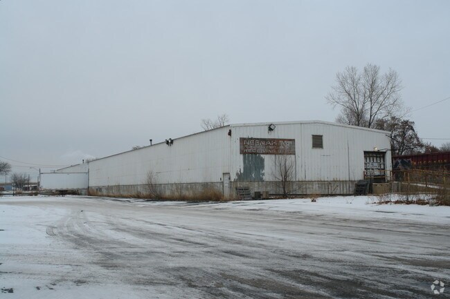

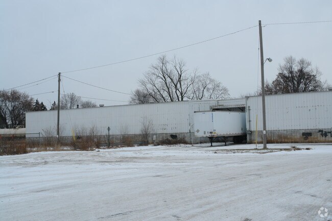
Property Detail
327 E Irving Ave
04-03890000
CSM 5075 LOT 1
Taxexempt
Winnebago
I2
Wisconsin
B and X Area of moderate flood hazard, usually the area between the limits of the 100-year and 500-year floods.
1
0
5.71 AC
2024
Appleton/Oshkosh
000400
Other Market Areas
14,590 SF
Oshkosh-Neenah, WI
NEARBY LISTINGS FOR SALE OR LEASE
DEMOGRAPHICS near 327 E Irving Ave
1 mile
3 mile
5 mile
2025 Total Population
10,224
44,244
73,369
2030 Population
10,351
44,647
74,264
Pop Growth 2025-2030
+ 1.24%
+ 0.91%
+ 1.22%
Average Age
39
40
41
2025 Total Households
4,537
18,806
31,065
HH Growth 2025-2030
+ 1.19%
+ 0.88%
+ 1.16%
Median Household Inc
$65,833
$72,047
$74,653
Avg Household Size
2.20
2.30
2.30
2025 Avg HH Vehicles
2.00
2.00
2.00
Median Home Value
$159,953
$199,498
$231,878
Median Year Built
1955
1968
1975
Nearby Places
Map Layers
Map Styles
 Street
 Aerial
Layers
 Traffic
 Biking
Places
Listings with unknown addresses are not visible on the map
- Restaurants
- Banks
- Shops
- Fitness
- Groceries
PUBLIC TRANSPORTATION
AIRPORT
Appleton International
Drive
Walk
Distance
Appleton International
29 min
20.5 mi
Freight Ports
Port Milwaukee
Drive
Walk
Distance
Port Milwaukee
107 min
89.7 mi
Nearby Properties
Address
Land Use
TOTAL SIZE
Lot Size
Zoning
Address
Land Use
TOTAL SIZE
Lot Size
Zoning
32.81 AC
CBPPD
Address
Land Use
TOTAL SIZE
Lot Size
Zoning
7.74 AC
Address
Land Use
TOTAL SIZE
Lot Size
Zoning
208,278 SF
22.77 AC
C2
Address
Land Use
TOTAL SIZE
Lot Size
Zoning
570,585 SF
81.26 AC
M2
Address
Land Use
TOTAL SIZE
Lot Size
Zoning
552,602 SF
7.28 AC
M3
Address
Land Use
TOTAL SIZE
Lot Size
Zoning
128,951 SF
4.95 AC
R1
Address
Land Use
TOTAL SIZE
Lot Size
Zoning
485,007 SF
41.76 AC
M3
Address
Land Use
TOTAL SIZE
Lot Size
Zoning
195,847 SF
4.66 AC
UMU-PD
Address
Land Use
TOTAL SIZE
Lot Size
Zoning
14.77 AC
SMU-PD
Address
Land Use
TOTAL SIZE
Lot Size
Zoning
2.29 AC
RMUPDRFO
Address
Land Use
TOTAL SIZE
Lot Size
Zoning
70,672 SF
4.97 AC
Address
Land Use
TOTAL SIZE
Lot Size
Zoning
161,640 SF
18.54 AC
C-2PD
Address
Land Use
TOTAL SIZE
Lot Size
Zoning
70,335 SF
16 AC
HI
Address
Land Use
TOTAL SIZE
Lot Size
Zoning
2.63 AC
RMU-PD-RFO
Address
Land Use
TOTAL SIZE
Lot Size
Zoning
2.40 AC
CBP-PD
Address
Land Use
TOTAL SIZE
Lot Size
Zoning
152,505 SF
6.54 AC
MR-20-RFO
Address
Land Use
TOTAL SIZE
Lot Size
Zoning
136,368 SF
10.24 AC
C-2PD
Address
Land Use
TOTAL SIZE
Lot Size
Zoning
84,363 SF
10.97 AC
C-2PD
Address
Land Use
TOTAL SIZE
Lot Size
Zoning
53,998 SF
3.63 AC
C2
Address
Land Use
TOTAL SIZE
Lot Size
Zoning
175,906 SF
11.60 AC
MR-20
Address
Land Use
TOTAL SIZE
Lot Size
Zoning
1.78 AC
C3
Address
Land Use
TOTAL SIZE
Lot Size
Zoning
107,778 SF
8.57 AC
SMUPD
Address
Land Use
TOTAL SIZE
Lot Size
Zoning
9.86 AC
MR-12
Address
Land Use
TOTAL SIZE
Lot Size
Zoning
92,958 SF
1.02 AC
C2
Address
Land Use
TOTAL SIZE
Lot Size
Zoning
128,951 SF
1.15 AC
R1;SINGLE
Address
Land Use
TOTAL SIZE
Lot Size
Zoning
80,118 SF
7.88 AC
C2
Address
Land Use
TOTAL SIZE
Lot Size
Zoning
34,340 SF
8.56 AC
C2
Address
Land Use
TOTAL SIZE
Lot Size
Zoning
114,338 SF
10.20 AC
C2
Address
Land Use
TOTAL SIZE
Lot Size
Zoning
140,296 SF
13.58 AC
C-2
Address
Land Use
TOTAL SIZE
Lot Size
Zoning
101,011 SF
16.53 AC
C3
The World's #1 Commercial Real Estate Marketplace
Connect with us
© 2026 CoStar Group
The information above has been obtained from sources believed reliable. While we do not doubt its accuracy we have not verified it and make no guarantee, warranty or representation about it. It is your responsibility to independently confirm its accuracy and completeness. Any projections, opinions, assumptions, or estimates used are for example only and do not represent the current or future performance of the property. The value of this transaction to you depends on tax and other factors which should be evaluated by your tax, financial, and legal advisors. You and your advisors should conduct a careful, independent investigation of the property to determine to your satisfaction the suitability of the property for your needs.