Property Record
327 Riggs St, Oxford, CT 06478
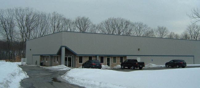

Property Detail
327 Riggs St
OXFO-000025-000018-000004-000007
Naugatuck Vly
Industrialgeneral
Connecticut
IND
4-7
A Areas with a 1% annual chance of flooding and a 26% chance of flooding over the life of a 30-year mortgage.
5.62 AC
2025
Naugatuck
2025
Westchester/So Connecticut
346102
New Haven, CT
14,960 SF
NEARBY LISTINGS FOR SALE OR LEASE
DEMOGRAPHICS near 327 Riggs St
1 mile
3 mile
5 mile
2025 Total Population
1,717
12,575
60,837
2030 Population
1,807
13,114
62,743
Pop Growth 2025-2030
+ 5.24%
+ 4.29%
+ 3.13%
Average Age
49
43
43
2025 Total Households
689
4,846
23,759
HH Growth 2025-2030
+ 5.08%
+ 4.13%
+ 3.09%
Median Household Inc
$117,218
$106,148
$100,257
Avg Household Size
2.40
2.50
2.50
2025 Avg HH Vehicles
2.00
2.00
2.00
Median Home Value
$473,333
$431,116
$378,938
Median Year Built
2002
1982
1975
Nearby Places
Map Layers
Map Styles
 Street
 Aerial
Layers
 Traffic
 Biking
Places
Listings with unknown addresses are not visible on the map
- Restaurants
- Banks
- Shops
- Fitness
- Groceries
PUBLIC TRANSPORTATION
COMMUTER RAIL
Naugatuck Station (New Haven Line - Metro-North Commuter Railroad Company (Metro-North))
Drive
Walk
Distance
Naugatuck Station (New Haven Line - Metro-North Commuter Railroad Company (Metro-North))
16 min
5.5 mi
Beacon Falls Station (New Haven Line - Metro-North Commuter Railroad Company (Metro-North))
Drive
Walk
Distance
Beacon Falls Station (New Haven Line - Metro-North Commuter Railroad Company (Metro-North))
15 min
7.2 mi
AIRPORT
Tweed/New Haven
Drive
Walk
Distance
Tweed/New Haven
43 min
22.7 mi
Freight Ports
Port of New Haven
Drive
Walk
Distance
Port of New Haven
38 min
19.8 mi
Nearby Properties
Address
Land Use
TOTAL SIZE
Lot Size
Zoning
Address
Land Use
TOTAL SIZE
Lot Size
Zoning
404.50 AC
IND
Address
Land Use
TOTAL SIZE
Lot Size
Zoning
17,181 SF
18.82 AC
R30
Address
Land Use
TOTAL SIZE
Lot Size
Zoning
268,279 SF
52.80 AC
RA1
Address
Land Use
TOTAL SIZE
Lot Size
Zoning
17.80 AC
IND
Address
Land Use
TOTAL SIZE
Lot Size
Zoning
20.30 AC
IND
Address
Land Use
TOTAL SIZE
Lot Size
Zoning
13,440 SF
15.60 AC
RA1
Address
Land Use
TOTAL SIZE
Lot Size
Zoning
40.53 AC
L200
Address
Land Use
TOTAL SIZE
Lot Size
Zoning
26.10 AC
RESA
Address
Land Use
TOTAL SIZE
Lot Size
Zoning
137,519 SF
10.11 AC
IND
Address
Land Use
TOTAL SIZE
Lot Size
Zoning
20 AC
IND
Address
Land Use
TOTAL SIZE
Lot Size
Zoning
59,580 SF
12.45 AC
R8
Address
Land Use
TOTAL SIZE
Lot Size
Zoning
62.31 AC
IND
Address
Land Use
TOTAL SIZE
Lot Size
Zoning
110,160 SF
24.13 AC
IND
Address
Land Use
TOTAL SIZE
Lot Size
Zoning
142,146 SF
6.63 AC
B-2
Address
Land Use
TOTAL SIZE
Lot Size
Zoning
717.07 AC
RA1
Address
Land Use
TOTAL SIZE
Lot Size
Zoning
60,528 SF
10 AC
IND
Address
Land Use
TOTAL SIZE
Lot Size
Zoning
193,112 SF
12 AC
R8
Address
Land Use
TOTAL SIZE
Lot Size
Zoning
5 AC
RA1
Address
Land Use
TOTAL SIZE
Lot Size
Zoning
9.66 AC
IND
Address
Land Use
TOTAL SIZE
Lot Size
Zoning
60,000 SF
12 AC
IND
Address
Land Use
TOTAL SIZE
Lot Size
Zoning
36,900 SF
8.90 AC
RA1
Address
Land Use
TOTAL SIZE
Lot Size
Zoning
43,250 SF
6.20 AC
IND
Address
Land Use
TOTAL SIZE
Lot Size
Zoning
45,000 SF
5.36 AC
IND
Address
Land Use
TOTAL SIZE
Lot Size
Zoning
51,345 SF
6.75 AC
IND
Address
Land Use
TOTAL SIZE
Lot Size
Zoning
67,910 SF
5.60 AC
IND
Address
Land Use
TOTAL SIZE
Lot Size
Zoning
35.94 AC
RESA
Address
Land Use
TOTAL SIZE
Lot Size
Zoning
7.84 AC
RA1
Address
Land Use
TOTAL SIZE
Lot Size
Zoning
13,120 SF
5.68 AC
RESA
Address
Land Use
TOTAL SIZE
Lot Size
Zoning
29,258 SF
4.40 AC
RA1
Address
Land Use
TOTAL SIZE
Lot Size
Zoning
50,937 SF
7.25 AC
GI40
The World's #1 Commercial Real Estate Marketplace
Connect with us
© 2026 CoStar Group
The information above has been obtained from sources believed reliable. While we do not doubt its accuracy we have not verified it and make no guarantee, warranty or representation about it. It is your responsibility to independently confirm its accuracy and completeness. Any projections, opinions, assumptions, or estimates used are for example only and do not represent the current or future performance of the property. The value of this transaction to you depends on tax and other factors which should be evaluated by your tax, financial, and legal advisors. You and your advisors should conduct a careful, independent investigation of the property to determine to your satisfaction the suitability of the property for your needs.