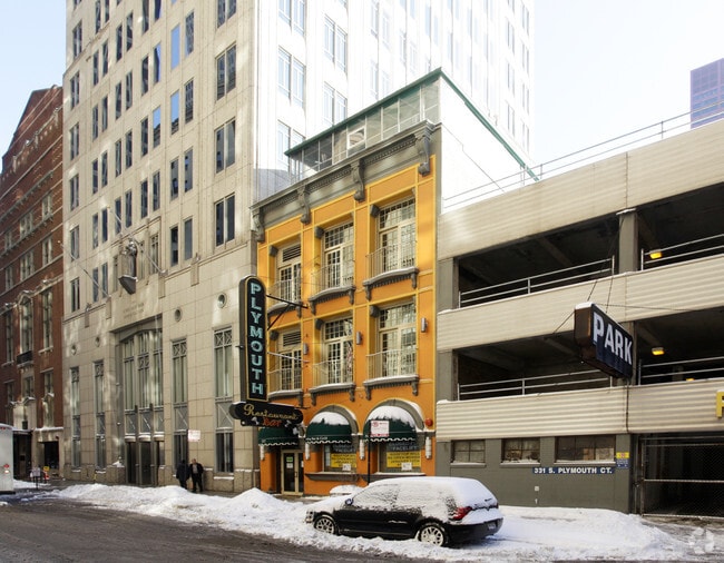
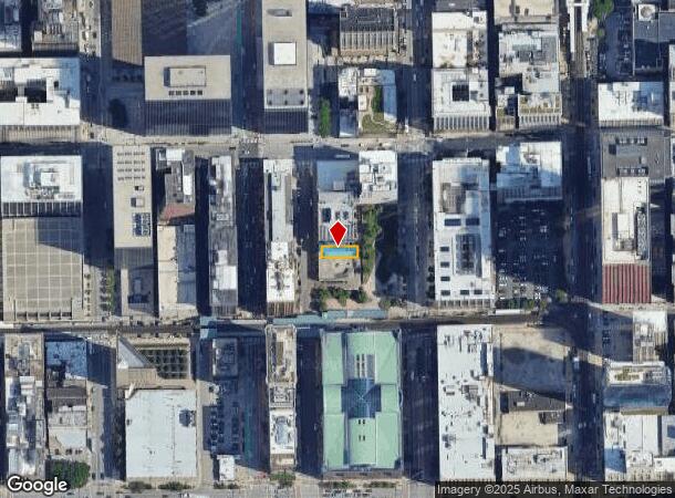
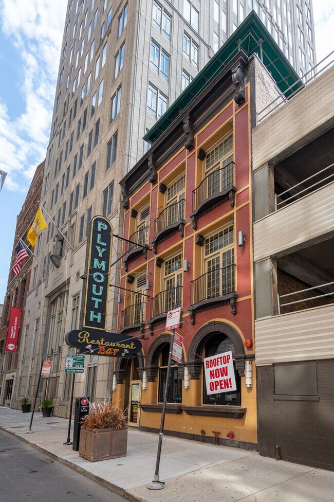
Property Record
327 S Plymouth Ct, Chicago, IL 60604

NEARBY LISTINGS FOR SALE OR LEASE
Property Detail
327 S Plymouth Ct
Chicago-Naperville-Elgin, IL-IN-WI
Assessors Sub
17-16-235-005-0000
(ASSESSORS) SUB OF LTS2,5,8,11,14,17,20,23 IN BLK139 OF SCHOOL SECTION ADD TO CHICAGO SUB IN SEC 16-39-14
Storebuilding
Cook
X
Illinois
17031C0419J
2,5,8
2023
0.61 AC
2024
Central Loop
839100
Chicago
8,400 SF
DEMOGRAPHICS near 327 S Plymouth Ct
1 Mile
3 Mile
5 Mile
2024 Total Population
88,915
384,966
779,486
2029 Population
89,058
379,048
755,936
Pop Growth 2024-2029
+ 0.16%
(1.54%)
(3.02%)
Average Age
37
38
37
2024 Total Households
51,868
208,622
383,795
HH Growth 2024-2029
(0.05%)
(1.50%)
(2.85%)
Median Household Inc
$118,303
$108,292
$93,348
Avg Household Size
1.60
1.80
1.90
2024 Avg HH Vehicles
1.00
1.00
1.00
Median Home Value
$442,617
$477,886
$466,152
Median Year Built
2003
1989
1973
Nearby Places
Map Layers
Map Styles
 Street
 Aerial
- Restaurants
- Banks
- Shops
- Fitness
- Groceries
PUBLIC TRANSPORTATION
TRANSIT/SUBWAY
Harold Washington Library-State/Van Buren (Brown Line - Chicago Transit Authority "L" Trains (The "L"), Orange Line - Chicago Transit Authority "L" Trains (The "L"), Pink Line - Chicago Transit Authority "L" Trains (The "L"), Purple Line - Chicago Transit Authority "L" Trains (The "L"))
DRIVE
WALK
Distance
Harold Washington Library-State/Van Buren (Brown Line - Chicago Transit Authority "L" Trains (The "L"), Orange Line - Chicago Transit Authority "L" Trains (The "L"), Pink Line - Chicago Transit Authority "L" Trains (The "L"), Purple Line - Chicago Transit Authority "L" Trains (The "L"))
1 min
1 min
0.0 mi
Jackson Station (Blue Line) (Blue Line - Chicago Transit Authority "L" Trains (The "L"))
DRIVE
WALK
Distance
Jackson Station (Blue Line) (Blue Line - Chicago Transit Authority "L" Trains (The "L"))
0 min
2 min
0.1 mi
Jackson Station (Red Line) (Red Line - Chicago Transit Authority "L" Trains (The "L"))
DRIVE
WALK
Distance
Jackson Station (Red Line) (Red Line - Chicago Transit Authority "L" Trains (The "L"))
0 min
2 min
0.1 mi
LaSalle Station (Blue Line) (Blue Line - Chicago Transit Authority "L" Trains (The "L"))
DRIVE
WALK
Distance
LaSalle Station (Blue Line) (Blue Line - Chicago Transit Authority "L" Trains (The "L"))
1 min
6 min
0.3 mi
Chicago LaSalle Station (Rock Island District Line - Northeast Illinois Regional Commuter Railroad (Metra))
DRIVE
WALK
Distance
Chicago LaSalle Station (Rock Island District Line - Northeast Illinois Regional Commuter Railroad (Metra))
2 min
7 min
0.3 mi
COMMUTER RAIL
Chicago LaSalle Station (Rock Island District Line - Northeast Illinois Regional Commuter Railroad (Metra))
DRIVE
WALK
Distance
Chicago LaSalle Station (Rock Island District Line - Northeast Illinois Regional Commuter Railroad (Metra))
2 min
7 min
0.3 mi
Van Buren Station (Metra Electric Line - Northeast Illinois Regional Commuter Railroad (Metra))
DRIVE
WALK
Distance
Van Buren Station (Metra Electric Line - Northeast Illinois Regional Commuter Railroad (Metra))
2 min
7 min
0.4 mi
AIRPORT
Chicago Midway International
DRIVE
WALK
Distance
Chicago Midway International
19 min
12.2 mi
Chicago O'Hare International
DRIVE
WALK
Distance
Chicago O'Hare International
29 min
18.2 mi
SALE & LEASE HISTORY
LISTING DATE
SALE/LEASE

Sep 09, 2020
For Sale
Mar 07, 2024
For Lease
Jul 20, 2023
For Sale
Aug 23, 2019
For Sale
Apr 14, 2017
For Lease
Apr 01, 2024
For Lease
Nearby Properties
Address
Land Use
TOTAL SIZE
Lot Size
Zoning
Address
Land Use
TOTAL SIZE
Lot Size
Zoning
4,667,723 SF
2.94 AC
DC-16
Address
Land Use
TOTAL SIZE
Lot Size
Zoning
1,546,909 SF
0.98 AC
PD 1369
Address
Land Use
TOTAL SIZE
Lot Size
Zoning
3,457,865 SF
3.74 AC
PD 70
Address
Land Use
TOTAL SIZE
Lot Size
Zoning
1,362,475 SF
1.97 AC
PD 1226
Address
Land Use
TOTAL SIZE
Lot Size
Zoning
2,343,906 SF
2.32 AC
PD 70
Address
Land Use
TOTAL SIZE
Lot Size
Zoning
1,396,750 SF
4.09 AC
PD 98
Address
Land Use
TOTAL SIZE
Lot Size
Zoning
1,810,145 SF
1.03 AC
PD 365
Address
Land Use
TOTAL SIZE
Lot Size
Zoning
3,090,691 SF
3.30 AC
PD 377,PD
Address
Land Use
TOTAL SIZE
Lot Size
Zoning
0.82 AC
PD 1115
Address
Land Use
TOTAL SIZE
Lot Size
Zoning
0.88 AC
DC-16,PD 9
Address
Land Use
TOTAL SIZE
Lot Size
Zoning
2,750,656 SF
6.29 AC
PD 1065
Address
Land Use
TOTAL SIZE
Lot Size
Zoning
1,888,207 SF
2.03 AC
PD 264
Address
Land Use
TOTAL SIZE
Lot Size
Zoning
1,496,448 SF
2 AC
PD 376
Address
Land Use
TOTAL SIZE
Lot Size
Zoning
2,429,909 SF
2.93 AC
PD 882
Address
Land Use
TOTAL SIZE
Lot Size
Zoning
2,456,900 SF
0.96 AC
PD 256
Address
Land Use
TOTAL SIZE
Lot Size
Zoning
2,612,517 SF
1.28 AC
PD 256
Address
Land Use
TOTAL SIZE
Lot Size
Zoning
4,296,046 SF
6.15 AC
DC-16
Address
Land Use
TOTAL SIZE
Lot Size
Zoning
1,215,367 SF
3.76 AC
PD 675
Address
Land Use
TOTAL SIZE
Lot Size
Zoning
3,914,400 SF
5.70 AC
DC-16
Address
Land Use
TOTAL SIZE
Lot Size
Zoning
1,559,966 SF
1.38 AC
DC-12
Address
Land Use
TOTAL SIZE
Lot Size
Zoning
831,084 SF
2.05 AC
PD 316
Address
Land Use
TOTAL SIZE
Lot Size
Zoning
1,316,385 SF
0.76 AC
PD 381
Address
Land Use
TOTAL SIZE
Lot Size
Zoning
1,231,710 SF
2.01 AC
PD 27
Address
Land Use
TOTAL SIZE
Lot Size
Zoning
1,051,000 SF
0.93 AC
PD 325
Address
Land Use
TOTAL SIZE
Lot Size
Zoning
0.61 AC
PD 824
Address
Land Use
TOTAL SIZE
Lot Size
Zoning
1,502,279 SF
3.79 AC
PD 98
Address
Land Use
TOTAL SIZE
Lot Size
Zoning
1,661,783 SF
0.56 AC
PD 500
Address
Land Use
TOTAL SIZE
Lot Size
Zoning
1,600,546 SF
1.04 AC
PD 191
Address
Land Use
TOTAL SIZE
Lot Size
Zoning
0.23 AC
PD 756
Address
Land Use
TOTAL SIZE
Lot Size
Zoning
1.54 AC
PD 743
The World's #1 Commercial Real Estate Marketplace
Connect with us
© 2025 CoStar Group
The information above has been obtained from sources believed reliable. While we do not doubt its accuracy we have not verified it and make no guarantee, warranty or representation about it. It is your responsibility to independently confirm its accuracy and completeness. Any projections, opinions, assumptions, or estimates used are for example only and do not represent the current or future performance of the property. The value of this transaction to you depends on tax and other factors which should be evaluated by your tax, financial, and legal advisors. You and your advisors should conduct a careful, independent investigation of the property to determine to your satisfaction the suitability of the property for your needs.