Property Record
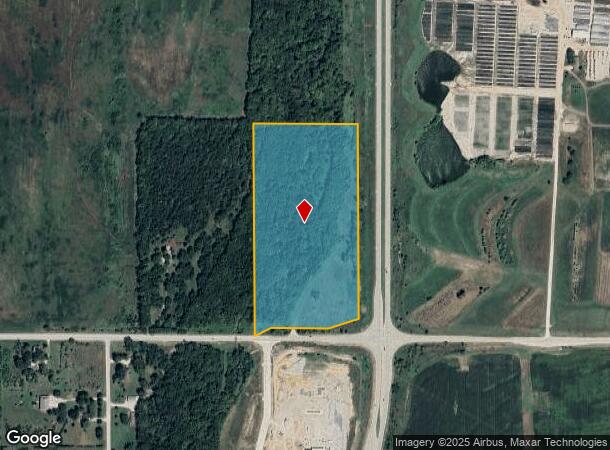
32710 W 199Th St, Edgerton, KS 66021


NEARBY LISTINGS FOR SALE OR LEASE
Property Detail
32710 W 199Th St
4F221504-4003
4-15-22 SE1/4 SE1/4 EX 20 AC & EX 1.70 AC IN STS 18.30 ACS M/L MC 319
Commercialnec
Johnson
AE
Kansas
20091C0134G
18.17 AC
2024
South Johnson County
2024
Kansas City
053701
Kansas City, MO-KS
630 SF
DEMOGRAPHICS near 32710 W 199Th St
1 Mile
3 Mile
5 Mile
2024 Total Population
66
6,188
27,319
2029 Population
70
6,455
28,503
Pop Growth 2024-2029
+ 6.06%
+ 4.31%
+ 4.33%
Average Age
43
36
35
2024 Total Households
23
2,123
9,542
HH Growth 2024-2029
+ 8.70%
+ 4.43%
+ 4.47%
Median Household Inc
$93,749
$89,404
$81,969
Avg Household Size
2.80
2.90
2.80
2024 Avg HH Vehicles
3.00
2.00
2.00
Median Home Value
$499,999
$231,342
$247,671
Median Year Built
1985
1997
1998
Nearby Places
Map Layers
Map Styles
 Street
 Aerial
- Restaurants
- Banks
- Shops
- Fitness
- Groceries
SALE & LEASE HISTORY
LISTING DATE
SALE/LEASE

Nov 21, 2021
For Sale
Feb 02, 2022
For Sale
Aug 21, 2023
For Sale
Nearby Properties
Address
Land Use
TOTAL SIZE
Lot Size
Zoning
Address
Land Use
TOTAL SIZE
Lot Size
Zoning
1,952,263 SF
191.05 AC
RUR
Address
Land Use
TOTAL SIZE
Lot Size
Zoning
616,794 SF
48.06 AC
A-G
Address
Land Use
TOTAL SIZE
Lot Size
Zoning
1,007,020 SF
57.84 AC
RUR
Address
Land Use
TOTAL SIZE
Lot Size
Zoning
951,860 SF
55.73 AC
RUR
Address
Land Use
TOTAL SIZE
Lot Size
Zoning
921,308 SF
46.62 AC
RUR
Address
Land Use
TOTAL SIZE
Lot Size
Zoning
822,082 SF
42.61 AC
RUR
Address
Land Use
TOTAL SIZE
Lot Size
Zoning
790,120 SF
38.55 AC
RUR
Address
Land Use
TOTAL SIZE
Lot Size
Zoning
750,100 SF
39.48 AC
RUR
Address
Land Use
TOTAL SIZE
Lot Size
Zoning
748,227 SF
38.70 AC
RUR
Address
Land Use
TOTAL SIZE
Lot Size
Zoning
764,500 SF
62.27 AC
RUR
Address
Land Use
TOTAL SIZE
Lot Size
Zoning
760,255 SF
36.45 AC
RUR
Address
Land Use
TOTAL SIZE
Lot Size
Zoning
1,005,940 SF
66.67 AC
L-P
Address
Land Use
TOTAL SIZE
Lot Size
Zoning
650,915 SF
30.96 AC
RUR
Address
Land Use
TOTAL SIZE
Lot Size
Zoning
655,128 SF
36.79 AC
A-G
Address
Land Use
TOTAL SIZE
Lot Size
Zoning
573,983 SF
29.43 AC
A-G
Address
Land Use
TOTAL SIZE
Lot Size
Zoning
548,880 SF
33.62 AC
RUR
Address
Land Use
TOTAL SIZE
Lot Size
Zoning
511,945 SF
30.34 AC
RUR
Address
Land Use
TOTAL SIZE
Lot Size
Zoning
500,770 SF
26.61 AC
L-P
Address
Land Use
TOTAL SIZE
Lot Size
Zoning
379,400 SF
22.06 AC
RUR
Address
Land Use
TOTAL SIZE
Lot Size
Zoning
301,675 SF
15.57 AC
I-H, L-P
Address
Land Use
TOTAL SIZE
Lot Size
Zoning
186,110 SF
11.06 AC
I-H, L-P
Address
Land Use
TOTAL SIZE
Lot Size
Zoning
88,724 SF
127.92 AC
A
Address
Land Use
TOTAL SIZE
Lot Size
Zoning
71,146 SF
16.20 AC
A
Address
Land Use
TOTAL SIZE
Lot Size
Zoning
25,407 SF
4.24 AC
RUR
Address
Land Use
TOTAL SIZE
Lot Size
Zoning
9,604 SF
88.55 AC
AG
Address
Land Use
TOTAL SIZE
Lot Size
Zoning
49,060 SF
7.36 AC
A
Address
Land Use
TOTAL SIZE
Lot Size
Zoning
55,593 SF
9.14 AC
R-1
Address
Land Use
TOTAL SIZE
Lot Size
Zoning
327,218 SF
18.66 AC
L-P
Address
Land Use
TOTAL SIZE
Lot Size
Zoning
10,615 SF
30.48 AC
L-P
Address
Land Use
TOTAL SIZE
Lot Size
Zoning
337.91 AC
AG
The World's #1 Commercial Real Estate Marketplace
Connect with us
© 2026 CoStar Group
The information above has been obtained from sources believed reliable. While we do not doubt its accuracy we have not verified it and make no guarantee, warranty or representation about it. It is your responsibility to independently confirm its accuracy and completeness. Any projections, opinions, assumptions, or estimates used are for example only and do not represent the current or future performance of the property. The value of this transaction to you depends on tax and other factors which should be evaluated by your tax, financial, and legal advisors. You and your advisors should conduct a careful, independent investigation of the property to determine to your satisfaction the suitability of the property for your needs.