Property Record
3277 Beekman St, Cincinnati, OH 45225

NEARBY LISTINGS FOR SALE OR LEASE
Property Detail
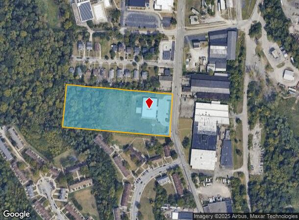
3277 Beekman St
Cincinnati, OH-KY-IN
Joshua Williams Jr Sub
192-0070-0013-90
BEEKMAN ST FT IRR PT LOT 8 JOSHUA WILLIAMS JR SUB PARS 13-44 CONS EX
Storebuilding
Hamilton
X
Ohio
39061C0218F
8
2025
4.04 AC
2025
Queensgate
007700
Cincinnati/Dayton
37,119 SF
DEMOGRAPHICS near 3277 Beekman St
1 mile
3 mile
5 mile
2024 Total Population
11,073
134,324
339,009
2029 Population
11,437
135,486
340,018
Pop Growth 2024-2029
+ 3.29%
+ 0.87%
+ 0.30%
Average Age
33
34
37
2024 Total Households
4,621
55,674
146,929
HH Growth 2024-2029
+ 3.55%
+ 0.89%
+ 0.34%
Median Household Inc
$17,353
$34,658
$45,807
Avg Household Size
2.30
2.20
2.10
2024 Avg HH Vehicles
1.00
1.00
1.00
Median Home Value
$111,538
$158,522
$165,183
Median Year Built
1966
1956
1955
Nearby Places
Map Layers
Map Styles
 Street
 Aerial
Transit
 Traffic
 Biking
Places
Listings with unknown addresses are not visible on the map
- Restaurants
- Banks
- Shops
- Fitness
- Groceries
PUBLIC TRANSPORTATION
COMMUTER RAIL
Cincinnati Union Terminal (Cardinal - Amtrak)
Drive
Walk
Distance
Cincinnati Union Terminal (Cardinal - Amtrak)
7 min
3.6 mi
AIRPORT
Cincinnati/Northern Kentucky International
Drive
Walk
Distance
Cincinnati/Northern Kentucky International
32 min
17.7 mi
Freight Ports
Port of Toledo
Drive
Walk
Distance
Port of Toledo
240 min
204.5 mi
Nearby Properties
Address
Land Use
TOTAL SIZE
Lot Size
Zoning
Address
Land Use
TOTAL SIZE
Lot Size
Zoning
77.73 AC
IR
Address
Land Use
TOTAL SIZE
Lot Size
Zoning
6.35 AC
IR
Address
Land Use
TOTAL SIZE
Lot Size
Zoning
11.82 AC
Address
Land Use
TOTAL SIZE
Lot Size
Zoning
11.62 AC
Address
Land Use
TOTAL SIZE
Lot Size
Zoning
11.41 AC
IR
Address
Land Use
TOTAL SIZE
Lot Size
Zoning
22.45 AC
Address
Land Use
TOTAL SIZE
Lot Size
Zoning
3.09 AC
Address
Land Use
TOTAL SIZE
Lot Size
Zoning
2.80 AC
IR
Address
Land Use
TOTAL SIZE
Lot Size
Zoning
3.40 AC
IR
Address
Land Use
TOTAL SIZE
Lot Size
Zoning
Address
Land Use
TOTAL SIZE
Lot Size
Zoning
7.14 AC
Address
Land Use
TOTAL SIZE
Lot Size
Zoning
13.32 AC
Address
Land Use
TOTAL SIZE
Lot Size
Zoning
16.67 AC
IR
Address
Land Use
TOTAL SIZE
Lot Size
Zoning
9.38 AC
PR
Address
Land Use
TOTAL SIZE
Lot Size
Zoning
Address
Land Use
TOTAL SIZE
Lot Size
Zoning
3,184 SF
2.34 AC
IR
Address
Land Use
TOTAL SIZE
Lot Size
Zoning
2.97 AC
IR
Address
Land Use
TOTAL SIZE
Lot Size
Zoning
112.35 AC
RM20
Address
Land Use
TOTAL SIZE
Lot Size
Zoning
29.60 AC
IR
Address
Land Use
TOTAL SIZE
Lot Size
Zoning
11.36 AC
IR
Address
Land Use
TOTAL SIZE
Lot Size
Zoning
0.37 AC
IR
Address
Land Use
TOTAL SIZE
Lot Size
Zoning
Address
Land Use
TOTAL SIZE
Lot Size
Zoning
10,778 SF
0.09 AC
CCM
Address
Land Use
TOTAL SIZE
Lot Size
Zoning
1.88 AC
Address
Land Use
TOTAL SIZE
Lot Size
Zoning
1.57 AC
Address
Land Use
TOTAL SIZE
Lot Size
Zoning
1,020 SF
44.83 AC
PR
Address
Land Use
TOTAL SIZE
Lot Size
Zoning
153,753 SF
1.66 AC
PD
Address
Land Use
TOTAL SIZE
Lot Size
Zoning
2.23 AC
Address
Land Use
TOTAL SIZE
Lot Size
Zoning
0.12 AC
IR
Address
Land Use
TOTAL SIZE
Lot Size
Zoning
2.27 AC
The World's #1 Commercial Real Estate Marketplace
Connect with us
© 2026 CoStar Group
The information above has been obtained from sources believed reliable. While we do not doubt its accuracy we have not verified it and make no guarantee, warranty or representation about it. It is your responsibility to independently confirm its accuracy and completeness. Any projections, opinions, assumptions, or estimates used are for example only and do not represent the current or future performance of the property. The value of this transaction to you depends on tax and other factors which should be evaluated by your tax, financial, and legal advisors. You and your advisors should conduct a careful, independent investigation of the property to determine to your satisfaction the suitability of the property for your needs.