Property Record
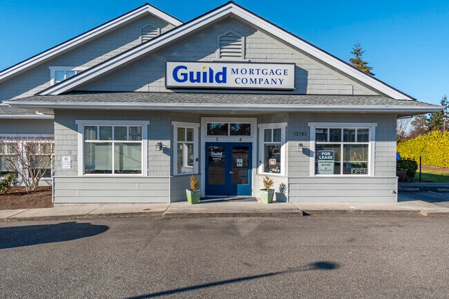
32785 State Route 20, Oak Harbor, WA 98277


Property Detail
32785 State Route 20
R13335-298-3050
43 ALLEN DC - LOT 1 THORNTONS SUB UNPLATTED BG SWCR LOT 5 GOLDIE RD AC N89W407.13ALG SLN SD LOT WLY TP ELN CO RD S0W252.78 TPB S0W197.22ALG ELN E128 .71TO NWLY LN ST HWY 525 N38E166.89 N51W221.89 S38W90.23TPB TGW PED EZ AF#86006401
Financialbuilding
ISLAND
OH
Washington
B and X Area of moderate flood hazard, usually the area between the limits of the 100-year and 500-year floods.
1,5
2025
1 AC
2025
Seattle North/Everett
970402
Other Market Areas
10,629 SF
Oak Harbor, WA
NEARBY LISTINGS FOR SALE OR LEASE
DEMOGRAPHICS near 32785 State Route 20
1 mile
3 mile
5 mile
2025 Total Population
9,258
28,474
36,365
2030 Population
8,914
27,595
35,376
Pop Growth 2025-2030
(3.72%)
(3.09%)
(2.72%)
Average Age
37
36
38
2025 Total Households
3,873
10,478
13,479
HH Growth 2025-2030
(3.87%)
(3.37%)
(2.97%)
Median Household Inc
$65,178
$78,787
$82,969
Avg Household Size
2.40
2.50
2.50
2025 Avg HH Vehicles
2.00
2.00
2.00
Median Home Value
$403,815
$457,361
$481,141
Median Year Built
1981
1984
1985
Nearby Places
Map Layers
Map Styles
 Street
 Aerial
Layers
 Traffic
 Biking
Places
Listings with unknown addresses are not visible on the map
- Restaurants
- Banks
- Shops
- Fitness
- Groceries
PUBLIC TRANSPORTATION
AIRPORT
Seattle Paine Field International
Drive
Walk
Distance
Seattle Paine Field International
93 min
46.9 mi
Freight Ports
Drive
Walk
Distance
33 min
19.7 mi
SALE & LEASE HISTORY
LISTING DATE
SALE/LEASE

Jan 29, 2025
For Lease
Nearby Properties
Address
Land Use
TOTAL SIZE
Lot Size
Zoning
Address
Land Use
TOTAL SIZE
Lot Size
Zoning
273,742 SF
44.92 AC
OH
Address
Land Use
TOTAL SIZE
Lot Size
Zoning
83,018 SF
3.07 AC
OH
Address
Land Use
TOTAL SIZE
Lot Size
Zoning
121,642 SF
6.28 AC
OH
Address
Land Use
TOTAL SIZE
Lot Size
Zoning
94,005 SF
4.79 AC
OH
Address
Land Use
TOTAL SIZE
Lot Size
Zoning
87,878 SF
15.76 AC
OH
Address
Land Use
TOTAL SIZE
Lot Size
Zoning
70,705 SF
7.47 AC
OH
Address
Land Use
TOTAL SIZE
Lot Size
Zoning
19,160 SF
8.50 AC
50
Address
Land Use
TOTAL SIZE
Lot Size
Zoning
105,488 SF
11.32 AC
C-5
Address
Land Use
TOTAL SIZE
Lot Size
Zoning
101,703 SF
10.66 AC
OH
Address
Land Use
TOTAL SIZE
Lot Size
Zoning
57,924 SF
19.54 AC
OH
Address
Land Use
TOTAL SIZE
Lot Size
Zoning
41,845 SF
3.29 AC
OH
Address
Land Use
TOTAL SIZE
Lot Size
Zoning
24,800 SF
3.18 AC
OH
Address
Land Use
TOTAL SIZE
Lot Size
Zoning
27,618 SF
3.91 AC
OH
Address
Land Use
TOTAL SIZE
Lot Size
Zoning
41,180 SF
12.68 AC
OH
Address
Land Use
TOTAL SIZE
Lot Size
Zoning
84,128 SF
8.36 AC
50
Address
Land Use
TOTAL SIZE
Lot Size
Zoning
30,649 SF
3.14 AC
OH
Address
Land Use
TOTAL SIZE
Lot Size
Zoning
43,347 SF
2.04 AC
Address
Land Use
TOTAL SIZE
Lot Size
Zoning
39,068 SF
2.15 AC
OH
Address
Land Use
TOTAL SIZE
Lot Size
Zoning
32,776 SF
3.30 AC
OH
Address
Land Use
TOTAL SIZE
Lot Size
Zoning
15,512 SF
3.15 AC
OH
Address
Land Use
TOTAL SIZE
Lot Size
Zoning
75,050 SF
6.75 AC
Address
Land Use
TOTAL SIZE
Lot Size
Zoning
53,090 SF
1.71 AC
OH
Address
Land Use
TOTAL SIZE
Lot Size
Zoning
44,368 SF
4.53 AC
OH
Address
Land Use
TOTAL SIZE
Lot Size
Zoning
13,999 SF
1.47 AC
OH
Address
Land Use
TOTAL SIZE
Lot Size
Zoning
41,632 SF
2.41 AC
OH
The World's #1 Commercial Real Estate Marketplace
Connect with us
© 2026 CoStar Group
The information above has been obtained from sources believed reliable. While we do not doubt its accuracy we have not verified it and make no guarantee, warranty or representation about it. It is your responsibility to independently confirm its accuracy and completeness. Any projections, opinions, assumptions, or estimates used are for example only and do not represent the current or future performance of the property. The value of this transaction to you depends on tax and other factors which should be evaluated by your tax, financial, and legal advisors. You and your advisors should conduct a careful, independent investigation of the property to determine to your satisfaction the suitability of the property for your needs.