Property Record
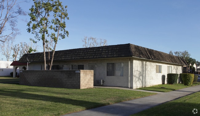
3279 Bernard St, Riverside, CA 92504


NEARBY LISTINGS FOR SALE OR LEASE
Property Detail
3279 Bernard St
Riverside-San Bernardino-Ontario, CA
Amended Map Of Por Of Monroe Heights
231-180-014
4.96 ACRES M/L IN POR LOT B MB 019/009 AMENDED MAP OF POR OF MONROE HEIGHTS
Apartment
Riverside
X
California
06065C0720G
b
2024
4.96 AC
2025
Presidential Park
031704
Inland Empire (California)
DEMOGRAPHICS near 3279 Bernard St
1 mile
3 mile
5 mile
2024 Total Population
15,909
118,634
262,563
2029 Population
16,932
124,954
276,008
Pop Growth 2024-2029
+ 6.43%
+ 5.33%
+ 5.12%
Average Age
35
36
37
2024 Total Households
4,557
34,803
76,707
HH Growth 2024-2029
+ 6.19%
+ 4.87%
+ 4.66%
Median Household Inc
$66,400
$72,826
$83,919
Avg Household Size
3.00
3.20
3.20
2024 Avg HH Vehicles
2.00
2.00
2.00
Median Home Value
$425,892
$433,702
$482,481
Median Year Built
1974
1971
1975
Nearby Places
Map Layers
Map Styles
 Street
 Aerial
Transit
 Traffic
 Biking
Places
Listings with unknown addresses are not visible on the map
- Restaurants
- Banks
- Shops
- Fitness
- Groceries
PUBLIC TRANSPORTATION
COMMUTER RAIL
Riverside-La Sierra (91 Line - Southern California Regional Rail Authority (Metrolink), Inland Empire-Orange County Line - Southern California Regional Rail Authority (Metrolink))
Drive
Walk
Distance
Riverside-La Sierra (91 Line - Southern California Regional Rail Authority (Metrolink), Inland Empire-Orange County Line - Southern California Regional Rail Authority (Metrolink))
8 min
3.5 mi
Riverside-Downtown (91 Line - Southern California Regional Rail Authority (Metrolink), Inland Empire-Orange County Line - Southern California Regional Rail Authority (Metrolink), Riverside Line - Southern California Regional Rail Authority (Metrolink))
Drive
Walk
Distance
Riverside-Downtown (91 Line - Southern California Regional Rail Authority (Metrolink), Inland Empire-Orange County Line - Southern California Regional Rail Authority (Metrolink), Riverside Line - Southern California Regional Rail Authority (Metrolink))
10 min
5.5 mi
AIRPORT
Ontario International
Drive
Walk
Distance
Ontario International
25 min
14.8 mi
John Wayne/Orange County
Drive
Walk
Distance
John Wayne/Orange County
47 min
37.3 mi
Freight Ports
Port of Long Beach
Drive
Walk
Distance
Port of Long Beach
69 min
51.4 mi
Nearby Properties
Address
Land Use
TOTAL SIZE
Lot Size
Zoning
Address
Land Use
TOTAL SIZE
Lot Size
Zoning
1,658,755 SF
37.05 AC
Address
Land Use
TOTAL SIZE
Lot Size
Zoning
263,807 SF
13.14 AC
Address
Land Use
TOTAL SIZE
Lot Size
Zoning
412,950 SF
23.16 AC
C2
Address
Land Use
TOTAL SIZE
Lot Size
Zoning
154,680 SF
3.13 AC
R1
Address
Land Use
TOTAL SIZE
Lot Size
Zoning
45,862 SF
5.12 AC
Address
Land Use
TOTAL SIZE
Lot Size
Zoning
32,830 SF
6.66 AC
Address
Land Use
TOTAL SIZE
Lot Size
Zoning
169,980 SF
10.51 AC
C3
Address
Land Use
TOTAL SIZE
Lot Size
Zoning
27,916 SF
8.50 AC
R3
Address
Land Use
TOTAL SIZE
Lot Size
Zoning
43,152 SF
6.76 AC
R3S2
Address
Land Use
TOTAL SIZE
Lot Size
Zoning
37,729 SF
3.23 AC
Address
Land Use
TOTAL SIZE
Lot Size
Zoning
234,750 SF
13.31 AC
R3150
Address
Land Use
TOTAL SIZE
Lot Size
Zoning
25,808 SF
6.21 AC
Address
Land Use
TOTAL SIZE
Lot Size
Zoning
855,621 SF
46.79 AC
I
Address
Land Use
TOTAL SIZE
Lot Size
Zoning
129,739 SF
5.08 AC
Address
Land Use
TOTAL SIZE
Lot Size
Zoning
249,729 SF
15.60 AC
R3
Address
Land Use
TOTAL SIZE
Lot Size
Zoning
179,589 SF
18.62 AC
Address
Land Use
TOTAL SIZE
Lot Size
Zoning
157,112 SF
10.83 AC
Address
Land Use
TOTAL SIZE
Lot Size
Zoning
8.75 AC
R1065
Address
Land Use
TOTAL SIZE
Lot Size
Zoning
14,068 SF
6.61 AC
R3
Address
Land Use
TOTAL SIZE
Lot Size
Zoning
127,770 SF
12.94 AC
Address
Land Use
TOTAL SIZE
Lot Size
Zoning
4,562 SF
6.42 AC
Address
Land Use
TOTAL SIZE
Lot Size
Zoning
163,325 SF
6.42 AC
R1
Address
Land Use
TOTAL SIZE
Lot Size
Zoning
483,726 SF
3.47 AC
C2
Address
Land Use
TOTAL SIZE
Lot Size
Zoning
110,680 SF
11.88 AC
MP
Address
Land Use
TOTAL SIZE
Lot Size
Zoning
73,538 SF
4.11 AC
R3150
Address
Land Use
TOTAL SIZE
Lot Size
Zoning
125,169 SF
5 AC
C1
Address
Land Use
TOTAL SIZE
Lot Size
Zoning
63,718 SF
7.25 AC
R3
Address
Land Use
TOTAL SIZE
Lot Size
Zoning
96,543 SF
3.34 AC
Address
Land Use
TOTAL SIZE
Lot Size
Zoning
18,480 SF
7.19 AC
The World's #1 Commercial Real Estate Marketplace
Connect with us
© 2026 CoStar Group
The information above has been obtained from sources believed reliable. While we do not doubt its accuracy we have not verified it and make no guarantee, warranty or representation about it. It is your responsibility to independently confirm its accuracy and completeness. Any projections, opinions, assumptions, or estimates used are for example only and do not represent the current or future performance of the property. The value of this transaction to you depends on tax and other factors which should be evaluated by your tax, financial, and legal advisors. You and your advisors should conduct a careful, independent investigation of the property to determine to your satisfaction the suitability of the property for your needs.