Property Record
3279 E Western Reserve Rd, Youngstown, OH 44514


NEARBY LISTINGS FOR SALE OR LEASE
Property Detail
3279 E Western Reserve Rd
Youngstown/Warren/Boardman
D & K Barth Plat
Youngstown-Warren-Boardman, OH-PA
LOT 1 15 X 1644.78 IRR D & K BARTH PLAT
01-109-0-015.02-0
Mahoning
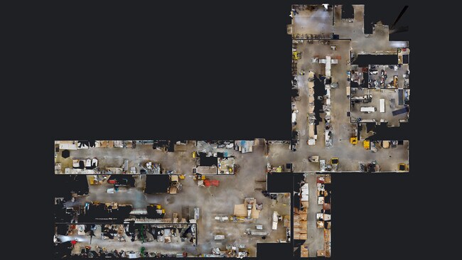
Warehouse
Ohio
2024
1
2024
20.72 AC
813601
Mahoning County
27,884 SF
DEMOGRAPHICS near 3279 E Western Reserve Rd
1 Mile
3 Mile
5 Mile
2024 Total Population
1,472
16,343
48,319
2029 Population
1,429
15,900
47,061
Pop Growth 2024-2029
(2.92%)
(2.71%)
(2.60%)
Average Age
46
46
45
2024 Total Households
571
6,846
21,050
HH Growth 2024-2029
(2.98%)
(2.75%)
(2.66%)
Median Household Inc
$108,508
$76,347
$63,931
Avg Household Size
2.60
2.30
2.20
2024 Avg HH Vehicles
2.00
2.00
2.00
Median Home Value
$268,782
$219,280
$168,606
Median Year Built
1983
1975
1968
Nearby Places
Map Layers
Map Styles
 Street
 Aerial
- Restaurants
- Banks
- Shops
- Fitness
- Groceries
SALE & LEASE HISTORY
LISTING DATE
SALE/LEASE

Sep 17, 2020
For Lease
Nearby Properties
Address
Land Use
TOTAL SIZE
Lot Size
Zoning
Address
Land Use
TOTAL SIZE
Lot Size
Zoning
105,326 SF
6.75 AC
Address
Land Use
TOTAL SIZE
Lot Size
Zoning
49,014 SF
8.63 AC
C
Address
Land Use
TOTAL SIZE
Lot Size
Zoning
110,146 SF
50.48 AC
Address
Land Use
TOTAL SIZE
Lot Size
Zoning
52,847 SF
24.17 AC
Address
Land Use
TOTAL SIZE
Lot Size
Zoning
53,530 SF
5.85 AC
Address
Land Use
TOTAL SIZE
Lot Size
Zoning
139,722 SF
19.72 AC
R1
Address
Land Use
TOTAL SIZE
Lot Size
Zoning
68,415 SF
11.60 AC
R1
Address
Land Use
TOTAL SIZE
Lot Size
Zoning
73,489 SF
14.40 AC
Address
Land Use
TOTAL SIZE
Lot Size
Zoning
134,320 SF
3.36 AC
Address
Land Use
TOTAL SIZE
Lot Size
Zoning
59,081 SF
14.19 AC
Address
Land Use
TOTAL SIZE
Lot Size
Zoning
54,828 SF
10.02 AC
Address
Land Use
TOTAL SIZE
Lot Size
Zoning
24,770 SF
6.83 AC
C
Address
Land Use
TOTAL SIZE
Lot Size
Zoning
50,336 SF
10.09 AC
Address
Land Use
TOTAL SIZE
Lot Size
Zoning
43,445 SF
3.82 AC
E
Address
Land Use
TOTAL SIZE
Lot Size
Zoning
50,238 SF
7.66 AC
Address
Land Use
TOTAL SIZE
Lot Size
Zoning
22,584 SF
9.71 AC
Address
Land Use
TOTAL SIZE
Lot Size
Zoning
17,671 SF
2.22 AC
Address
Land Use
TOTAL SIZE
Lot Size
Zoning
19,688 SF
98.45 AC
SR
Address
Land Use
TOTAL SIZE
Lot Size
Zoning
32,414 SF
5.32 AC
Address
Land Use
TOTAL SIZE
Lot Size
Zoning
19,764 SF
4.06 AC
TC
Address
Land Use
TOTAL SIZE
Lot Size
Zoning
113,311 SF
9.80 AC
I
Address
Land Use
TOTAL SIZE
Lot Size
Zoning
41,799 SF
7.40 AC
C
Address
Land Use
TOTAL SIZE
Lot Size
Zoning
17,477 SF
4.74 AC
GC
Address
Land Use
TOTAL SIZE
Lot Size
Zoning
40,356 SF
7.85 AC
C
Address
Land Use
TOTAL SIZE
Lot Size
Zoning
19.66 AC
R1
Address
Land Use
TOTAL SIZE
Lot Size
Zoning
16,521 SF
3.90 AC
OI
Address
Land Use
TOTAL SIZE
Lot Size
Zoning
53,712 SF
4.80 AC
TC
Address
Land Use
TOTAL SIZE
Lot Size
Zoning
8,530 SF
8.42 AC
Address
Land Use
TOTAL SIZE
Lot Size
Zoning
28,606 SF
5.64 AC
I
Address
Land Use
TOTAL SIZE
Lot Size
Zoning
13,195 SF
26.73 AC
E
The World's #1 Commercial Real Estate Marketplace
Connect with us
© 2025 CoStar Group
The information above has been obtained from sources believed reliable. While we do not doubt its accuracy we have not verified it and make no guarantee, warranty or representation about it. It is your responsibility to independently confirm its accuracy and completeness. Any projections, opinions, assumptions, or estimates used are for example only and do not represent the current or future performance of the property. The value of this transaction to you depends on tax and other factors which should be evaluated by your tax, financial, and legal advisors. You and your advisors should conduct a careful, independent investigation of the property to determine to your satisfaction the suitability of the property for your needs.