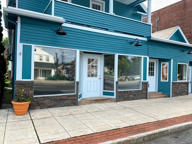
Property Record
328 Main St, Cromwell, CT 06416


Property Detail
328 Main St
441300
Lower Ct River Vly
Commercialnec
Connecticut
DC
2
B and X Area of moderate flood hazard, usually the area between the limits of the 100-year and 500-year floods.
0.19 AC
2025
NW Middlesex/Middletown
2025
Hartford
570300
Hartford-West Hartford-East Hartford, CT
NEARBY LISTINGS FOR SALE OR LEASE
DEMOGRAPHICS near 328 Main St
1 mile
3 mile
5 mile
2025 Total Population
2,972
36,809
86,853
2030 Population
2,974
36,946
87,864
Pop Growth 2025-2030
+ 0.07%
+ 0.37%
+ 1.16%
Average Age
45
42
42
2025 Total Households
1,220
15,844
36,348
HH Growth 2025-2030
0.00%
+ 0.33%
+ 1.16%
Median Household Inc
$71,920
$77,093
$86,099
Avg Household Size
2.10
2.20
2.20
2025 Avg HH Vehicles
2.00
2.00
2.00
Median Home Value
$319,408
$306,752
$331,506
Median Year Built
1968
1970
1973
Nearby Places
Map Layers
Map Styles
 Street
 Aerial
Transit
 Traffic
 Biking
Places
Listings with unknown addresses are not visible on the map
- Restaurants
- Banks
- Shops
- Fitness
- Groceries
PUBLIC TRANSPORTATION
COMMUTER RAIL
Drive
Walk
Distance
13 min
7.9 mi
Drive
Walk
Distance
13 min
7.9 mi
AIRPORT
Bradley International
Drive
Walk
Distance
Bradley International
50 min
31.2 mi
Tweed/New Haven
Drive
Walk
Distance
Tweed/New Haven
47 min
32.3 mi
SALE & LEASE HISTORY
LISTING DATE
SALE/LEASE

May 12, 2019
For Lease
Nearby Properties
Address
Land Use
TOTAL SIZE
Lot Size
Zoning
Address
Land Use
TOTAL SIZE
Lot Size
Zoning
65.89 AC
R-45
Address
Land Use
TOTAL SIZE
Lot Size
Zoning
33,524 SF
37.71 AC
ID
Address
Land Use
TOTAL SIZE
Lot Size
Zoning
0.56 AC
B-1
Address
Land Use
TOTAL SIZE
Lot Size
Zoning
2.33 AC
ID
Address
Land Use
TOTAL SIZE
Lot Size
Zoning
29.45 AC
R-15
Address
Land Use
TOTAL SIZE
Lot Size
Zoning
27.21 AC
M
Address
Land Use
TOTAL SIZE
Lot Size
Zoning
4.90 AC
ID
Address
Land Use
TOTAL SIZE
Lot Size
Zoning
19.49 AC
PRD
Address
Land Use
TOTAL SIZE
Lot Size
Zoning
7.79 AC
ID
Address
Land Use
TOTAL SIZE
Lot Size
Zoning
1.62 AC
ID
Address
Land Use
TOTAL SIZE
Lot Size
Zoning
65,615 SF
1.46 AC
ID
Address
Land Use
TOTAL SIZE
Lot Size
Zoning
92,766 SF
1.79 AC
ID
Address
Land Use
TOTAL SIZE
Lot Size
Zoning
27,152 SF
8.75 AC
R-25
Address
Land Use
TOTAL SIZE
Lot Size
Zoning
10.10 AC
IND
Address
Land Use
TOTAL SIZE
Lot Size
Zoning
3.58 AC
DVD
Address
Land Use
TOTAL SIZE
Lot Size
Zoning
3.24 AC
ID
Address
Land Use
TOTAL SIZE
Lot Size
Zoning
24.45 AC
HB
Address
Land Use
TOTAL SIZE
Lot Size
Zoning
13.28 AC
PRD
Address
Land Use
TOTAL SIZE
Lot Size
Zoning
102,239 SF
1.02 AC
B-1
Address
Land Use
TOTAL SIZE
Lot Size
Zoning
83,241 SF
52.65 AC
R-15
Address
Land Use
TOTAL SIZE
Lot Size
Zoning
161,959 SF
45.61 AC
R-25
Address
Land Use
TOTAL SIZE
Lot Size
Zoning
15,395 SF
158.10 AC
R-25
Address
Land Use
TOTAL SIZE
Lot Size
Zoning
88,369 SF
26 AC
R-15
Address
Land Use
TOTAL SIZE
Lot Size
Zoning
3.25 AC
ID
Address
Land Use
TOTAL SIZE
Lot Size
Zoning
80,627 SF
10.54 AC
HB
Address
Land Use
TOTAL SIZE
Lot Size
Zoning
146.96 AC
IND
Address
Land Use
TOTAL SIZE
Lot Size
Zoning
37.25 AC
R-25
Address
Land Use
TOTAL SIZE
Lot Size
Zoning
177,765 SF
1.10 AC
B-1
Address
Land Use
TOTAL SIZE
Lot Size
Zoning
2.98 AC
ID
Address
Land Use
TOTAL SIZE
Lot Size
Zoning
2.75 AC
ID
The World's #1 Commercial Real Estate Marketplace
Connect with us
© 2026 CoStar Group
The information above has been obtained from sources believed reliable. While we do not doubt its accuracy we have not verified it and make no guarantee, warranty or representation about it. It is your responsibility to independently confirm its accuracy and completeness. Any projections, opinions, assumptions, or estimates used are for example only and do not represent the current or future performance of the property. The value of this transaction to you depends on tax and other factors which should be evaluated by your tax, financial, and legal advisors. You and your advisors should conduct a careful, independent investigation of the property to determine to your satisfaction the suitability of the property for your needs.