Property Record
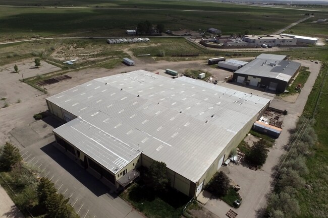
3283 Nine Mile Rd, Casper, WY 82604


NEARBY LISTINGS FOR SALE OR LEASE
Property Detail
3283 Nine Mile Rd
Casper, WY
Teton Ind Pk Simple
34-80-19-3-0-600600
TETON IND PK SIMPLE LOT 1
Warehouse
Natrona
D
Wyoming
56025C1675D
1
2024
13.37 AC
2025
I-25 Corridor/Casper
001802
Other Market Areas
29,700 SF
DEMOGRAPHICS near 3283 Nine Mile Rd
1 Mile
3 Mile
5 Mile
2024 Total Population
38
1,270
2,022
2029 Population
39
1,292
2,053
Pop Growth 2024-2029
+ 2.63%
+ 1.73%
+ 1.53%
Average Age
44
44
45
2024 Total Households
12
454
742
HH Growth 2024-2029
+ 8.33%
+ 1.54%
+ 1.48%
Median Household Inc
$95,833
$97,380
$96,798
Avg Household Size
2.50
2.50
2.50
2024 Avg HH Vehicles
3.00
3.00
3.00
Median Home Value
$350,000
$385,436
$384,658
Median Year Built
1999
1985
1983
Nearby Places
Map Layers
Map Styles
 Street
 Aerial
- Restaurants
- Banks
- Shops
- Fitness
- Groceries
PUBLIC TRANSPORTATION
AIRPORT
Casper/Natrona County International
DRIVE
WALK
Distance
Casper/Natrona County International
17 min
5.2 mi
Freight Ports
Tulsa Port Of Catoosa
DRIVE
WALK
Distance
Tulsa Port Of Catoosa
1,005 min
987.4 mi
SALE & LEASE HISTORY
LISTING DATE
SALE/LEASE

Jun 05, 2017
For Sale
Nearby Properties
Address
Land Use
TOTAL SIZE
Lot Size
Zoning
Address
Land Use
TOTAL SIZE
Lot Size
Zoning
59,696 SF
3 AC
Address
Land Use
TOTAL SIZE
Lot Size
Zoning
4,000 SF
12.65 AC
Address
Land Use
TOTAL SIZE
Lot Size
Zoning
7,500 SF
5.21 AC
Address
Land Use
TOTAL SIZE
Lot Size
Zoning
6,000 SF
4.08 AC
Address
Land Use
TOTAL SIZE
Lot Size
Zoning
15,616 SF
8.56 AC
Address
Land Use
TOTAL SIZE
Lot Size
Zoning
22,400 SF
4.07 AC
Address
Land Use
TOTAL SIZE
Lot Size
Zoning
12,250 SF
10.36 AC
Address
Land Use
TOTAL SIZE
Lot Size
Zoning
4,800 SF
14.06 AC
Address
Land Use
TOTAL SIZE
Lot Size
Zoning
9,120 SF
32.74 AC
Address
Land Use
TOTAL SIZE
Lot Size
Zoning
18,200 SF
10.33 AC
Address
Land Use
TOTAL SIZE
Lot Size
Zoning
3,444 SF
12.37 AC
Address
Land Use
TOTAL SIZE
Lot Size
Zoning
6,948 SF
9.39 AC
Address
Land Use
TOTAL SIZE
Lot Size
Zoning
18,900 SF
36.97 AC
Address
Land Use
TOTAL SIZE
Lot Size
Zoning
3,444 SF
10.65 AC
Address
Land Use
TOTAL SIZE
Lot Size
Zoning
11,280 SF
2.30 AC
Address
Land Use
TOTAL SIZE
Lot Size
Zoning
7,400 SF
6.34 AC
Address
Land Use
TOTAL SIZE
Lot Size
Zoning
8,760 SF
1.12 AC
Address
Land Use
TOTAL SIZE
Lot Size
Zoning
7,400 SF
5 AC
Address
Land Use
TOTAL SIZE
Lot Size
Zoning
14,560 SF
1 AC
Address
Land Use
TOTAL SIZE
Lot Size
Zoning
2,521 SF
7 AC
Address
Land Use
TOTAL SIZE
Lot Size
Zoning
12,000 SF
9 AC
Address
Land Use
TOTAL SIZE
Lot Size
Zoning
11,700 SF
4.78 AC
Address
Land Use
TOTAL SIZE
Lot Size
Zoning
8,538 SF
12.10 AC
Address
Land Use
TOTAL SIZE
Lot Size
Zoning
21,000 SF
4 AC
Address
Land Use
TOTAL SIZE
Lot Size
Zoning
10,000 SF
4.13 AC
Address
Land Use
TOTAL SIZE
Lot Size
Zoning
10,200 SF
6.99 AC
Address
Land Use
TOTAL SIZE
Lot Size
Zoning
5,750 SF
2.90 AC
Address
Land Use
TOTAL SIZE
Lot Size
Zoning
7,200 SF
1.99 AC
Address
Land Use
TOTAL SIZE
Lot Size
Zoning
6,384 SF
3 AC
Address
Land Use
TOTAL SIZE
Lot Size
Zoning
6,000 SF
3.33 AC
The World's #1 Commercial Real Estate Marketplace
Connect with us
© 2025 CoStar Group
The information above has been obtained from sources believed reliable. While we do not doubt its accuracy we have not verified it and make no guarantee, warranty or representation about it. It is your responsibility to independently confirm its accuracy and completeness. Any projections, opinions, assumptions, or estimates used are for example only and do not represent the current or future performance of the property. The value of this transaction to you depends on tax and other factors which should be evaluated by your tax, financial, and legal advisors. You and your advisors should conduct a careful, independent investigation of the property to determine to your satisfaction the suitability of the property for your needs.