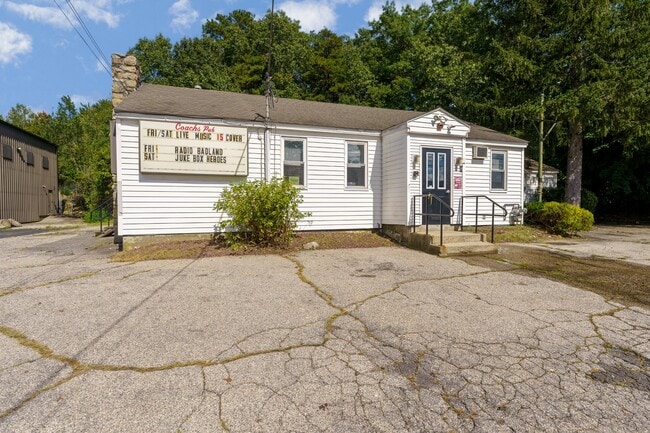
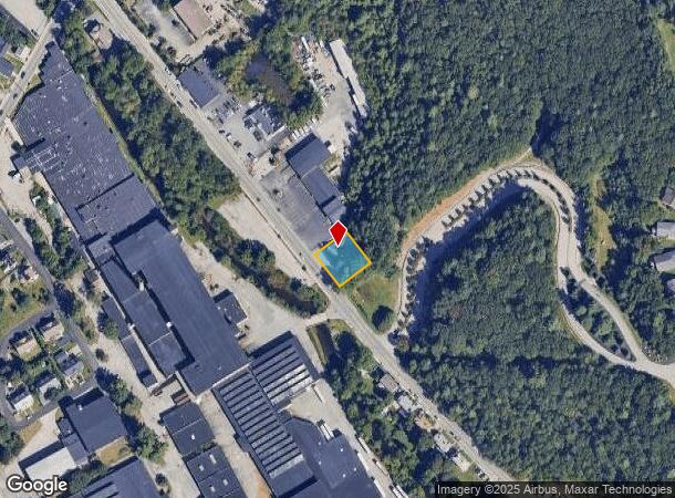
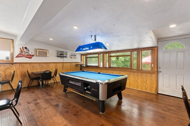
Property Record
329 Waterman Ave, Smithfield, RI 02917
NEARBY LISTINGS FOR SALE OR LEASE
Property Detail
329 Waterman Ave
SMIT-000025-000000-000041
Providence
Commercialbuilding
Rhode Island
AE
41
44007C0188H
0.23 AC
2025
Smithfield
2025
Providence
012602
Providence-Warwick, RI-MA
4,093 SF
DEMOGRAPHICS near 329 Waterman Ave
1 Mile
3 Mile
5 Mile
2024 Total Population
7,642
51,810
178,294
2029 Population
7,652
51,856
177,558
Pop Growth 2024-2029
+ 0.13%
+ 0.09%
(0.41%)
Average Age
44
44
40
2024 Total Households
3,398
22,047
68,671
HH Growth 2024-2029
0.00%
0.00%
(0.47%)
Median Household Inc
$78,509
$81,206
$71,948
Avg Household Size
2.20
2.30
2.50
2024 Avg HH Vehicles
2.00
2.00
2.00
Median Home Value
$331,326
$334,604
$304,320
Median Year Built
1961
1972
1962
Nearby Places
Map Layers
Map Styles
 Street
 Aerial
- Restaurants
- Banks
- Shops
- Fitness
- Groceries
PUBLIC TRANSPORTATION
COMMUTER RAIL
Providence (Providence/Stoughton Line - Massachusetts Bay Transportation Authority Commuter Rail (Purple Line))
DRIVE
WALK
Distance
Providence (Providence/Stoughton Line - Massachusetts Bay Transportation Authority Commuter Rail (Purple Line))
12 min
6.4 mi
DRIVE
WALK
Distance
12 min
6.8 mi
AIRPORT
Rhode Island Tf Green International
DRIVE
WALK
Distance
Rhode Island Tf Green International
26 min
16.2 mi
Worcester Regional
DRIVE
WALK
Distance
Worcester Regional
57 min
42.8 mi
SALE & LEASE HISTORY
LISTING DATE
SALE/LEASE

Oct 27, 2023
For Sale
Nearby Properties
Address
Land Use
TOTAL SIZE
Lot Size
Zoning
Address
Land Use
TOTAL SIZE
Lot Size
Zoning
254,488 SF
17.50 AC
IS
Address
Land Use
TOTAL SIZE
Lot Size
Zoning
89.07 AC
PD
Address
Land Use
TOTAL SIZE
Lot Size
Zoning
53.18 AC
C
Address
Land Use
TOTAL SIZE
Lot Size
Zoning
123.25 AC
R40
Address
Land Use
TOTAL SIZE
Lot Size
Zoning
200.05 AC
RA40
Address
Land Use
TOTAL SIZE
Lot Size
Zoning
301,035 SF
21.69 AC
15
Address
Land Use
TOTAL SIZE
Lot Size
Zoning
1,792 SF
28.46 AC
Address
Land Use
TOTAL SIZE
Lot Size
Zoning
140,678 SF
37.04 AC
RA40
Address
Land Use
TOTAL SIZE
Lot Size
Zoning
38.50 AC
RA40
Address
Land Use
TOTAL SIZE
Lot Size
Zoning
159,028 SF
12.09 AC
RG
Address
Land Use
TOTAL SIZE
Lot Size
Zoning
288,736 SF
11.99 AC
RG
Address
Land Use
TOTAL SIZE
Lot Size
Zoning
8.96 AC
I-2
Address
Land Use
TOTAL SIZE
Lot Size
Zoning
315.90 AC
I
Address
Land Use
TOTAL SIZE
Lot Size
Zoning
166,368 SF
10.74 AC
R20
Address
Land Use
TOTAL SIZE
Lot Size
Zoning
237,440 SF
19.31 AC
IS
Address
Land Use
TOTAL SIZE
Lot Size
Zoning
175,231 SF
9.37 AC
Address
Land Use
TOTAL SIZE
Lot Size
Zoning
115,802 SF
10.30 AC
PC
Address
Land Use
TOTAL SIZE
Lot Size
Zoning
Address
Land Use
TOTAL SIZE
Lot Size
Zoning
Address
Land Use
TOTAL SIZE
Lot Size
Zoning
185,010 SF
7.75 AC
MG
Address
Land Use
TOTAL SIZE
Lot Size
Zoning
137,704 SF
11.57 AC
Address
Land Use
TOTAL SIZE
Lot Size
Zoning
56,451 SF
5 AC
C
Address
Land Use
TOTAL SIZE
Lot Size
Zoning
22,868 SF
12.22 AC
R20
Address
Land Use
TOTAL SIZE
Lot Size
Zoning
135,476 SF
10.30 AC
MG
Address
Land Use
TOTAL SIZE
Lot Size
Zoning
124,397 SF
13.66 AC
C
Address
Land Use
TOTAL SIZE
Lot Size
Zoning
89,788 SF
11.25 AC
R20
Address
Land Use
TOTAL SIZE
Lot Size
Zoning
114,795 SF
1.93 AC
BL
Address
Land Use
TOTAL SIZE
Lot Size
Zoning
69,032 SF
16.07 AC
IS
Address
Land Use
TOTAL SIZE
Lot Size
Zoning
72,531 SF
11.70 AC
R20
Address
Land Use
TOTAL SIZE
Lot Size
Zoning
60,254 SF
2.46 AC
RL10
The World's #1 Commercial Real Estate Marketplace
Connect with us
© 2025 CoStar Group
The information above has been obtained from sources believed reliable. While we do not doubt its accuracy we have not verified it and make no guarantee, warranty or representation about it. It is your responsibility to independently confirm its accuracy and completeness. Any projections, opinions, assumptions, or estimates used are for example only and do not represent the current or future performance of the property. The value of this transaction to you depends on tax and other factors which should be evaluated by your tax, financial, and legal advisors. You and your advisors should conduct a careful, independent investigation of the property to determine to your satisfaction the suitability of the property for your needs.