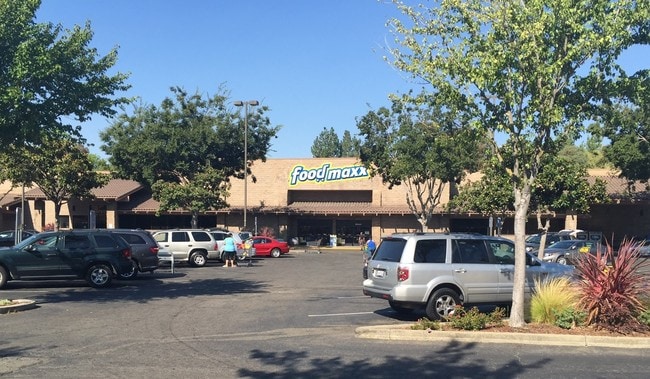
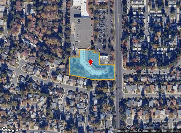
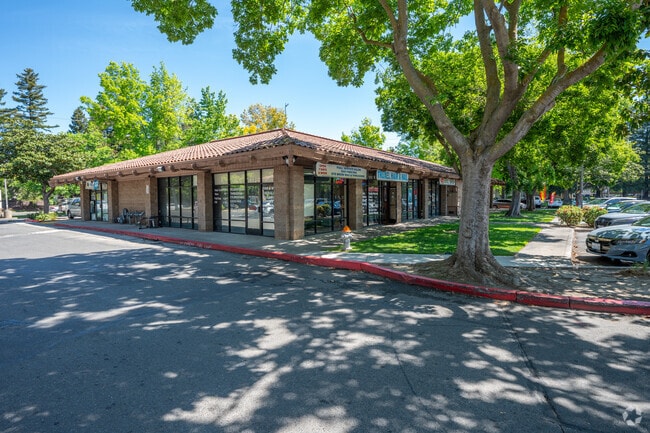
Property Record
3171 Truxel Rd, Sacramento, CA 95833

NEARBY LISTINGS FOR SALE OR LEASE
Property Detail
3171 Truxel Rd
225-1030-007
Lot B Of Del Verde Unit #1129 Bm 7
Regionalshoppingcenterormallwithanchorstore
PCL 3, PM 138-10 EXC ALL THAT POR DES AS BEG AT THE NW COROF SD PCL; TH N89%51E 117.48 FT; TH N00%09W 65.14 FT;
A99
Sacramento
06067C0063J
California
2024
2.38 AC
2025
Natomas
007012
Sacramento
27,013 SF
Sacramento--Roseville--Arden-Arcade, CA
DEMOGRAPHICS near 3171 Truxel Rd
1 Mile
3 Mile
5 Mile
2024 Total Population
25,875
139,472
308,781
2029 Population
26,058
141,332
312,552
Pop Growth 2024-2029
+ 0.71%
+ 1.33%
+ 1.22%
Average Age
36
36
37
2024 Total Households
9,135
47,306
116,509
HH Growth 2024-2029
+ 0.49%
+ 1.50%
+ 1.37%
Median Household Inc
$70,390
$73,059
$75,986
Avg Household Size
2.80
2.70
2.50
2024 Avg HH Vehicles
2.00
2.00
2.00
Median Home Value
$387,551
$424,946
$458,878
Median Year Built
1984
1989
1981
Nearby Places
Map Layers
Map Styles
 Street
 Aerial
- Restaurants
- Banks
- Shops
- Fitness
- Groceries
PUBLIC TRANSPORTATION
AIRPORT
Sacramento International
DRIVE
WALK
Distance
Sacramento International
14 min
9.6 mi
SALE & LEASE HISTORY
LISTING DATE
SALE/LEASE

Sep 25, 2016
For Lease
May 21, 2018
For Lease
Nearby Properties
Address
Land Use
TOTAL SIZE
Lot Size
Zoning
Address
Land Use
TOTAL SIZE
Lot Size
Zoning
363,761 SF
10.34 AC
SC-PUD
Address
Land Use
TOTAL SIZE
Lot Size
Zoning
522,025 SF
65.80 AC
SC-PUD EC-
Address
Land Use
TOTAL SIZE
Lot Size
Zoning
9.74 AC
EC-50-PUD
Address
Land Use
TOTAL SIZE
Lot Size
Zoning
153,090 SF
7.77 AC
MP
Address
Land Use
TOTAL SIZE
Lot Size
Zoning
213,557 SF
2.33 AC
C-3-SPD
Address
Land Use
TOTAL SIZE
Lot Size
Zoning
467,970 SF
4.59 AC
W-F
Address
Land Use
TOTAL SIZE
Lot Size
Zoning
343,500 SF
12.68 AC
R-2B-R-PUD
Address
Land Use
TOTAL SIZE
Lot Size
Zoning
318,616 SF
16.40 AC
R-2B-PUD
Address
Land Use
TOTAL SIZE
Lot Size
Zoning
100.41 AC
C-2-PUD
Address
Land Use
TOTAL SIZE
Lot Size
Zoning
2.88 AC
C-3-SPD
Address
Land Use
TOTAL SIZE
Lot Size
Zoning
303,254 SF
10.63 AC
OB-PUD
Address
Land Use
TOTAL SIZE
Lot Size
Zoning
241,321 SF
14.43 AC
R-3-PUD
Address
Land Use
TOTAL SIZE
Lot Size
Zoning
568,239 SF
32.68 AC
R-2B-PUD
Address
Land Use
TOTAL SIZE
Lot Size
Zoning
6.43 AC
EC-50-PUD
Address
Land Use
TOTAL SIZE
Lot Size
Zoning
429,346 SF
18.88 AC
R-2B-PUD E
Address
Land Use
TOTAL SIZE
Lot Size
Zoning
298,493 SF
18.56 AC
EC-40-PUD
Address
Land Use
TOTAL SIZE
Lot Size
Zoning
34,993 SF
9.06 AC
R-2B-PUD
Address
Land Use
TOTAL SIZE
Lot Size
Zoning
153,288 SF
0.47 AC
C-3-SPD
Address
Land Use
TOTAL SIZE
Lot Size
Zoning
195,928 SF
8.62 AC
EC-40-PUD
Address
Land Use
TOTAL SIZE
Lot Size
Zoning
7.20 AC
PD
Address
Land Use
TOTAL SIZE
Lot Size
Zoning
164,061 SF
8.15 AC
R-3-PUD
Address
Land Use
TOTAL SIZE
Lot Size
Zoning
282,292 SF
14.42 AC
R-3-PUD
Address
Land Use
TOTAL SIZE
Lot Size
Zoning
193,464 SF
0.11 AC
R3
Address
Land Use
TOTAL SIZE
Lot Size
Zoning
327,278 SF
20.63 AC
R-2A
Address
Land Use
TOTAL SIZE
Lot Size
Zoning
218,732 SF
9.45 AC
R-2B-PUD
Address
Land Use
TOTAL SIZE
Lot Size
Zoning
6.23 AC
EC-50-PUD
Address
Land Use
TOTAL SIZE
Lot Size
Zoning
9.01 AC
EC-80-PUD
Address
Land Use
TOTAL SIZE
Lot Size
Zoning
267,894 SF
20.61 AC
OB-PUD
Address
Land Use
TOTAL SIZE
Lot Size
Zoning
207,273 SF
11.44 AC
R-2B-R-PUD
The World's #1 Commercial Real Estate Marketplace
Connect with us
© 2025 CoStar Group
The information above has been obtained from sources believed reliable. While we do not doubt its accuracy we have not verified it and make no guarantee, warranty or representation about it. It is your responsibility to independently confirm its accuracy and completeness. Any projections, opinions, assumptions, or estimates used are for example only and do not represent the current or future performance of the property. The value of this transaction to you depends on tax and other factors which should be evaluated by your tax, financial, and legal advisors. You and your advisors should conduct a careful, independent investigation of the property to determine to your satisfaction the suitability of the property for your needs.