Property Record
3292 Durham Rd, Doylestown, PA 18902


NEARBY LISTINGS FOR SALE OR LEASE
Property Detail
3292 Durham Rd
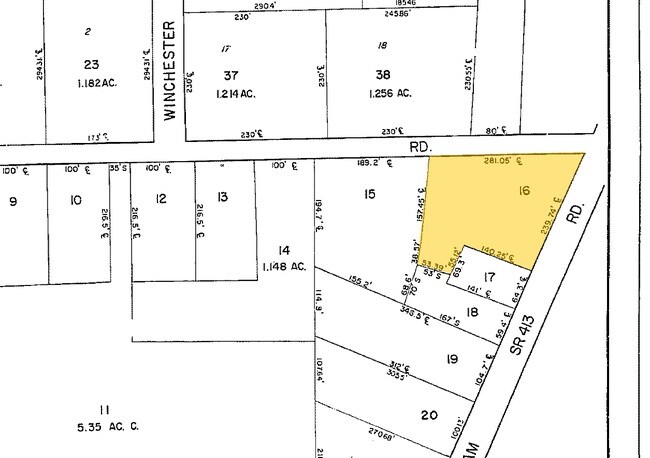
06-005-016
Village Of Mechanicsville
Storemultistory
SW COR LR09058 & SR413 281X196
X
Bucks
42017C0305J
Pennsylvania
2024
0.92 AC
2025
Upper Bucks County
104505
Philadelphia
2,900 SF
Philadelphia-Camden-Wilmington, PA-NJ-DE-MD
DEMOGRAPHICS near 3292 Durham Rd
1 mile
3 mile
5 mile
2024 Total Population
3,042
19,794
55,401
2029 Population
3,012
19,461
54,991
Pop Growth 2024-2029
(0.99%)
(1.68%)
(0.74%)
Average Age
44
43
45
2024 Total Households
1,062
6,916
21,506
HH Growth 2024-2029
(1.04%)
(1.79%)
(0.60%)
Median Household Inc
$164,307
$167,193
$132,277
Avg Household Size
2.80
2.80
2.50
2024 Avg HH Vehicles
2.00
2.00
2.00
Median Home Value
$649,754
$677,492
$607,080
Median Year Built
1991
1989
1985
Nearby Places
Map Layers
Map Styles
 Street
 Aerial
Transit
 Traffic
 Biking
Places
Listings with unknown addresses are not visible on the map
- Restaurants
- Banks
- Shops
- Fitness
- Groceries
PUBLIC TRANSPORTATION
COMMUTER RAIL
Doylestown (R5 - Southeastern Pennsylvania Transportation Authority Regional Rail (SEPTA Regional Rail))
Drive
Walk
Distance
Doylestown (R5 - Southeastern Pennsylvania Transportation Authority Regional Rail (SEPTA Regional Rail))
11 min
4.3 mi
Delaware Valley College (R5 - Southeastern Pennsylvania Transportation Authority Regional Rail (SEPTA Regional Rail))
Drive
Walk
Distance
Delaware Valley College (R5 - Southeastern Pennsylvania Transportation Authority Regional Rail (SEPTA Regional Rail))
14 min
6.9 mi
AIRPORT
Trenton Mercer
Drive
Walk
Distance
Trenton Mercer
35 min
19.2 mi
Lehigh Valley International
Drive
Walk
Distance
Lehigh Valley International
63 min
35.2 mi
Philadelphia International
Drive
Walk
Distance
Philadelphia International
75 min
47.7 mi
Freight Ports
Port of Philadelphia
Drive
Walk
Distance
Port of Philadelphia
54 min
30.2 mi
Nearby Properties
Address
Land Use
TOTAL SIZE
Lot Size
Zoning
Address
Land Use
TOTAL SIZE
Lot Size
Zoning
109,660 SF
9.81 AC
R3
Address
Land Use
TOTAL SIZE
Lot Size
Zoning
515 SF
128.48 AC
R1
Address
Land Use
TOTAL SIZE
Lot Size
Zoning
51,286 SF
12.56 AC
R1
Address
Land Use
TOTAL SIZE
Lot Size
Zoning
25,043 SF
0.36 AC
LC
Address
Land Use
TOTAL SIZE
Lot Size
Zoning
45,479 SF
6.79 AC
LC
Address
Land Use
TOTAL SIZE
Lot Size
Zoning
4.41 AC
VC2
Address
Land Use
TOTAL SIZE
Lot Size
Zoning
12,212 SF
5.63 AC
VC2
Address
Land Use
TOTAL SIZE
Lot Size
Zoning
102,144 SF
14.15 AC
VC2
Address
Land Use
TOTAL SIZE
Lot Size
Zoning
82,623 SF
15.36 AC
VC2
Address
Land Use
TOTAL SIZE
Lot Size
Zoning
15,336 SF
9.10 AC
R3
Address
Land Use
TOTAL SIZE
Lot Size
Zoning
2,000 SF
8.62 AC
PI
Address
Land Use
TOTAL SIZE
Lot Size
Zoning
19,348 SF
4.86 AC
I
Address
Land Use
TOTAL SIZE
Lot Size
Zoning
14,571 SF
97.39 AC
R1
Address
Land Use
TOTAL SIZE
Lot Size
Zoning
12,309 SF
2.24 AC
C2
Address
Land Use
TOTAL SIZE
Lot Size
Zoning
10,671 SF
5.44 AC
P1
Address
Land Use
TOTAL SIZE
Lot Size
Zoning
14,015 SF
13.07 AC
R2
Address
Land Use
TOTAL SIZE
Lot Size
Zoning
18,010 SF
4.34 AC
C2
Address
Land Use
TOTAL SIZE
Lot Size
Zoning
9,934 SF
15.07 AC
R2
Address
Land Use
TOTAL SIZE
Lot Size
Zoning
12,824 SF
4.03 AC
C2
Address
Land Use
TOTAL SIZE
Lot Size
Zoning
40,000 SF
7.36 AC
P1
Address
Land Use
TOTAL SIZE
Lot Size
Zoning
18,631 SF
1.83 AC
R3
Address
Land Use
TOTAL SIZE
Lot Size
Zoning
17,151 SF
3.04 AC
R3
Address
Land Use
TOTAL SIZE
Lot Size
Zoning
22,680 SF
3.49 AC
R5
Address
Land Use
TOTAL SIZE
Lot Size
Zoning
9,437 SF
4.52 AC
R1
Address
Land Use
TOTAL SIZE
Lot Size
Zoning
20,448 SF
2.35 AC
LI
Address
Land Use
TOTAL SIZE
Lot Size
Zoning
7,625 SF
5.30 AC
R1
Address
Land Use
TOTAL SIZE
Lot Size
Zoning
9,745 SF
10.55 AC
R2
Address
Land Use
TOTAL SIZE
Lot Size
Zoning
2,160 SF
2.20 AC
PC1
Address
Land Use
TOTAL SIZE
Lot Size
Zoning
14,587 SF
3.05 AC
R3
Address
Land Use
TOTAL SIZE
Lot Size
Zoning
8,062 SF
15.08 AC
AG
The World's #1 Commercial Real Estate Marketplace
Connect with us
© 2026 CoStar Group
The information above has been obtained from sources believed reliable. While we do not doubt its accuracy we have not verified it and make no guarantee, warranty or representation about it. It is your responsibility to independently confirm its accuracy and completeness. Any projections, opinions, assumptions, or estimates used are for example only and do not represent the current or future performance of the property. The value of this transaction to you depends on tax and other factors which should be evaluated by your tax, financial, and legal advisors. You and your advisors should conduct a careful, independent investigation of the property to determine to your satisfaction the suitability of the property for your needs.