Property Record
3292 Durham Rd, Doylestown, PA 18902


Save to a Folder
{{folder.Name}}
{{folder.ListingIds.length}} Properties
{{folder.ListingIds.length}} Property
Create a New Folder
Property Detail
3292 Durham Rd
06-005-016
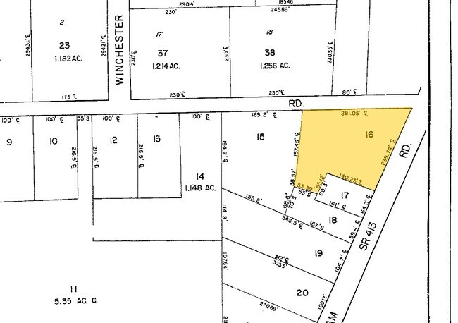
SW COR LR09058 & SR413 281X196
Storemultistory
Bucks
VC1
Pennsylvania
B and X Area of moderate flood hazard, usually the area between the limits of the 100-year and 500-year floods.
0.92 AC
2025
Upper Bucks County
2026
Philadelphia
104505
Philadelphia-Camden-Wilmington, PA-NJ-DE-MD
10,058 SF
NEARBY LISTINGS FOR SALE OR LEASE
DEMOGRAPHICS near 3292 Durham Rd
1 mile
3 mile
5 mile
2025 Total Population
3,075
19,994
57,569
2030 Population
3,068
19,799
57,891
Pop Growth 2025-2030
(0.23%)
(0.98%)
+ 0.56%
Average Age
44
44
45
2025 Total Households
1,073
6,988
22,418
HH Growth 2025-2030
(0.28%)
(1.07%)
+ 0.84%
Median Household Inc
$184,506
$179,100
$138,241
Avg Household Size
2.80
2.80
2.50
2025 Avg HH Vehicles
2.00
2.00
2.00
Median Home Value
$774,774
$754,421
$686,743
Median Year Built
1992
1989
1986
Nearby Places
Map Layers
Map Styles
 Street
 Aerial
Layers
 Traffic
 Biking
Places
Listings with unknown addresses are not visible on the map
- Restaurants
- Banks
- Shops
- Fitness
- Groceries
PUBLIC TRANSPORTATION
AIRPORT
Lehigh Valley International
Drive
Walk
Distance
Lehigh Valley International
62 min
37.5 mi
Freight Ports
Port of Philadelphia
Drive
Walk
Distance
Port of Philadelphia
1 min
25.1 mi
Nearby Properties
Address
Land Use
TOTAL SIZE
Lot Size
Zoning
Address
Land Use
TOTAL SIZE
Lot Size
Zoning
109,660 SF
9.81 AC
R3
Address
Land Use
TOTAL SIZE
Lot Size
Zoning
515 SF
128.48 AC
R1
Address
Land Use
TOTAL SIZE
Lot Size
Zoning
25,043 SF
0.36 AC
LC
Address
Land Use
TOTAL SIZE
Lot Size
Zoning
44,687 SF
6.79 AC
LC
Address
Land Use
TOTAL SIZE
Lot Size
Zoning
4.41 AC
VC2
Address
Land Use
TOTAL SIZE
Lot Size
Zoning
12,212 SF
5.63 AC
VC2
Address
Land Use
TOTAL SIZE
Lot Size
Zoning
102,144 SF
14.15 AC
VC2
Address
Land Use
TOTAL SIZE
Lot Size
Zoning
82,623 SF
15.36 AC
VC2
Address
Land Use
TOTAL SIZE
Lot Size
Zoning
31,925 SF
9.10 AC
R3
Address
Land Use
TOTAL SIZE
Lot Size
Zoning
2,000 SF
8.62 AC
PI
Address
Land Use
TOTAL SIZE
Lot Size
Zoning
19,348 SF
4.86 AC
I
Address
Land Use
TOTAL SIZE
Lot Size
Zoning
51,286 SF
12.56 AC
R1
Address
Land Use
TOTAL SIZE
Lot Size
Zoning
24,728 SF
2.24 AC
C2
Address
Land Use
TOTAL SIZE
Lot Size
Zoning
10,671 SF
5.44 AC
P1
Address
Land Use
TOTAL SIZE
Lot Size
Zoning
18,010 SF
4.34 AC
C2
Address
Land Use
TOTAL SIZE
Lot Size
Zoning
12,824 SF
4.03 AC
C2
Address
Land Use
TOTAL SIZE
Lot Size
Zoning
40,000 SF
7.36 AC
P1
Address
Land Use
TOTAL SIZE
Lot Size
Zoning
18,631 SF
1.83 AC
R3
Address
Land Use
TOTAL SIZE
Lot Size
Zoning
17,151 SF
3.04 AC
R3
Address
Land Use
TOTAL SIZE
Lot Size
Zoning
22,965 SF
3.49 AC
R5
Address
Land Use
TOTAL SIZE
Lot Size
Zoning
20,448 SF
2.35 AC
LI
Address
Land Use
TOTAL SIZE
Lot Size
Zoning
5,676 SF
2.20 AC
PC1
Address
Land Use
TOTAL SIZE
Lot Size
Zoning
14,587 SF
3.05 AC
R3
Address
Land Use
TOTAL SIZE
Lot Size
Zoning
24,518 SF
2.15 AC
RC
Address
Land Use
TOTAL SIZE
Lot Size
Zoning
36,000 SF
7 AC
P1
Address
Land Use
TOTAL SIZE
Lot Size
Zoning
20,000 SF
2.23 AC
C2
Address
Land Use
TOTAL SIZE
Lot Size
Zoning
31,764 SF
5.79 AC
P1
Address
Land Use
TOTAL SIZE
Lot Size
Zoning
3,032 SF
1.24 AC
PC1
Address
Land Use
TOTAL SIZE
Lot Size
Zoning
36,846 SF
2.76 AC
LI
Address
Land Use
TOTAL SIZE
Lot Size
Zoning
25,951 SF
2.08 AC
C2
The World's #1 Commercial Real Estate Marketplace
Connect with us
© 2026 CoStar Group
The information above has been obtained from sources believed reliable. While we do not doubt its accuracy we have not verified it and make no guarantee, warranty or representation about it. It is your responsibility to independently confirm its accuracy and completeness. Any projections, opinions, assumptions, or estimates used are for example only and do not represent the current or future performance of the property. The value of this transaction to you depends on tax and other factors which should be evaluated by your tax, financial, and legal advisors. You and your advisors should conduct a careful, independent investigation of the property to determine to your satisfaction the suitability of the property for your needs.