Property Record
32N Rge 52E, Elko, NV 89801

Property Detail
32N Rge 52E
Elko, NV
LAND IN VARIOUS SECTIONS IN MDB&M DESCRIBED AS FOLLOWS: LOTS 1,2; S2NE4; SE4; ALL EXCEPTING THE SW4NE4; ALL; THAT PORTION OF THE SE4SW4 LYING ELY OF THE EUREKA CO LINE AND NLY OF THE R/W OF NV RT 278 THAT PORTION OF THE NW4 LYING ELY OF THE EUREKA CO
005-050-900
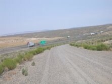
ELKO
Vacantlandnec
Nevada
A Areas with a 1% annual chance of flooding and a 26% chance of flooding over the life of a 30-year mortgage.
1-2
0
5,139.38 AC
2025
Carson City/Nevada Area
950800
Other Market Areas
NEARBY LISTINGS FOR SALE OR LEASE
DEMOGRAPHICS near 32N Rge 52E
1 mile
3 mile
5 mile
2025 Total Population
0
1,394
1,688
2030 Population
0
1,331
1,612
Pop Growth 2025-2030
0.00%
(4.52%)
(4.50%)
Average Age
0
39
39
2025 Total Households
0
542
651
HH Growth 2025-2030
0.00%
(4.61%)
(4.76%)
Median Household Inc
$0
$63,629
$63,165
Avg Household Size
.00
2.40
2.40
2025 Avg HH Vehicles
.00
2.00
2.00
Median Home Value
$0
$233,544
$225,555
Median Year Built
0
1983
1983
Nearby Places
Map Layers
Map Styles
 Street
 Aerial
Layers
 Traffic
 Biking
Places
Listings with unknown addresses are not visible on the map
- Restaurants
- Banks
- Shops
- Fitness
- Groceries
Nearby Properties
Address
Land Use
TOTAL SIZE
Lot Size
Zoning
Address
Land Use
TOTAL SIZE
Lot Size
Zoning
15,632 SF
56.40 AC
MULT
Address
Land Use
TOTAL SIZE
Lot Size
Zoning
49,848 SF
269.58 AC
RR&F
Address
Land Use
TOTAL SIZE
Lot Size
Zoning
61,894 SF
10 AC
SCHOOL
Address
Land Use
TOTAL SIZE
Lot Size
Zoning
28,286 SF
2.17 AC
TC
Address
Land Use
TOTAL SIZE
Lot Size
Zoning
15,532 SF
2.10 AC
COM
Address
Land Use
TOTAL SIZE
Lot Size
Zoning
8,347 SF
1.67 AC
TC
Address
Land Use
TOTAL SIZE
Lot Size
Zoning
6,125 SF
1.06 AC
COM
Address
Land Use
TOTAL SIZE
Lot Size
Zoning
5,041 SF
9.64 AC
RR&F
Address
Land Use
TOTAL SIZE
Lot Size
Zoning
9,400 SF
1.53 AC
MULT
Address
Land Use
TOTAL SIZE
Lot Size
Zoning
1,920 SF
14.79 AC
LI
Address
Land Use
TOTAL SIZE
Lot Size
Zoning
6,088 SF
1.20 AC
COM
Address
Land Use
TOTAL SIZE
Lot Size
Zoning
8,080 SF
0.78 AC
COM
Address
Land Use
TOTAL SIZE
Lot Size
Zoning
8,804 SF
0.69 AC
RMH3
Address
Land Use
TOTAL SIZE
Lot Size
Zoning
4,888 SF
1 AC
COM
Address
Land Use
TOTAL SIZE
Lot Size
Zoning
3,427 SF
0.57 AC
RMH2
Address
Land Use
TOTAL SIZE
Lot Size
Zoning
11,008 SF
4 AC
LI
Address
Land Use
TOTAL SIZE
Lot Size
Zoning
7,750 SF
1.38 AC
NR
Address
Land Use
TOTAL SIZE
Lot Size
Zoning
2,884 SF
0.59 AC
COM
Address
Land Use
TOTAL SIZE
Lot Size
Zoning
5,820 SF
0.69 AC
RMH3
Address
Land Use
TOTAL SIZE
Lot Size
Zoning
2,430 SF
0.71 AC
COM
Address
Land Use
TOTAL SIZE
Lot Size
Zoning
44,000 SF
1.55 AC
COM
Address
Land Use
TOTAL SIZE
Lot Size
Zoning
6,300 SF
10.97 AC
RR&F
Address
Land Use
TOTAL SIZE
Lot Size
Zoning
125.40 AC
RR&F
Address
Land Use
TOTAL SIZE
Lot Size
Zoning
3,200 SF
0.21 AC
COM1
Address
Land Use
TOTAL SIZE
Lot Size
Zoning
7,320 SF
0.40 AC
RMH2
Address
Land Use
TOTAL SIZE
Lot Size
Zoning
7,500 SF
0.06 AC
COM
Address
Land Use
TOTAL SIZE
Lot Size
Zoning
2.34 AC
COM
The World's #1 Commercial Real Estate Marketplace
Connect with us
© 2026 CoStar Group
The information above has been obtained from sources believed reliable. While we do not doubt its accuracy we have not verified it and make no guarantee, warranty or representation about it. It is your responsibility to independently confirm its accuracy and completeness. Any projections, opinions, assumptions, or estimates used are for example only and do not represent the current or future performance of the property. The value of this transaction to you depends on tax and other factors which should be evaluated by your tax, financial, and legal advisors. You and your advisors should conduct a careful, independent investigation of the property to determine to your satisfaction the suitability of the property for your needs.