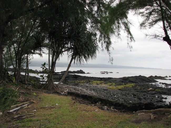
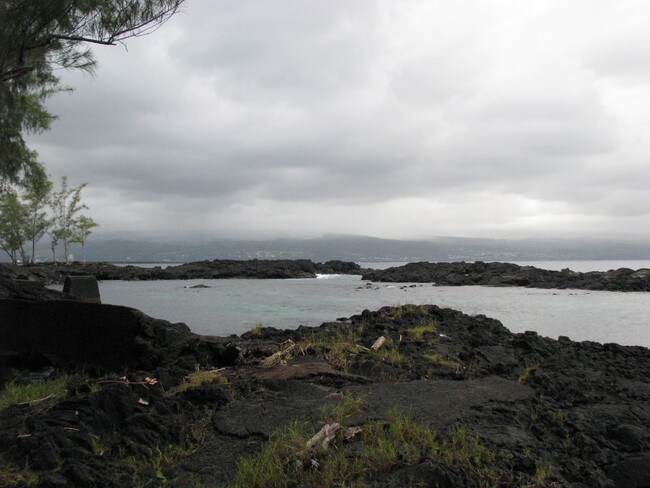
Property Record
33 Apapane Rd, Hilo, HI 96720


Property Detail
33 Apapane Rd
Hilo-Kailua, HI
LOT 18 1.447 AC DES LPGR 10701 KEAUKAHA SEASIDE LOTS
3-2-1-011-003-0000
HAWAII
Residentialacreage
Hawaii
V-.75
18
AE The base floodplain where base flood elevations are provided. AE Zones are now used on new format FIRMs instead of A1-A30 Zones.
1.45 AC
2024
Hilo/East Big Island
2025
Hawaii
020500
NEARBY LISTINGS FOR SALE OR LEASE
-
-
View all Hilo listings for sale on LoopNet.com
DEMOGRAPHICS near 33 Apapane Rd
1 mile
3 mile
5 mile
2025 Total Population
2,093
9,735
36,758
2030 Population
2,198
10,344
38,713
Pop Growth 2025-2030
+ 5.02%
+ 6.26%
+ 5.32%
Average Age
40
41
42
2025 Total Households
632
3,900
13,674
HH Growth 2025-2030
+ 5.38%
+ 6.41%
+ 5.35%
Median Household Inc
$75,746
$57,189
$69,772
Avg Household Size
3.10
2.40
2.50
2025 Avg HH Vehicles
2.00
2.00
2.00
Median Home Value
$317,557
$381,199
$491,981
Median Year Built
1982
1976
1978
Nearby Places
Map Layers
Map Styles
 Street
 Aerial
Transit
 Traffic
 Biking
Places
Listings with unknown addresses are not visible on the map
- Restaurants
- Banks
- Shops
- Fitness
- Groceries
PUBLIC TRANSPORTATION
AIRPORT
Hilo International
Drive
Walk
Distance
Hilo International
9 min
1.7 mi
SALE & LEASE HISTORY
LISTING DATE
SALE/LEASE

Aug 10, 2017
For Sale
Nearby Properties
Address
Land Use
TOTAL SIZE
Lot Size
Zoning
Address
Land Use
TOTAL SIZE
Lot Size
Zoning
165,552 SF
8 AC
CG-7.5
Address
Land Use
TOTAL SIZE
Lot Size
Zoning
474,990 SF
36.50 AC
OPEN
Address
Land Use
TOTAL SIZE
Lot Size
Zoning
328,862 SF
858.74 AC
OPEN
Address
Land Use
TOTAL SIZE
Lot Size
Zoning
218,538 SF
15.57 AC
MCX-20
Address
Land Use
TOTAL SIZE
Lot Size
Zoning
121,312 SF
5 AC
V-.75
Address
Land Use
TOTAL SIZE
Lot Size
Zoning
2,369.87 AC
A-5a
Address
Land Use
TOTAL SIZE
Lot Size
Zoning
94,704 SF
2.95 AC
V-.75
Address
Land Use
TOTAL SIZE
Lot Size
Zoning
51,381 SF
4.04 AC
CG-7.5
Address
Land Use
TOTAL SIZE
Lot Size
Zoning
79,794 SF
6.54 AC
CG-7.5
Address
Land Use
TOTAL SIZE
Lot Size
Zoning
103,234 SF
10.69 AC
ML-20
Address
Land Use
TOTAL SIZE
Lot Size
Zoning
26,540 SF
442.49 AC
A-5a
Address
Land Use
TOTAL SIZE
Lot Size
Zoning
101,100 SF
13.59 AC
OPEN
Address
Land Use
TOTAL SIZE
Lot Size
Zoning
39,714 SF
14.52 AC
MG-1a
Address
Land Use
TOTAL SIZE
Lot Size
Zoning
134,564 SF
5.19 AC
CG-20
Address
Land Use
TOTAL SIZE
Lot Size
Zoning
103,932 SF
4.02 AC
CG-7.5
Address
Land Use
TOTAL SIZE
Lot Size
Zoning
90,060 SF
10.56 AC
MG-1a
Address
Land Use
TOTAL SIZE
Lot Size
Zoning
8,000 SF
25.32 AC
MG-1a
Address
Land Use
TOTAL SIZE
Lot Size
Zoning
12.77 AC
ML-20
Address
Land Use
TOTAL SIZE
Lot Size
Zoning
13,237 SF
2.55 AC
CG-7.5
Address
Land Use
TOTAL SIZE
Lot Size
Zoning
11,801 SF
3.43 AC
MG-1a
Address
Land Use
TOTAL SIZE
Lot Size
Zoning
1,270.50 AC
A-5a
Address
Land Use
TOTAL SIZE
Lot Size
Zoning
45,341 SF
2.83 AC
RM-1
Address
Land Use
TOTAL SIZE
Lot Size
Zoning
28,876 SF
1.09 AC
V-.75
Address
Land Use
TOTAL SIZE
Lot Size
Zoning
40.42 AC
OPEN
Address
Land Use
TOTAL SIZE
Lot Size
Zoning
32,552 SF
4.68 AC
CG-7.5
Address
Land Use
TOTAL SIZE
Lot Size
Zoning
61,210 SF
2.77 AC
CG-20
Address
Land Use
TOTAL SIZE
Lot Size
Zoning
84,452 SF
5.56 AC
MG-1a
Address
Land Use
TOTAL SIZE
Lot Size
Zoning
47,000 SF
3.57 AC
MG-1a
Address
Land Use
TOTAL SIZE
Lot Size
Zoning
3,357 SF
73.45 AC
MG-1a
Address
Land Use
TOTAL SIZE
Lot Size
Zoning
1.37 AC
CDH
The World's #1 Commercial Real Estate Marketplace
Connect with us
© 2026 CoStar Group
The information above has been obtained from sources believed reliable. While we do not doubt its accuracy we have not verified it and make no guarantee, warranty or representation about it. It is your responsibility to independently confirm its accuracy and completeness. Any projections, opinions, assumptions, or estimates used are for example only and do not represent the current or future performance of the property. The value of this transaction to you depends on tax and other factors which should be evaluated by your tax, financial, and legal advisors. You and your advisors should conduct a careful, independent investigation of the property to determine to your satisfaction the suitability of the property for your needs.