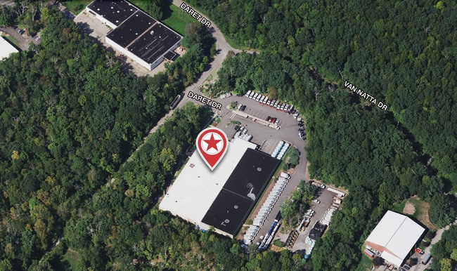
Property Record
33 Daret Dr, Ringwood, NJ 07456


Current Lease Availabilities
NEARBY LISTINGS FOR SALE OR LEASE
Property Detail
33 Daret Dr
11-00508-0000-00002-12
Passaic
Warehouse
New Jersey
X
2.12
34031C0044G
11.54 AC
2024
Suburban Passaic
2025
Northern New Jersey
216701
New York-Jersey City-White Plains, NY-NJ
57,156 SF
DEMOGRAPHICS near 33 Daret Dr
1 Mile
3 Mile
5 Mile
2024 Total Population
175
7,320
28,180
2029 Population
174
7,312
28,157
Pop Growth 2024-2029
(0.57%)
(0.11%)
(0.08%)
Average Age
44
43
44
2024 Total Households
60
2,602
10,337
HH Growth 2024-2029
0.00%
(0.35%)
(0.28%)
Median Household Inc
$131,250
$133,154
$115,123
Avg Household Size
2.80
2.80
2.60
2024 Avg HH Vehicles
3.00
2.00
2.00
Median Home Value
$428,846
$421,148
$391,347
Median Year Built
1959
1962
1968
Nearby Places
Map Layers
Map Styles
 Street
 Aerial
- Restaurants
- Banks
- Shops
- Fitness
- Groceries
PUBLIC TRANSPORTATION
COMMUTER RAIL
Sloatsburg (Bergen County/Port Jervis Line - NJ Transit Commuter Rail (NJ Transit), Main/Port Jervis Line - NJ Transit Commuter Rail (NJ Transit))
DRIVE
WALK
Distance
Sloatsburg (Bergen County/Port Jervis Line - NJ Transit Commuter Rail (NJ Transit), Main/Port Jervis Line - NJ Transit Commuter Rail (NJ Transit))
14 min
6.6 mi
AIRPORT
New York Stewart International
DRIVE
WALK
Distance
New York Stewart International
59 min
41.4 mi
Freight Ports
Port Newark Container Terminal
DRIVE
WALK
Distance
Port Newark Container Terminal
61 min
41.2 mi
Nearby Properties
Address
Land Use
TOTAL SIZE
Lot Size
Zoning
Address
Land Use
TOTAL SIZE
Lot Size
Zoning
426,876 SF
171.60 AC
00799
Address
Land Use
TOTAL SIZE
Lot Size
Zoning
2,811.50 AC
Address
Land Use
TOTAL SIZE
Lot Size
Zoning
Address
Land Use
TOTAL SIZE
Lot Size
Zoning
3,716 SF
981.20 AC
Address
Land Use
TOTAL SIZE
Lot Size
Zoning
Address
Land Use
TOTAL SIZE
Lot Size
Zoning
1.30 AC
Address
Land Use
TOTAL SIZE
Lot Size
Zoning
11.92 AC
Address
Land Use
TOTAL SIZE
Lot Size
Zoning
907.75 AC
Address
Land Use
TOTAL SIZE
Lot Size
Zoning
Address
Land Use
TOTAL SIZE
Lot Size
Zoning
17,780 SF
461.10 AC
Address
Land Use
TOTAL SIZE
Lot Size
Zoning
460.70 AC
Address
Land Use
TOTAL SIZE
Lot Size
Zoning
Address
Land Use
TOTAL SIZE
Lot Size
Zoning
2,484 SF
5 AC
Address
Land Use
TOTAL SIZE
Lot Size
Zoning
2,016 SF
92 AC
Address
Land Use
TOTAL SIZE
Lot Size
Zoning
10.63 AC
Address
Land Use
TOTAL SIZE
Lot Size
Zoning
Address
Land Use
TOTAL SIZE
Lot Size
Zoning
38.59 AC
Address
Land Use
TOTAL SIZE
Lot Size
Zoning
Address
Land Use
TOTAL SIZE
Lot Size
Zoning
416.27 AC
Address
Land Use
TOTAL SIZE
Lot Size
Zoning
37,000 SF
7 AC
Address
Land Use
TOTAL SIZE
Lot Size
Zoning
312.25 AC
Address
Land Use
TOTAL SIZE
Lot Size
Zoning
343.02 AC
Address
Land Use
TOTAL SIZE
Lot Size
Zoning
277 AC
Address
Land Use
TOTAL SIZE
Lot Size
Zoning
44,894 SF
3.54 AC
Address
Land Use
TOTAL SIZE
Lot Size
Zoning
Address
Land Use
TOTAL SIZE
Lot Size
Zoning
20,624 SF
1.98 AC
Address
Land Use
TOTAL SIZE
Lot Size
Zoning
3,440 SF
149.42 AC
Address
Land Use
TOTAL SIZE
Lot Size
Zoning
3,456 SF
1.90 AC
Address
Land Use
TOTAL SIZE
Lot Size
Zoning
212.49 AC
The World's #1 Commercial Real Estate Marketplace
Connect with us
© 2026 CoStar Group
The information above has been obtained from sources believed reliable. While we do not doubt its accuracy we have not verified it and make no guarantee, warranty or representation about it. It is your responsibility to independently confirm its accuracy and completeness. Any projections, opinions, assumptions, or estimates used are for example only and do not represent the current or future performance of the property. The value of this transaction to you depends on tax and other factors which should be evaluated by your tax, financial, and legal advisors. You and your advisors should conduct a careful, independent investigation of the property to determine to your satisfaction the suitability of the property for your needs.