Property Record
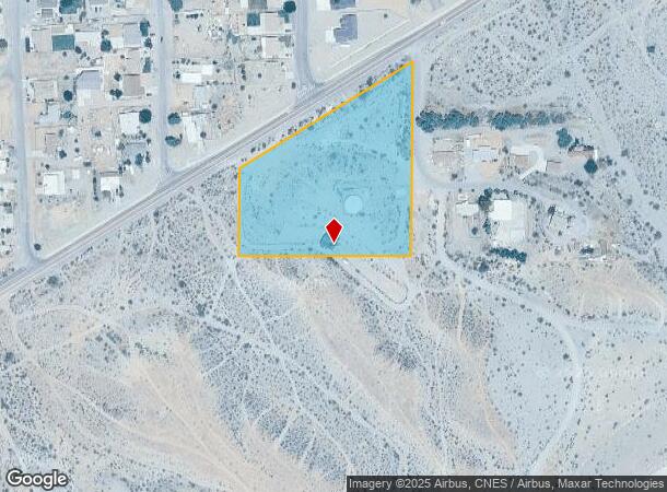
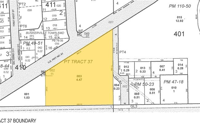
33 E Riverside Rd, Bunkerville, NV 89007

Property Detail
33 E Riverside Rd
002-25-401-003
PT TRACT 37
Vacantlandnec
Clark
X
Nevada
32003C0369F
4.47 AC
2026
Outlying NE Clark County
2026
Las Vegas
007600
Las Vegas-Henderson-North Las Vegas, NV
NEARBY LISTINGS FOR SALE OR LEASE
-
-
-
-
-
Interstate 15 Southbound Exit Corner & Falcon Ridge
Mesquite, NV 89027
$3,450,000
10.69 AC Lots
Land
-
-
-
View all Bunkerville listings for sale on LoopNet.com
DEMOGRAPHICS near 33 E Riverside Rd
1 mile
3 mile
5 mile
2024 Total Population
1,014
5,453
21,264
2029 Population
1,066
5,921
23,501
Pop Growth 2024-2029
+ 5.13%
+ 8.58%
+ 10.52%
Average Age
36
47
53
2024 Total Households
287
2,235
9,447
HH Growth 2024-2029
+ 4.88%
+ 8.81%
+ 10.77%
Median Household Inc
$111,647
$63,170
$67,984
Avg Household Size
3.20
2.40
2.20
2024 Avg HH Vehicles
3.00
2.00
2.00
Median Home Value
$704,545
$300,556
$372,374
Median Year Built
1992
2000
2005
Nearby Places
Map Layers
Map Styles
 Street
 Aerial
Transit
 Traffic
 Biking
Places
Listings with unknown addresses are not visible on the map
- Restaurants
- Banks
- Shops
- Fitness
- Groceries
SALE & LEASE HISTORY
LISTING DATE
SALE/LEASE

Sep 24, 2016
For Sale
Nearby Properties
Address
Land Use
TOTAL SIZE
Lot Size
Zoning
Address
Land Use
TOTAL SIZE
Lot Size
Zoning
568,590 SF
63.57 AC
Address
Land Use
TOTAL SIZE
Lot Size
Zoning
148,373 SF
19.35 AC
HT
Address
Land Use
TOTAL SIZE
Lot Size
Zoning
568,553 SF
56.06 AC
IR1
Address
Land Use
TOTAL SIZE
Lot Size
Zoning
83,429 SF
23.92 AC
CRH
Address
Land Use
TOTAL SIZE
Lot Size
Zoning
496,775 SF
5.02 AC
HT
Address
Land Use
TOTAL SIZE
Lot Size
Zoning
3,450 SF
4.93 AC
PB
Address
Land Use
TOTAL SIZE
Lot Size
Zoning
154,961 SF
17.17 AC
PUD
Address
Land Use
TOTAL SIZE
Lot Size
Zoning
10.07 AC
PF
Address
Land Use
TOTAL SIZE
Lot Size
Zoning
107,554 SF
10.04 AC
Address
Land Use
TOTAL SIZE
Lot Size
Zoning
66,537 SF
6.27 AC
PUD
Address
Land Use
TOTAL SIZE
Lot Size
Zoning
11,249 SF
220.36 AC
PUD
Address
Land Use
TOTAL SIZE
Lot Size
Zoning
37,245 SF
8.50 AC
IR1
Address
Land Use
TOTAL SIZE
Lot Size
Zoning
50,402 SF
6.14 AC
IR1
Address
Land Use
TOTAL SIZE
Lot Size
Zoning
29,934 SF
1.08 AC
CRH
Address
Land Use
TOTAL SIZE
Lot Size
Zoning
12,800 SF
30.40 AC
IR1
Address
Land Use
TOTAL SIZE
Lot Size
Zoning
19,503 SF
6.22 AC
PUD
Address
Land Use
TOTAL SIZE
Lot Size
Zoning
27,077 SF
2.58 AC
IR1
Address
Land Use
TOTAL SIZE
Lot Size
Zoning
1,340 SF
17.28 AC
HT
Address
Land Use
TOTAL SIZE
Lot Size
Zoning
24,929 SF
1.37 AC
PUD
Address
Land Use
TOTAL SIZE
Lot Size
Zoning
38.91 AC
IR1
Address
Land Use
TOTAL SIZE
Lot Size
Zoning
20,295 SF
3.25 AC
Address
Land Use
TOTAL SIZE
Lot Size
Zoning
41,050 SF
2.86 AC
IR1
Address
Land Use
TOTAL SIZE
Lot Size
Zoning
14,736 SF
2.23 AC
PUD
Address
Land Use
TOTAL SIZE
Lot Size
Zoning
35.15 AC
IR1
Address
Land Use
TOTAL SIZE
Lot Size
Zoning
14,822 SF
1.07 AC
Address
Land Use
TOTAL SIZE
Lot Size
Zoning
2.68 AC
RU
The World's #1 Commercial Real Estate Marketplace
Connect with us
© 2026 CoStar Group
The information above has been obtained from sources believed reliable. While we do not doubt its accuracy we have not verified it and make no guarantee, warranty or representation about it. It is your responsibility to independently confirm its accuracy and completeness. Any projections, opinions, assumptions, or estimates used are for example only and do not represent the current or future performance of the property. The value of this transaction to you depends on tax and other factors which should be evaluated by your tax, financial, and legal advisors. You and your advisors should conduct a careful, independent investigation of the property to determine to your satisfaction the suitability of the property for your needs.