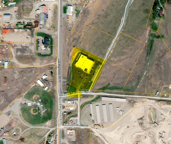
Property Record
33 Kaylin Dr, Eureka, MT 59917


Property Detail
33 Kaylin Dr
56-4823-11-1-05-01-0000
COMSTOCK ACRES, S11, T36 N, R27 W, ACRES 4.4, PM 6743 PARCEL A IN NW
Supermarket
Lincoln
2025
Montana
2025
4.40 AC
000401
Glacier Country
29,424 SF
Other Market Areas
NEARBY LISTINGS FOR SALE OR LEASE
-
-
View all Eureka listings for sale on LoopNet.com
DEMOGRAPHICS near 33 Kaylin Dr
1 mile
3 mile
5 mile
2025 Total Population
463
2,248
3,281
2030 Population
487
2,360
3,469
Pop Growth 2025-2030
+ 5.18%
+ 4.98%
+ 5.73%
Average Age
47
47
48
2025 Total Households
198
958
1,407
HH Growth 2025-2030
+ 4.55%
+ 4.59%
+ 5.33%
Median Household Inc
$46,875
$49,341
$55,465
Avg Household Size
2.30
2.30
2.30
2025 Avg HH Vehicles
2.00
2.00
2.00
Median Home Value
$279,729
$276,785
$320,866
Median Year Built
1990
1988
1992
Nearby Places
Map Layers
Map Styles
 Street
 Aerial
Layers
 Traffic
 Biking
Places
Listings with unknown addresses are not visible on the map
- Restaurants
- Banks
- Shops
- Fitness
- Groceries
Nearby Properties
Address
Land Use
TOTAL SIZE
Lot Size
Zoning
Address
Land Use
TOTAL SIZE
Lot Size
Zoning
9,523 SF
335.22 AC
Address
Land Use
TOTAL SIZE
Lot Size
Zoning
Address
Land Use
TOTAL SIZE
Lot Size
Zoning
14,637 SF
3 AC
Address
Land Use
TOTAL SIZE
Lot Size
Zoning
25.93 AC
Address
Land Use
TOTAL SIZE
Lot Size
Zoning
2,432 SF
1 AC
Address
Land Use
TOTAL SIZE
Lot Size
Zoning
11,442 SF
1.98 AC
Address
Land Use
TOTAL SIZE
Lot Size
Zoning
6,792 SF
1.31 AC
Address
Land Use
TOTAL SIZE
Lot Size
Zoning
6,027 SF
2.54 AC
Address
Land Use
TOTAL SIZE
Lot Size
Zoning
5,352 SF
0.26 AC
Address
Land Use
TOTAL SIZE
Lot Size
Zoning
9,272 SF
0.45 AC
Address
Land Use
TOTAL SIZE
Lot Size
Zoning
7,060 SF
0.52 AC
Address
Land Use
TOTAL SIZE
Lot Size
Zoning
9,872 SF
14.80 AC
Address
Land Use
TOTAL SIZE
Lot Size
Zoning
4,863 SF
0.26 AC
Address
Land Use
TOTAL SIZE
Lot Size
Zoning
88.63 AC
Address
Land Use
TOTAL SIZE
Lot Size
Zoning
9,000 SF
1.14 AC
Address
Land Use
TOTAL SIZE
Lot Size
Zoning
5,335 SF
4.87 AC
Address
Land Use
TOTAL SIZE
Lot Size
Zoning
5,818 SF
2.23 AC
Address
Land Use
TOTAL SIZE
Lot Size
Zoning
17,600 SF
4.03 AC
Address
Land Use
TOTAL SIZE
Lot Size
Zoning
8,328 SF
20.04 AC
Address
Land Use
TOTAL SIZE
Lot Size
Zoning
5,972 SF
2.64 AC
Address
Land Use
TOTAL SIZE
Lot Size
Zoning
4,176 SF
14.20 AC
Address
Land Use
TOTAL SIZE
Lot Size
Zoning
7,080 SF
39.08 AC
Address
Land Use
TOTAL SIZE
Lot Size
Zoning
7,477 SF
1.29 AC
Address
Land Use
TOTAL SIZE
Lot Size
Zoning
5,400 SF
5.71 AC
Address
Land Use
TOTAL SIZE
Lot Size
Zoning
5,432 SF
19.18 AC
Address
Land Use
TOTAL SIZE
Lot Size
Zoning
5,400 SF
0.70 AC
Address
Land Use
TOTAL SIZE
Lot Size
Zoning
6,500 SF
2.11 AC
Address
Land Use
TOTAL SIZE
Lot Size
Zoning
7,200 SF
5.58 AC
The World's #1 Commercial Real Estate Marketplace
Connect with us
© 2026 CoStar Group
The information above has been obtained from sources believed reliable. While we do not doubt its accuracy we have not verified it and make no guarantee, warranty or representation about it. It is your responsibility to independently confirm its accuracy and completeness. Any projections, opinions, assumptions, or estimates used are for example only and do not represent the current or future performance of the property. The value of this transaction to you depends on tax and other factors which should be evaluated by your tax, financial, and legal advisors. You and your advisors should conduct a careful, independent investigation of the property to determine to your satisfaction the suitability of the property for your needs.