No Photo
Property Record
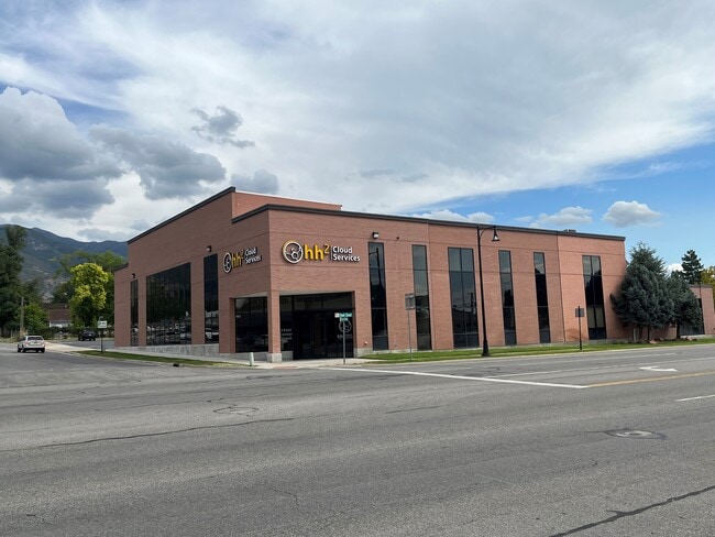
33 S Main St, Kaysville, UT 84037


NEARBY LISTINGS FOR SALE OR LEASE
-
-
-
-
860-880 North Fairfield Road, Layton, UT 84041
Layton, UT 84041
$14.00 SF/YR
1,475 - 13,692 SF
Retail
-
-
View all Kaysville listings for lease on LoopNet.com
Property Detail
33 S Main St
Ogden-Clearfield, UT
Plat A Kaysville Townsite
11-108-0123
ALL OF LOT 3, 5 & 6 & PART OF LOT 4, BLK 6, PLAT A, KAYSVILLE TS SURVEY DESC AS FOLLOWS: BEG AT THE SE COR OF SD LOT 3; & RUN TH N 528 FT TO THE NE COR OF SD LOT 6; TH W'LY 264 FT TO THE NW COR OF SD
Financialbuilding
Davis
X
Utah
49011C0237F
3-6
2025
3.01 AC
2025
Davis/Weber Counties
127100
Salt Lake City
32,417 SF
DEMOGRAPHICS near 33 S Main St
1 Mile
3 Mile
5 Mile
2024 Total Population
10,909
73,507
136,648
2029 Population
11,524
77,843
144,856
Pop Growth 2024-2029
+ 5.64%
+ 5.90%
+ 6.01%
Average Age
36
35
35
2024 Total Households
3,372
21,661
41,352
HH Growth 2024-2029
+ 5.66%
+ 5.94%
+ 6.04%
Median Household Inc
$87,314
$107,513
$100,378
Avg Household Size
3.20
3.40
3.30
2024 Avg HH Vehicles
2.00
2.00
2.00
Median Home Value
$461,851
$495,800
$465,696
Median Year Built
1979
1992
1993
Nearby Places
Map Layers
Map Styles
 Street
 Aerial
- Restaurants
- Banks
- Shops
- Fitness
- Groceries
PUBLIC TRANSPORTATION
COMMUTER RAIL
Layton (FrontRunner North - Utah Transit Authority (UTA))
DRIVE
WALK
Distance
Layton (FrontRunner North - Utah Transit Authority (UTA))
5 min
2.6 mi
Farmington (FrontRunner North - Utah Transit Authority (UTA))
DRIVE
WALK
Distance
Farmington (FrontRunner North - Utah Transit Authority (UTA))
7 min
3.9 mi
AIRPORT
Salt Lake City International
DRIVE
WALK
Distance
Salt Lake City International
31 min
23.3 mi
Freight Ports
Port of Stockton
DRIVE
WALK
Distance
Port of Stockton
731 min
713.6 mi
SALE & LEASE HISTORY
LISTING DATE
SALE/LEASE

Nov 21, 2022
For Lease
Mar 26, 2024
For Lease
Jan 11, 2023
For Sale
Feb 26, 2021
For Lease
Nearby Properties
Address
Land Use
TOTAL SIZE
Lot Size
Zoning
Address
Land Use
TOTAL SIZE
Lot Size
Zoning
346,223 SF
36.29 AC
BRP
Address
Land Use
TOTAL SIZE
Lot Size
Zoning
102,978 SF
6.42 AC
Address
Land Use
TOTAL SIZE
Lot Size
Zoning
100,348 SF
21.75 AC
R18
Address
Land Use
TOTAL SIZE
Lot Size
Zoning
67,233 SF
32.52 AC
A1
Address
Land Use
TOTAL SIZE
Lot Size
Zoning
16,184 SF
23.31 AC
PU
Address
Land Use
TOTAL SIZE
Lot Size
Zoning
94,532 SF
7.07 AC
Address
Land Use
TOTAL SIZE
Lot Size
Zoning
147,675 SF
11.25 AC
C-H
Address
Land Use
TOTAL SIZE
Lot Size
Zoning
111,724 SF
10.72 AC
RA
Address
Land Use
TOTAL SIZE
Lot Size
Zoning
67,536 SF
13.16 AC
LI
Address
Land Use
TOTAL SIZE
Lot Size
Zoning
61,926 SF
40.43 AC
PU
Address
Land Use
TOTAL SIZE
Lot Size
Zoning
73,229 SF
9.94 AC
R120
Address
Land Use
TOTAL SIZE
Lot Size
Zoning
140,364 SF
6.47 AC
RH
Address
Land Use
TOTAL SIZE
Lot Size
Zoning
218,896 SF
2.76 AC
MUTOD
Address
Land Use
TOTAL SIZE
Lot Size
Zoning
119,988 SF
10.63 AC
LI
Address
Land Use
TOTAL SIZE
Lot Size
Zoning
72,750 SF
13.09 AC
A1
Address
Land Use
TOTAL SIZE
Lot Size
Zoning
312,601 SF
13.30 AC
R18
Address
Land Use
TOTAL SIZE
Lot Size
Zoning
61,864 SF
11.66 AC
Address
Land Use
TOTAL SIZE
Lot Size
Zoning
7,098 SF
183.50 AC
A
Address
Land Use
TOTAL SIZE
Lot Size
Zoning
77,091 SF
11.09 AC
A
Address
Land Use
TOTAL SIZE
Lot Size
Zoning
43,620 SF
67.58 AC
PU
Address
Land Use
TOTAL SIZE
Lot Size
Zoning
300,026 SF
4.39 AC
Address
Land Use
TOTAL SIZE
Lot Size
Zoning
52,223 SF
7.01 AC
Address
Land Use
TOTAL SIZE
Lot Size
Zoning
122,792 SF
21.72 AC
R18
Address
Land Use
TOTAL SIZE
Lot Size
Zoning
83,616 SF
7.48 AC
Address
Land Use
TOTAL SIZE
Lot Size
Zoning
3,640 SF
6.45 AC
R18
Address
Land Use
TOTAL SIZE
Lot Size
Zoning
1,120 SF
45.92 AC
PU
Address
Land Use
TOTAL SIZE
Lot Size
Zoning
50,471 SF
4.48 AC
R18
Address
Land Use
TOTAL SIZE
Lot Size
Zoning
90,485 SF
3.23 AC
Address
Land Use
TOTAL SIZE
Lot Size
Zoning
105,133 SF
10.98 AC
Address
Land Use
TOTAL SIZE
Lot Size
Zoning
5,508 SF
4.98 AC
PU
The World's #1 Commercial Real Estate Marketplace
Connect with us
© 2026 CoStar Group
The information above has been obtained from sources believed reliable. While we do not doubt its accuracy we have not verified it and make no guarantee, warranty or representation about it. It is your responsibility to independently confirm its accuracy and completeness. Any projections, opinions, assumptions, or estimates used are for example only and do not represent the current or future performance of the property. The value of this transaction to you depends on tax and other factors which should be evaluated by your tax, financial, and legal advisors. You and your advisors should conduct a careful, independent investigation of the property to determine to your satisfaction the suitability of the property for your needs.