Property Record
33 S Main St, Oconomowoc, WI 53066
NEARBY LISTINGS FOR SALE OR LEASE
Property Detail
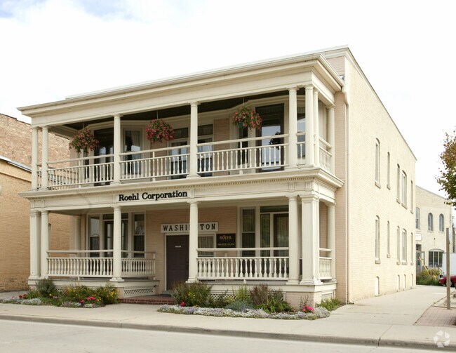
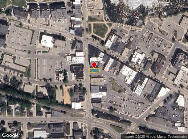
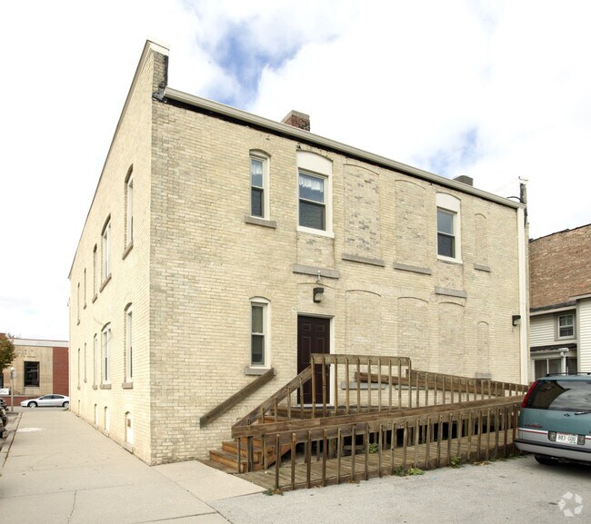
33 S Main St
Milwaukee-Waukesha-West Allis, WI
Original Plat Of The Village Of Oconomow
OCOC-0563-208
PT LOT 166 ORIGINAL PLAT OF THE VILLAGE OF OCONOMOWOC S 37. 04 FT W 88 FT PT W1/2 SEC 33 T8N R17E ALSO PT LOT 165 ORIGINAL PLAT OF THE VILLAGE OF OCONOMOWOC COM SW COR LOT 166 N8734E 88 FT S226E 0.30 FT S8745W 88 FT TO BGN 13.2 SQ FT DOC# 3730501
Commercialnec
Waukesha
X
Wisconsin
55133C0151G
166
2024
0.08 AC
2024
NE/Delafield
204301
Milwaukee/Madison
DEMOGRAPHICS near 33 S Main St
1 Mile
3 Mile
5 Mile
2024 Total Population
8,739
26,658
37,597
2029 Population
9,109
27,719
39,053
Pop Growth 2024-2029
+ 4.23%
+ 3.98%
+ 3.87%
Average Age
42
43
43
2024 Total Households
3,851
11,031
15,264
HH Growth 2024-2029
+ 4.18%
+ 4.03%
+ 3.92%
Median Household Inc
$84,058
$97,751
$102,224
Avg Household Size
2.20
2.40
2.40
2024 Avg HH Vehicles
2.00
2.00
2.00
Median Home Value
$269,859
$345,467
$372,218
Median Year Built
1970
1985
1985
Nearby Places
Map Layers
Map Styles
 Street
 Aerial
- Restaurants
- Banks
- Shops
- Fitness
- Groceries
PUBLIC TRANSPORTATION
AIRPORT
General Mitchell International
DRIVE
WALK
Distance
General Mitchell International
55 min
38.8 mi
Freight Ports
Port Milwaukee
DRIVE
WALK
Distance
Port Milwaukee
48 min
35.3 mi
Nearby Properties
Address
Land Use
TOTAL SIZE
Lot Size
Zoning
Address
Land Use
TOTAL SIZE
Lot Size
Zoning
85.90 AC
Address
Land Use
TOTAL SIZE
Lot Size
Zoning
Address
Land Use
TOTAL SIZE
Lot Size
Zoning
12.32 AC
Address
Land Use
TOTAL SIZE
Lot Size
Zoning
11.16 AC
Address
Land Use
TOTAL SIZE
Lot Size
Zoning
12.01 AC
Address
Land Use
TOTAL SIZE
Lot Size
Zoning
Address
Land Use
TOTAL SIZE
Lot Size
Zoning
Address
Land Use
TOTAL SIZE
Lot Size
Zoning
Address
Land Use
TOTAL SIZE
Lot Size
Zoning
Address
Land Use
TOTAL SIZE
Lot Size
Zoning
8.92 AC
Address
Land Use
TOTAL SIZE
Lot Size
Zoning
22.10 AC
Address
Land Use
TOTAL SIZE
Lot Size
Zoning
Address
Land Use
TOTAL SIZE
Lot Size
Zoning
Address
Land Use
TOTAL SIZE
Lot Size
Zoning
Address
Land Use
TOTAL SIZE
Lot Size
Zoning
Address
Land Use
TOTAL SIZE
Lot Size
Zoning
Address
Land Use
TOTAL SIZE
Lot Size
Zoning
Address
Land Use
TOTAL SIZE
Lot Size
Zoning
Address
Land Use
TOTAL SIZE
Lot Size
Zoning
3.52 AC
Address
Land Use
TOTAL SIZE
Lot Size
Zoning
Address
Land Use
TOTAL SIZE
Lot Size
Zoning
Address
Land Use
TOTAL SIZE
Lot Size
Zoning
Address
Land Use
TOTAL SIZE
Lot Size
Zoning
Address
Land Use
TOTAL SIZE
Lot Size
Zoning
Address
Land Use
TOTAL SIZE
Lot Size
Zoning
5.18 AC
Address
Land Use
TOTAL SIZE
Lot Size
Zoning
6.87 AC
Address
Land Use
TOTAL SIZE
Lot Size
Zoning
1.28 AC
Address
Land Use
TOTAL SIZE
Lot Size
Zoning
Address
Land Use
TOTAL SIZE
Lot Size
Zoning
Address
Land Use
TOTAL SIZE
Lot Size
Zoning
6.20 AC
The World's #1 Commercial Real Estate Marketplace
Connect with us
© 2025 CoStar Group
The information above has been obtained from sources believed reliable. While we do not doubt its accuracy we have not verified it and make no guarantee, warranty or representation about it. It is your responsibility to independently confirm its accuracy and completeness. Any projections, opinions, assumptions, or estimates used are for example only and do not represent the current or future performance of the property. The value of this transaction to you depends on tax and other factors which should be evaluated by your tax, financial, and legal advisors. You and your advisors should conduct a careful, independent investigation of the property to determine to your satisfaction the suitability of the property for your needs.