Property Record
330 Becker Dr, Schenectady, NY 12306
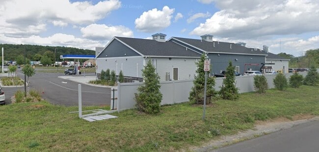

Property Detail
330 Becker Dr
057-000-0003-025-000-0000
Schenectady
Servicestationmarket
New York
B-2
25.001
B and X Area of moderate flood hazard, usually the area between the limits of the 100-year and 500-year floods.
3.37 AC
2025
Outer Schenectady County
2025
Albany/Schenectady/Troy
032601
Albany-Schenectady-Troy, NY
8,397 SF
NEARBY LISTINGS FOR SALE OR LEASE
-
-
View all Schenectady listings for sale on LoopNet.com
DEMOGRAPHICS near 330 Becker Dr
1 mile
3 mile
5 mile
2025 Total Population
949
14,878
62,553
2030 Population
967
15,111
63,471
Pop Growth 2025-2030
+ 1.90%
+ 1.57%
+ 1.47%
Average Age
43
42
41
2025 Total Households
340
6,356
26,469
HH Growth 2025-2030
+ 2.06%
+ 1.83%
+ 1.67%
Median Household Inc
$112,500
$81,912
$69,006
Avg Household Size
2.70
2.30
2.30
2025 Avg HH Vehicles
2.00
2.00
2.00
Median Home Value
$438,750
$265,933
$222,833
Median Year Built
1992
1965
1952
Nearby Places
Map Layers
Map Styles
 Street
 Aerial
Layers
 Traffic
 Biking
Places
Listings with unknown addresses are not visible on the map
- Restaurants
- Banks
- Shops
- Fitness
- Groceries
PUBLIC TRANSPORTATION
AIRPORT
Albany International
Drive
Walk
Distance
Albany International
28 min
17.1 mi
Freight Ports
Albany, NY Port
Drive
Walk
Distance
Albany, NY Port
27 min
20.3 mi
Nearby Properties
Address
Land Use
TOTAL SIZE
Lot Size
Zoning
Address
Land Use
TOTAL SIZE
Lot Size
Zoning
1,003,413 SF
177.60 AC
B-1, I-1
Address
Land Use
TOTAL SIZE
Lot Size
Zoning
128,744 SF
119 AC
A-1
Address
Land Use
TOTAL SIZE
Lot Size
Zoning
152,503 SF
8.21 AC
I-1
Address
Land Use
TOTAL SIZE
Lot Size
Zoning
99.20 AC
Address
Land Use
TOTAL SIZE
Lot Size
Zoning
12,289 SF
17.08 AC
R-3
Address
Land Use
TOTAL SIZE
Lot Size
Zoning
229,890 SF
85.08 AC
I-1
Address
Land Use
TOTAL SIZE
Lot Size
Zoning
230,000 SF
12.99 AC
I-1
Address
Land Use
TOTAL SIZE
Lot Size
Zoning
10,212 SF
7.09 AC
B-2
Address
Land Use
TOTAL SIZE
Lot Size
Zoning
10,212 SF
5.97 AC
B-2
Address
Land Use
TOTAL SIZE
Lot Size
Zoning
4,896 SF
12.80 AC
A-1
Address
Land Use
TOTAL SIZE
Lot Size
Zoning
115,660 SF
12.37 AC
B-1
Address
Land Use
TOTAL SIZE
Lot Size
Zoning
10,212 SF
5.55 AC
B-2
Address
Land Use
TOTAL SIZE
Lot Size
Zoning
2,000 SF
22.12 AC
I-2
Address
Land Use
TOTAL SIZE
Lot Size
Zoning
263,100 SF
77.76 AC
I-1
Address
Land Use
TOTAL SIZE
Lot Size
Zoning
37,600 SF
7.11 AC
I-1
Address
Land Use
TOTAL SIZE
Lot Size
Zoning
18,706 SF
43.70 AC
A-1
Address
Land Use
TOTAL SIZE
Lot Size
Zoning
33,668 SF
3.88 AC
B-2
Address
Land Use
TOTAL SIZE
Lot Size
Zoning
18,000 SF
8.50 AC
I-1
Address
Land Use
TOTAL SIZE
Lot Size
Zoning
271,772 SF
26.20 AC
I-1
Address
Land Use
TOTAL SIZE
Lot Size
Zoning
4,281 SF
8.42 AC
R-3
Address
Land Use
TOTAL SIZE
Lot Size
Zoning
45,270 SF
25.96 AC
R-1
Address
Land Use
TOTAL SIZE
Lot Size
Zoning
22,790 SF
0.53 AC
I-1
Address
Land Use
TOTAL SIZE
Lot Size
Zoning
113.46 AC
Address
Land Use
TOTAL SIZE
Lot Size
Zoning
Address
Land Use
TOTAL SIZE
Lot Size
Zoning
590,455 SF
72.23 AC
I-2, B-1
Address
Land Use
TOTAL SIZE
Lot Size
Zoning
66,580 SF
14.45 AC
B-2
Address
Land Use
TOTAL SIZE
Lot Size
Zoning
15,484 SF
1.49 AC
B-1
Address
Land Use
TOTAL SIZE
Lot Size
Zoning
13,128 SF
1.75 AC
B-1
Address
Land Use
TOTAL SIZE
Lot Size
Zoning
6,050 SF
7.35 AC
B-2
Address
Land Use
TOTAL SIZE
Lot Size
Zoning
99,512 SF
21.71 AC
I-1
The World's #1 Commercial Real Estate Marketplace
Connect with us
© 2026 CoStar Group
The information above has been obtained from sources believed reliable. While we do not doubt its accuracy we have not verified it and make no guarantee, warranty or representation about it. It is your responsibility to independently confirm its accuracy and completeness. Any projections, opinions, assumptions, or estimates used are for example only and do not represent the current or future performance of the property. The value of this transaction to you depends on tax and other factors which should be evaluated by your tax, financial, and legal advisors. You and your advisors should conduct a careful, independent investigation of the property to determine to your satisfaction the suitability of the property for your needs.