Property Record
330 Freeway Dr, Vidor, TX 77662
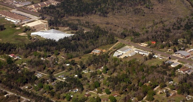

Property Detail
330 Freeway Dr
Beaumont-Port Arthur, TX
RIVER OAKS (VIDOR), LOT E 1/2 8, ACRES 2.969
011314-000080
ORANGE
Commercialnec
Texas
AE The base floodplain where base flood elevations are provided. AE Zones are now used on new format FIRMs instead of A1-A30 Zones.
8
2025
2.97 AC
2025
Orange County
021800
Beaumont/Port Arthur
8,100 SF
NEARBY LISTINGS FOR SALE OR LEASE
DEMOGRAPHICS near 330 Freeway Dr
1 mile
3 mile
5 mile
2025 Total Population
2,168
15,389
22,763
2030 Population
2,245
15,830
23,388
Pop Growth 2025-2030
+ 3.55%
+ 2.87%
+ 2.75%
Average Age
40
40
40
2025 Total Households
858
5,855
8,669
HH Growth 2025-2030
+ 3.61%
+ 2.85%
+ 2.72%
Median Household Inc
$75,880
$66,622
$65,453
Avg Household Size
2.50
2.50
2.50
2025 Avg HH Vehicles
2.00
2.00
2.00
Median Home Value
$154,873
$149,257
$148,776
Median Year Built
1984
1984
1984
Nearby Places
Map Layers
Map Styles
 Street
 Aerial
Transit
 Traffic
 Biking
Places
Listings with unknown addresses are not visible on the map
- Restaurants
- Banks
- Shops
- Fitness
- Groceries
Nearby Properties
Address
Land Use
TOTAL SIZE
Lot Size
Zoning
Address
Land Use
TOTAL SIZE
Lot Size
Zoning
107,684 SF
43.41 AC
Address
Land Use
TOTAL SIZE
Lot Size
Zoning
Address
Land Use
TOTAL SIZE
Lot Size
Zoning
262,985 SF
18.80 AC
Address
Land Use
TOTAL SIZE
Lot Size
Zoning
187,028 SF
25.07 AC
Address
Land Use
TOTAL SIZE
Lot Size
Zoning
91,251 SF
14.74 AC
Address
Land Use
TOTAL SIZE
Lot Size
Zoning
121,625 SF
20 AC
Address
Land Use
TOTAL SIZE
Lot Size
Zoning
27,344 SF
1.57 AC
Address
Land Use
TOTAL SIZE
Lot Size
Zoning
17,356 SF
2.01 AC
Address
Land Use
TOTAL SIZE
Lot Size
Zoning
46,375 SF
10.49 AC
Address
Land Use
TOTAL SIZE
Lot Size
Zoning
1,976 SF
13.56 AC
Address
Land Use
TOTAL SIZE
Lot Size
Zoning
13.80 AC
Address
Land Use
TOTAL SIZE
Lot Size
Zoning
16,000 SF
2.73 AC
Address
Land Use
TOTAL SIZE
Lot Size
Zoning
110,780 SF
9.32 AC
Address
Land Use
TOTAL SIZE
Lot Size
Zoning
62,892 SF
13.17 AC
Address
Land Use
TOTAL SIZE
Lot Size
Zoning
4,398 SF
0.97 AC
Address
Land Use
TOTAL SIZE
Lot Size
Zoning
35,320 SF
2.87 AC
Address
Land Use
TOTAL SIZE
Lot Size
Zoning
14,510 SF
1.61 AC
Address
Land Use
TOTAL SIZE
Lot Size
Zoning
12,983 SF
7.11 AC
Address
Land Use
TOTAL SIZE
Lot Size
Zoning
28,344 SF
23.99 AC
Address
Land Use
TOTAL SIZE
Lot Size
Zoning
25,143 SF
1.41 AC
Address
Land Use
TOTAL SIZE
Lot Size
Zoning
8,784 SF
31.18 AC
Address
Land Use
TOTAL SIZE
Lot Size
Zoning
414 SF
27.29 AC
Address
Land Use
TOTAL SIZE
Lot Size
Zoning
19,356 SF
10.03 AC
Address
Land Use
TOTAL SIZE
Lot Size
Zoning
5,675 SF
1.27 AC
Address
Land Use
TOTAL SIZE
Lot Size
Zoning
3.44 AC
Address
Land Use
TOTAL SIZE
Lot Size
Zoning
1.70 AC
Address
Land Use
TOTAL SIZE
Lot Size
Zoning
20,000 SF
3.45 AC
Address
Land Use
TOTAL SIZE
Lot Size
Zoning
11,626 SF
1.39 AC
Address
Land Use
TOTAL SIZE
Lot Size
Zoning
29,500 SF
3.60 AC
Address
Land Use
TOTAL SIZE
Lot Size
Zoning
4,560 SF
1.89 AC
The World's #1 Commercial Real Estate Marketplace
Connect with us
© 2026 CoStar Group
The information above has been obtained from sources believed reliable. While we do not doubt its accuracy we have not verified it and make no guarantee, warranty or representation about it. It is your responsibility to independently confirm its accuracy and completeness. Any projections, opinions, assumptions, or estimates used are for example only and do not represent the current or future performance of the property. The value of this transaction to you depends on tax and other factors which should be evaluated by your tax, financial, and legal advisors. You and your advisors should conduct a careful, independent investigation of the property to determine to your satisfaction the suitability of the property for your needs.