Property Record
330 N Main St, Seneca, IL 61360
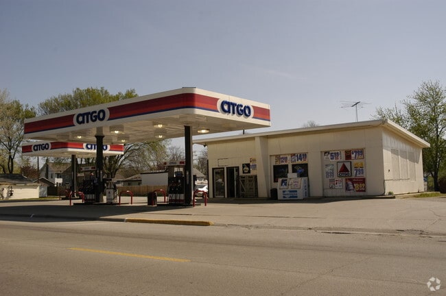

Property Detail
330 N Main St
Ottawa, IL
CROTTYS ADD, LT 1 & N1/2 LT 2 BLK 1 & VAC ST BETWEEN BLKS SEC 24-33-5
24-24-305001
La Salle
Commercialnec
Illinois
B and X Area of moderate flood hazard, usually the area between the limits of the 100-year and 500-year floods.
1-2
2024
0.40 AC
2024
I-39 Corr/LaSalle County
962400
Chicago
1,536 SF
NEARBY LISTINGS FOR SALE OR LEASE
-
-
View all Seneca listings for sale on LoopNet.com
DEMOGRAPHICS near 330 N Main St
1 mile
3 mile
5 mile
2025 Total Population
2,141
3,511
6,696
2030 Population
2,149
3,500
6,662
Pop Growth 2025-2030
+ 0.37%
(0.31%)
(0.51%)
Average Age
40
41
41
2025 Total Households
787
1,334
2,644
HH Growth 2025-2030
+ 0.38%
(0.37%)
(0.53%)
Median Household Inc
$92,729
$92,140
$78,800
Avg Household Size
2.60
2.60
2.50
2025 Avg HH Vehicles
2.00
2.00
2.00
Median Home Value
$214,622
$236,221
$192,505
Median Year Built
1979
1981
1975
Nearby Places
Map Layers
Map Styles
 Street
 Aerial
Transit
 Traffic
 Biking
Places
Listings with unknown addresses are not visible on the map
- Restaurants
- Banks
- Shops
- Fitness
- Groceries
SALE & LEASE HISTORY
LISTING DATE
SALE/LEASE

Sep 24, 2016
For Sale
Oct 19, 2025
For Sale
Nov 07, 2018
For Sale
Nearby Properties
Address
Land Use
TOTAL SIZE
Lot Size
Zoning
Address
Land Use
TOTAL SIZE
Lot Size
Zoning
20.74 AC
Address
Land Use
TOTAL SIZE
Lot Size
Zoning
31,417 SF
12.46 AC
Address
Land Use
TOTAL SIZE
Lot Size
Zoning
7,710 SF
17.28 AC
Address
Land Use
TOTAL SIZE
Lot Size
Zoning
226 SF
53.10 AC
Address
Land Use
TOTAL SIZE
Lot Size
Zoning
4,320 SF
11.54 AC
Address
Land Use
TOTAL SIZE
Lot Size
Zoning
7.45 AC
Address
Land Use
TOTAL SIZE
Lot Size
Zoning
33.99 AC
Address
Land Use
TOTAL SIZE
Lot Size
Zoning
5,940 SF
0.92 AC
Address
Land Use
TOTAL SIZE
Lot Size
Zoning
100 SF
159.50 AC
Address
Land Use
TOTAL SIZE
Lot Size
Zoning
3,444 SF
5.18 AC
Address
Land Use
TOTAL SIZE
Lot Size
Zoning
1,650 SF
30.28 AC
Address
Land Use
TOTAL SIZE
Lot Size
Zoning
1,384 SF
6 AC
Address
Land Use
TOTAL SIZE
Lot Size
Zoning
1,560 SF
8.87 AC
Address
Land Use
TOTAL SIZE
Lot Size
Zoning
27.51 AC
Address
Land Use
TOTAL SIZE
Lot Size
Zoning
4,350 SF
170 AC
Address
Land Use
TOTAL SIZE
Lot Size
Zoning
30,000 SF
20.71 AC
Address
Land Use
TOTAL SIZE
Lot Size
Zoning
3,114 SF
80.96 AC
Address
Land Use
TOTAL SIZE
Lot Size
Zoning
2,056 SF
39.89 AC
Address
Land Use
TOTAL SIZE
Lot Size
Zoning
1,414 SF
3.28 AC
Address
Land Use
TOTAL SIZE
Lot Size
Zoning
24,000 SF
26 AC
Address
Land Use
TOTAL SIZE
Lot Size
Zoning
10,760 SF
0.97 AC
Address
Land Use
TOTAL SIZE
Lot Size
Zoning
19,664 SF
4.41 AC
Address
Land Use
TOTAL SIZE
Lot Size
Zoning
4,146 SF
8.05 AC
Address
Land Use
TOTAL SIZE
Lot Size
Zoning
3,600 SF
38.03 AC
Address
Land Use
TOTAL SIZE
Lot Size
Zoning
25,200 SF
8.20 AC
Address
Land Use
TOTAL SIZE
Lot Size
Zoning
2,700 SF
22.48 AC
Address
Land Use
TOTAL SIZE
Lot Size
Zoning
5,209 SF
0.51 AC
Address
Land Use
TOTAL SIZE
Lot Size
Zoning
5,940 SF
41.17 AC
Address
Land Use
TOTAL SIZE
Lot Size
Zoning
2,775 SF
101.40 AC
Address
Land Use
TOTAL SIZE
Lot Size
Zoning
2,674 SF
10 AC
The World's #1 Commercial Real Estate Marketplace
Connect with us
© 2026 CoStar Group
The information above has been obtained from sources believed reliable. While we do not doubt its accuracy we have not verified it and make no guarantee, warranty or representation about it. It is your responsibility to independently confirm its accuracy and completeness. Any projections, opinions, assumptions, or estimates used are for example only and do not represent the current or future performance of the property. The value of this transaction to you depends on tax and other factors which should be evaluated by your tax, financial, and legal advisors. You and your advisors should conduct a careful, independent investigation of the property to determine to your satisfaction the suitability of the property for your needs.