Property Record
330 Millwood Rd, Lancaster, PA 17603

NEARBY LISTINGS FOR SALE OR LEASE
Property Detail
330 Millwood Rd
510-43697-0-0000
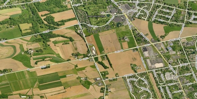
330 MILLWOOD RD
Lightindustrial
Lancaster
X
Pennsylvania
42071C0506F
2
2024
8.80 AC
2025
Lancaster County
013901
Philadelphia
31,639 SF
Lancaster, PA
DEMOGRAPHICS near 330 Millwood Rd
1 Mile
3 Mile
5 Mile
2024 Total Population
4,340
38,027
141,590
2029 Population
4,345
38,138
142,515
Pop Growth 2024-2029
+ 0.12%
+ 0.29%
+ 0.65%
Average Age
50
42
39
2024 Total Households
1,676
14,403
53,694
HH Growth 2024-2029
(0.42%)
+ 0.11%
+ 0.57%
Median Household Inc
$96,272
$74,130
$68,897
Avg Household Size
2.30
2.50
2.40
2024 Avg HH Vehicles
2.00
2.00
2.00
Median Home Value
$273,449
$228,343
$221,218
Median Year Built
1986
1982
1962
Nearby Places
Map Layers
Map Styles
 Street
 Aerial
- Restaurants
- Banks
- Shops
- Fitness
- Groceries
PUBLIC TRANSPORTATION
COMMUTER RAIL
DRIVE
WALK
Distance
13 min
4.8 mi
AIRPORT
Harrisburg International
DRIVE
WALK
Distance
Harrisburg International
53 min
36.5 mi
Freight Ports
Port Newark Container Terminal
DRIVE
WALK
Distance
Port Newark Container Terminal
67 min
42.5 mi
Nearby Properties
Address
Land Use
TOTAL SIZE
Lot Size
Zoning
Address
Land Use
TOTAL SIZE
Lot Size
Zoning
1,906,102 SF
136.98 AC
R3
Address
Land Use
TOTAL SIZE
Lot Size
Zoning
2,008,418 SF
76.74 AC
Address
Land Use
TOTAL SIZE
Lot Size
Zoning
35,920 SF
35.68 AC
Address
Land Use
TOTAL SIZE
Lot Size
Zoning
216,206 SF
17.88 AC
Address
Land Use
TOTAL SIZE
Lot Size
Zoning
156,190 SF
26.53 AC
Address
Land Use
TOTAL SIZE
Lot Size
Zoning
98,798 SF
42.19 AC
Address
Land Use
TOTAL SIZE
Lot Size
Zoning
32.52 AC
R-2
Address
Land Use
TOTAL SIZE
Lot Size
Zoning
109,300 SF
18.63 AC
Address
Land Use
TOTAL SIZE
Lot Size
Zoning
172,568 SF
9.76 AC
R3
Address
Land Use
TOTAL SIZE
Lot Size
Zoning
281,887 SF
19.29 AC
R-3
Address
Land Use
TOTAL SIZE
Lot Size
Zoning
244,922 SF
18.40 AC
MU
Address
Land Use
TOTAL SIZE
Lot Size
Zoning
146,813 SF
96.80 AC
A
Address
Land Use
TOTAL SIZE
Lot Size
Zoning
87,866 SF
5.10 AC
R-3
Address
Land Use
TOTAL SIZE
Lot Size
Zoning
278,244 SF
29.90 AC
R-3
Address
Land Use
TOTAL SIZE
Lot Size
Zoning
95,432 SF
10.19 AC
Address
Land Use
TOTAL SIZE
Lot Size
Zoning
156,140 SF
23.50 AC
RV
Address
Land Use
TOTAL SIZE
Lot Size
Zoning
122,820 SF
11.80 AC
R-3
Address
Land Use
TOTAL SIZE
Lot Size
Zoning
102,768 SF
11.30 AC
Address
Land Use
TOTAL SIZE
Lot Size
Zoning
211,230 SF
14.80 AC
R-3
Address
Land Use
TOTAL SIZE
Lot Size
Zoning
59,403 SF
2.20 AC
R2
Address
Land Use
TOTAL SIZE
Lot Size
Zoning
159,022 SF
8.21 AC
R-3
Address
Land Use
TOTAL SIZE
Lot Size
Zoning
40,195 SF
37.15 AC
Address
Land Use
TOTAL SIZE
Lot Size
Zoning
131,604 SF
18.90 AC
R-3
Address
Land Use
TOTAL SIZE
Lot Size
Zoning
39,810 SF
51.60 AC
OSR
Address
Land Use
TOTAL SIZE
Lot Size
Zoning
124,192 SF
14.90 AC
R4
Address
Land Use
TOTAL SIZE
Lot Size
Zoning
6,048 SF
8.10 AC
Address
Land Use
TOTAL SIZE
Lot Size
Zoning
189,390 SF
11.70 AC
R-3
Address
Land Use
TOTAL SIZE
Lot Size
Zoning
4,362 SF
45 AC
PO
Address
Land Use
TOTAL SIZE
Lot Size
Zoning
55,313 SF
20.10 AC
R2
Address
Land Use
TOTAL SIZE
Lot Size
Zoning
31,655 SF
0.14 AC
OTR
The World's #1 Commercial Real Estate Marketplace
Connect with us
© 2026 CoStar Group
The information above has been obtained from sources believed reliable. While we do not doubt its accuracy we have not verified it and make no guarantee, warranty or representation about it. It is your responsibility to independently confirm its accuracy and completeness. Any projections, opinions, assumptions, or estimates used are for example only and do not represent the current or future performance of the property. The value of this transaction to you depends on tax and other factors which should be evaluated by your tax, financial, and legal advisors. You and your advisors should conduct a careful, independent investigation of the property to determine to your satisfaction the suitability of the property for your needs.