Property Record
330 Route 211 W, Middletown, NY 10940
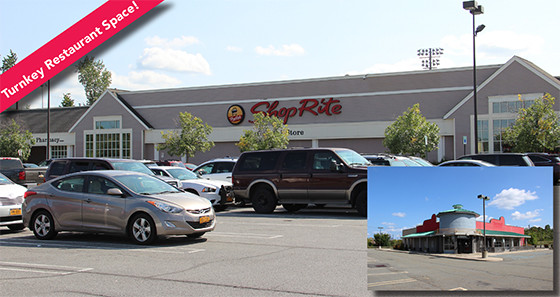

NEARBY LISTINGS FOR SALE OR LEASE
Property Detail
330 Route 211 W
335200-049-000-0001-028.000-0000
Orange
Warehouse
New York
X
28.00
36071C0255E
0.49 AC
2024
Orange County
2024
Northern New Jersey
011400
New York-Jersey City-White Plains, NY-NJ
1 SF
DEMOGRAPHICS near 330 Route 211 W
1 Mile
3 Mile
5 Mile
2024 Total Population
3,206
42,934
67,506
2029 Population
3,258
43,692
68,734
Pop Growth 2024-2029
+ 1.62%
+ 1.77%
+ 1.82%
Average Age
40
39
40
2024 Total Households
1,133
16,043
24,500
HH Growth 2024-2029
+ 1.77%
+ 1.94%
+ 1.98%
Median Household Inc
$120,324
$69,525
$79,737
Avg Household Size
2.60
2.60
2.60
2024 Avg HH Vehicles
2.00
2.00
2.00
Median Home Value
$271,827
$250,831
$267,692
Median Year Built
1956
1969
1974
Nearby Places
Map Layers
Map Styles
 Street
 Aerial
- Restaurants
- Banks
- Shops
- Fitness
- Groceries
PUBLIC TRANSPORTATION
COMMUTER RAIL
Middletown New York (Bergen County/Port Jervis Line - NJ Transit Commuter Rail (NJ Transit), Main/Port Jervis Line - NJ Transit Commuter Rail (NJ Transit))
DRIVE
WALK
Distance
Middletown New York (Bergen County/Port Jervis Line - NJ Transit Commuter Rail (NJ Transit), Main/Port Jervis Line - NJ Transit Commuter Rail (NJ Transit))
10 min
4.9 mi
Otisville (Bergen County/Port Jervis Line - NJ Transit Commuter Rail (NJ Transit), Main/Port Jervis Line - NJ Transit Commuter Rail (NJ Transit))
DRIVE
WALK
Distance
Otisville (Bergen County/Port Jervis Line - NJ Transit Commuter Rail (NJ Transit), Main/Port Jervis Line - NJ Transit Commuter Rail (NJ Transit))
8 min
5.5 mi
AIRPORT
New York Stewart International
DRIVE
WALK
Distance
New York Stewart International
34 min
25.1 mi
Freight Ports
Port Newark Container Terminal
DRIVE
WALK
Distance
Port Newark Container Terminal
98 min
73.7 mi
SALE & LEASE HISTORY
LISTING DATE
SALE/LEASE

Sep 24, 2016
For Sale
Oct 13, 2017
For Lease
May 06, 2019
For Lease
Nearby Properties
Address
Land Use
TOTAL SIZE
Lot Size
Zoning
Address
Land Use
TOTAL SIZE
Lot Size
Zoning
Address
Land Use
TOTAL SIZE
Lot Size
Zoning
40.40 AC
I-2
Address
Land Use
TOTAL SIZE
Lot Size
Zoning
24.40 AC
R-1
Address
Land Use
TOTAL SIZE
Lot Size
Zoning
17.60 AC
R-1
Address
Land Use
TOTAL SIZE
Lot Size
Zoning
142,416 SF
13.90 AC
R1
Address
Land Use
TOTAL SIZE
Lot Size
Zoning
5,832 SF
2.30 AC
TC-1
Address
Land Use
TOTAL SIZE
Lot Size
Zoning
208,464 SF
24.90 AC
HC
Address
Land Use
TOTAL SIZE
Lot Size
Zoning
7 AC
C-3
Address
Land Use
TOTAL SIZE
Lot Size
Zoning
6.80 AC
MC 1
Address
Land Use
TOTAL SIZE
Lot Size
Zoning
96,231 SF
14.80 AC
HC
Address
Land Use
TOTAL SIZE
Lot Size
Zoning
726 SF
40.30 AC
C-3
Address
Land Use
TOTAL SIZE
Lot Size
Zoning
4.90 AC
Address
Land Use
TOTAL SIZE
Lot Size
Zoning
91,794 SF
7.70 AC
R1
Address
Land Use
TOTAL SIZE
Lot Size
Zoning
17,536 SF
5.40 AC
HC
Address
Land Use
TOTAL SIZE
Lot Size
Zoning
12.60 AC
R-1
Address
Land Use
TOTAL SIZE
Lot Size
Zoning
55,972 SF
0.85 AC
DN
Address
Land Use
TOTAL SIZE
Lot Size
Zoning
24.90 AC
R-AH
Address
Land Use
TOTAL SIZE
Lot Size
Zoning
85,895 SF
31.80 AC
R1
Address
Land Use
TOTAL SIZE
Lot Size
Zoning
11.50 AC
SR-3B
Address
Land Use
TOTAL SIZE
Lot Size
Zoning
19.20 AC
C-3
Address
Land Use
TOTAL SIZE
Lot Size
Zoning
160,336 SF
12.10 AC
R1
Address
Land Use
TOTAL SIZE
Lot Size
Zoning
125,144 SF
6.60 AC
Address
Land Use
TOTAL SIZE
Lot Size
Zoning
3.70 AC
R-1
Address
Land Use
TOTAL SIZE
Lot Size
Zoning
21.20 AC
Address
Land Use
TOTAL SIZE
Lot Size
Zoning
48,587 SF
8.50 AC
R1
Address
Land Use
TOTAL SIZE
Lot Size
Zoning
21,134 SF
4.70 AC
TC-1
Address
Land Use
TOTAL SIZE
Lot Size
Zoning
26,800 SF
3.50 AC
Address
Land Use
TOTAL SIZE
Lot Size
Zoning
11.10 AC
SR-3B
Address
Land Use
TOTAL SIZE
Lot Size
Zoning
726 SF
33.90 AC
C-3
Address
Land Use
TOTAL SIZE
Lot Size
Zoning
12,152 SF
3.60 AC
TC-1
The World's #1 Commercial Real Estate Marketplace
Connect with us
© 2025 CoStar Group
The information above has been obtained from sources believed reliable. While we do not doubt its accuracy we have not verified it and make no guarantee, warranty or representation about it. It is your responsibility to independently confirm its accuracy and completeness. Any projections, opinions, assumptions, or estimates used are for example only and do not represent the current or future performance of the property. The value of this transaction to you depends on tax and other factors which should be evaluated by your tax, financial, and legal advisors. You and your advisors should conduct a careful, independent investigation of the property to determine to your satisfaction the suitability of the property for your needs.