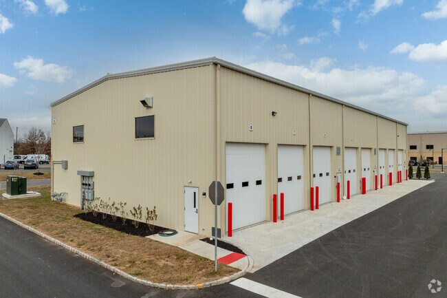
Property Record
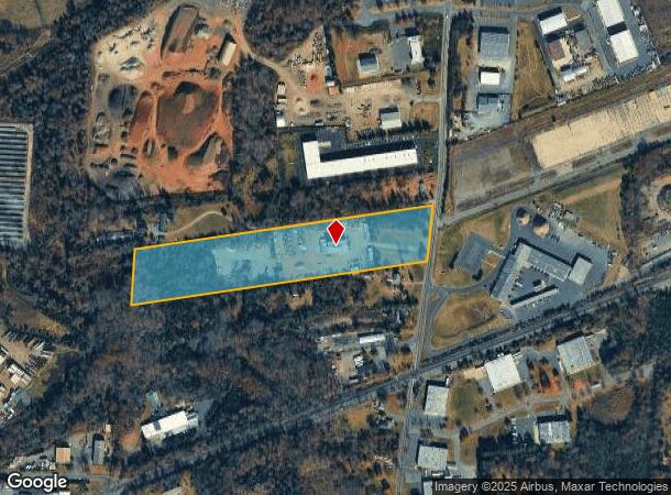
375 Roycefield Rd, Hillsborough, NJ 08844
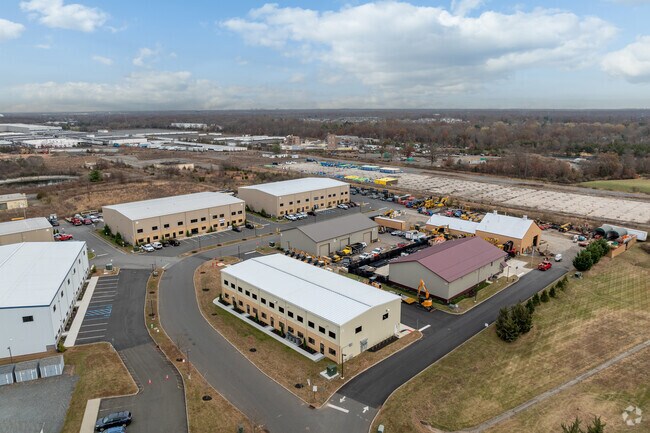

NEARBY LISTINGS FOR SALE OR LEASE
Property Detail
375 Roycefield Rd
10-00143-0000-00014-01
ADDITIONAL LOTS: INDUSTRIAL
Industrialgeneral
Somerset
X
New Jersey
34035C0144E
14.1
2024
10.82 AC
2025
Somerset
053706
Northern New Jersey
6,000 SF
Newark, NJ-PA
DEMOGRAPHICS near 375 Roycefield Rd
1 Mile
3 Mile
5 Mile
2024 Total Population
2,158
55,447
117,964
2029 Population
2,180
55,654
118,388
Pop Growth 2024-2029
+ 1.02%
+ 0.37%
+ 0.36%
Average Age
42
40
41
2024 Total Households
825
21,053
43,625
HH Growth 2024-2029
+ 0.97%
+ 0.44%
+ 0.39%
Median Household Inc
$110,901
$108,419
$122,389
Avg Household Size
2.50
2.60
2.60
2024 Avg HH Vehicles
2.00
2.00
2.00
Median Home Value
$481,382
$371,902
$437,658
Median Year Built
2000
1978
1982
Nearby Places
Map Layers
Map Styles
 Street
 Aerial
- Restaurants
- Banks
- Shops
- Fitness
- Groceries
PUBLIC TRANSPORTATION
COMMUTER RAIL
Raritan (Raritan Valley Line - NJ Transit Commuter Rail (NJ Transit))
DRIVE
WALK
Distance
Raritan (Raritan Valley Line - NJ Transit Commuter Rail (NJ Transit))
11 min
3.3 mi
Somerville (Raritan Valley Line - NJ Transit Commuter Rail (NJ Transit))
DRIVE
WALK
Distance
Somerville (Raritan Valley Line - NJ Transit Commuter Rail (NJ Transit))
10 min
3.7 mi
AIRPORT
Trenton Mercer
DRIVE
WALK
Distance
Trenton Mercer
47 min
27.4 mi
Newark Liberty International
DRIVE
WALK
Distance
Newark Liberty International
50 min
38.4 mi
Freight Ports
New York Container Terminal
DRIVE
WALK
Distance
New York Container Terminal
51 min
37.5 mi
SALE & LEASE HISTORY
LISTING DATE
SALE/LEASE

Mar 20, 2023
For Lease
Nearby Properties
Address
Land Use
TOTAL SIZE
Lot Size
Zoning
Address
Land Use
TOTAL SIZE
Lot Size
Zoning
25.70 AC
PACD
Address
Land Use
TOTAL SIZE
Lot Size
Zoning
66.08 AC
M3
Address
Land Use
TOTAL SIZE
Lot Size
Zoning
33.16 AC
M3
Address
Land Use
TOTAL SIZE
Lot Size
Zoning
10.31 AC
PDRD
Address
Land Use
TOTAL SIZE
Lot Size
Zoning
1,056 SF
0.07 AC
Address
Land Use
TOTAL SIZE
Lot Size
Zoning
25 SF
10.43 AC
M2
Address
Land Use
TOTAL SIZE
Lot Size
Zoning
19,528 SF
52.97 AC
02
Address
Land Use
TOTAL SIZE
Lot Size
Zoning
289,939 SF
27.31 AC
MUID
Address
Land Use
TOTAL SIZE
Lot Size
Zoning
14.06 AC
GV
Address
Land Use
TOTAL SIZE
Lot Size
Zoning
61,757 SF
8.75 AC
TC
Address
Land Use
TOTAL SIZE
Lot Size
Zoning
27.06 AC
GV
Address
Land Use
TOTAL SIZE
Lot Size
Zoning
Address
Land Use
TOTAL SIZE
Lot Size
Zoning
48 AC
R1
Address
Land Use
TOTAL SIZE
Lot Size
Zoning
111,204 SF
26.68 AC
PD
Address
Land Use
TOTAL SIZE
Lot Size
Zoning
1,383 SF
259.46 AC
ED
Address
Land Use
TOTAL SIZE
Lot Size
Zoning
43.66 AC
ARPD
Address
Land Use
TOTAL SIZE
Lot Size
Zoning
780 SF
9.89 AC
GA
Address
Land Use
TOTAL SIZE
Lot Size
Zoning
32.08 AC
R
Address
Land Use
TOTAL SIZE
Lot Size
Zoning
1,440 SF
19.33 AC
TC
Address
Land Use
TOTAL SIZE
Lot Size
Zoning
1,096 SF
17.75 AC
TC
Address
Land Use
TOTAL SIZE
Lot Size
Zoning
22.95 AC
ARPD
Address
Land Use
TOTAL SIZE
Lot Size
Zoning
15,000 SF
18.75 AC
AG
Address
Land Use
TOTAL SIZE
Lot Size
Zoning
1.81 AC
B-3
Address
Land Use
TOTAL SIZE
Lot Size
Zoning
27.10 AC
Address
Land Use
TOTAL SIZE
Lot Size
Zoning
186,180 SF
16.41 AC
PD
Address
Land Use
TOTAL SIZE
Lot Size
Zoning
Address
Land Use
TOTAL SIZE
Lot Size
Zoning
49.42 AC
R
Address
Land Use
TOTAL SIZE
Lot Size
Zoning
3.02 AC
B3
Address
Land Use
TOTAL SIZE
Lot Size
Zoning
424.28 AC
CDZ
Address
Land Use
TOTAL SIZE
Lot Size
Zoning
18.64 AC
M2
The World's #1 Commercial Real Estate Marketplace
Connect with us
© 2025 CoStar Group
The information above has been obtained from sources believed reliable. While we do not doubt its accuracy we have not verified it and make no guarantee, warranty or representation about it. It is your responsibility to independently confirm its accuracy and completeness. Any projections, opinions, assumptions, or estimates used are for example only and do not represent the current or future performance of the property. The value of this transaction to you depends on tax and other factors which should be evaluated by your tax, financial, and legal advisors. You and your advisors should conduct a careful, independent investigation of the property to determine to your satisfaction the suitability of the property for your needs.