Property Record
3300 12Th Ct, Vero Beach, FL 32960


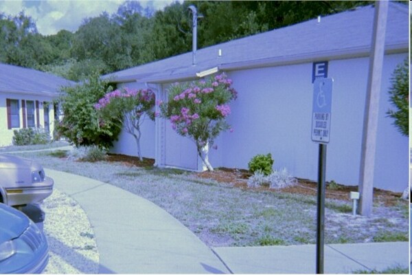
Property Detail
3300 12Th Ct
Hospitalprivate
SEC 35 TWP 32 RNG 39 BEING MORE PART DESC AS FOLL BEG AT THE INTERSEC OF THE N ROW OF 30TH ST AND THE E LINE OF THE E 10 AC OF THAT PART OF THE NE QTR OF THE SE QTR LYING N OF THE MAIN CANAL ROW IN SEC 35 TH RUN N AL SAID E LINE ON AN ASSUMED BEARING
RM-6
INDIAN RIVER
B and X Area of moderate flood hazard, usually the area between the limits of the 100-year and 500-year floods.
Florida
2025
9.35 AC
2025
Other Market Areas
050305
Sebastian-Vero Beach-West Vero Corridor, FL
47,075 SF
32-39-35-00000-7000-00001.0
NEARBY LISTINGS FOR SALE OR LEASE
DEMOGRAPHICS near 3300 12Th Ct
1 mile
3 mile
5 mile
2025 Total Population
3,555
47,220
90,834
2030 Population
3,751
50,426
96,584
Pop Growth 2025-2030
+ 5.51%
+ 6.79%
+ 6.33%
Average Age
50
49
50
2025 Total Households
1,667
22,100
41,493
HH Growth 2025-2030
+ 5.22%
+ 6.67%
+ 6.27%
Median Household Inc
$49,927
$63,578
$71,486
Avg Household Size
1.80
2.00
2.10
2025 Avg HH Vehicles
2.00
1.00
2.00
Median Home Value
$467,441
$381,661
$395,819
Median Year Built
1964
1982
1987
Nearby Places
Map Layers
Map Styles
 Street
 Aerial
Layers
 Traffic
 Biking
Places
Listings with unknown addresses are not visible on the map
- Restaurants
- Banks
- Shops
- Fitness
- Groceries
Nearby Properties
Address
Land Use
TOTAL SIZE
Lot Size
Zoning
Address
Land Use
TOTAL SIZE
Lot Size
Zoning
634,259 SF
53.45 AC
MED
Address
Land Use
TOTAL SIZE
Lot Size
Zoning
303,447 SF
26.90 AC
M
Address
Land Use
TOTAL SIZE
Lot Size
Zoning
571,211 SF
26.38 AC
RM-10
Address
Land Use
TOTAL SIZE
Lot Size
Zoning
302,878 SF
40 AC
INST
Address
Land Use
TOTAL SIZE
Lot Size
Zoning
240,516 SF
39.71 AC
RM-8
Address
Land Use
TOTAL SIZE
Lot Size
Zoning
39,873 SF
7.61 AC
GU
Address
Land Use
TOTAL SIZE
Lot Size
Zoning
2,133 SF
772.04 AC
ALI-A1
Address
Land Use
TOTAL SIZE
Lot Size
Zoning
46,567 SF
19.61 AC
CG
Address
Land Use
TOTAL SIZE
Lot Size
Zoning
12,192 SF
40 AC
RS-6
Address
Land Use
TOTAL SIZE
Lot Size
Zoning
125,677 SF
2.17 AC
DTW
Address
Land Use
TOTAL SIZE
Lot Size
Zoning
49,513 SF
60.64 AC
ALI-MC
Address
Land Use
TOTAL SIZE
Lot Size
Zoning
106,904 SF
79.05 AC
M
Address
Land Use
TOTAL SIZE
Lot Size
Zoning
124.80 AC
Address
Land Use
TOTAL SIZE
Lot Size
Zoning
8,837 SF
0.66 AC
R-1A
Address
Land Use
TOTAL SIZE
Lot Size
Zoning
80,682 SF
24.97 AC
R-1A
Address
Land Use
TOTAL SIZE
Lot Size
Zoning
313,820 SF
21.83 AC
RM-10 EX
Address
Land Use
TOTAL SIZE
Lot Size
Zoning
235,921 SF
28.80 AC
RM-8
Address
Land Use
TOTAL SIZE
Lot Size
Zoning
67,334 SF
9.63 AC
MED
Address
Land Use
TOTAL SIZE
Lot Size
Zoning
149,178 SF
10.72 AC
C-1B
Address
Land Use
TOTAL SIZE
Lot Size
Zoning
206,738 SF
17.76 AC
PD
Address
Land Use
TOTAL SIZE
Lot Size
Zoning
82,427 SF
2.48 AC
C-1A
Address
Land Use
TOTAL SIZE
Lot Size
Zoning
69,942 SF
10.47 AC
MED
Address
Land Use
TOTAL SIZE
Lot Size
Zoning
6,949 SF
8.17 AC
P-2
Address
Land Use
TOTAL SIZE
Lot Size
Zoning
231,651 SF
16.23 AC
RM-10
Address
Land Use
TOTAL SIZE
Lot Size
Zoning
39,798 SF
1.31 AC
C-1A
Address
Land Use
TOTAL SIZE
Lot Size
Zoning
2,888 SF
95.84 AC
R-1AA
Address
Land Use
TOTAL SIZE
Lot Size
Zoning
7,812 SF
0.83 AC
R-1AA
Address
Land Use
TOTAL SIZE
Lot Size
Zoning
76,484 SF
7.03 AC
P-2
Address
Land Use
TOTAL SIZE
Lot Size
Zoning
91,904 SF
10 AC
CG
Address
Land Use
TOTAL SIZE
Lot Size
Zoning
1,500 SF
34.50 AC
P-2
The World's #1 Commercial Real Estate Marketplace
Connect with us
© 2026 CoStar Group
The information above has been obtained from sources believed reliable. While we do not doubt its accuracy we have not verified it and make no guarantee, warranty or representation about it. It is your responsibility to independently confirm its accuracy and completeness. Any projections, opinions, assumptions, or estimates used are for example only and do not represent the current or future performance of the property. The value of this transaction to you depends on tax and other factors which should be evaluated by your tax, financial, and legal advisors. You and your advisors should conduct a careful, independent investigation of the property to determine to your satisfaction the suitability of the property for your needs.