Property Record
3300 Brookdale Ave, Oakland, CA 94602


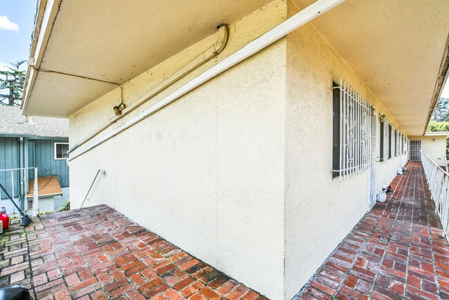
This Property Is For Sale
NEARBY LISTINGS FOR SALE OR LEASE
Property Detail
3300 Brookdale Ave
Oakland-Hayward-Berkeley, CA
Boardmans Map Oakland & Vicinity
027-0869-028-01
LOT: 00001 BLK: 0028 AR: 0027 PAGE: 0869
Multifamilydwelling
Alameda
X
California
06001C0087G
10&22
2024
0.22 AC
2025
Upper Peralta Creek
406601
East Bay/Oakland
5,453 SF
DEMOGRAPHICS near 3300 Brookdale Ave
1 Mile
3 Mile
5 Mile
2024 Total Population
51,098
260,478
513,773
2029 Population
49,197
251,491
498,584
Pop Growth 2024-2029
(3.72%)
(3.45%)
(2.96%)
Average Age
40
40
41
2024 Total Households
17,713
97,654
196,959
HH Growth 2024-2029
(3.92%)
(3.57%)
(3.00%)
Median Household Inc
$71,933
$89,175
$93,936
Avg Household Size
2.70
2.50
2.40
2024 Avg HH Vehicles
2.00
2.00
2.00
Median Home Value
$762,800
$940,378
$963,435
Median Year Built
1948
1949
1954
Nearby Places
Map Layers
Map Styles
 Street
 Aerial
- Restaurants
- Banks
- Shops
- Fitness
- Groceries
PUBLIC TRANSPORTATION
COMMUTER RAIL
DRIVE
WALK
Distance
9 min
4.9 mi
DRIVE
WALK
Distance
12 min
7.8 mi
AIRPORT
Metro Oakland International
DRIVE
WALK
Distance
Metro Oakland International
13 min
7.4 mi
San Francisco International
DRIVE
WALK
Distance
San Francisco International
40 min
26.7 mi
Norman Y Mineta San Jose International
DRIVE
WALK
Distance
Norman Y Mineta San Jose International
49 min
38.8 mi
Freight Ports
Port of Oakland
DRIVE
WALK
Distance
Port of Oakland
10 min
5.3 mi
Nearby Properties
Address
Land Use
TOTAL SIZE
Lot Size
Zoning
Address
Land Use
TOTAL SIZE
Lot Size
Zoning
546,164 SF
6.02 AC
Address
Land Use
TOTAL SIZE
Lot Size
Zoning
371,504 SF
4.08 AC
Address
Land Use
TOTAL SIZE
Lot Size
Zoning
534,208 SF
23.18 AC
Address
Land Use
TOTAL SIZE
Lot Size
Zoning
273,623 SF
1.44 AC
Address
Land Use
TOTAL SIZE
Lot Size
Zoning
297,617 SF
1.54 AC
Address
Land Use
TOTAL SIZE
Lot Size
Zoning
525,864 SF
16.53 AC
Address
Land Use
TOTAL SIZE
Lot Size
Zoning
336,680 SF
9.93 AC
M40
Address
Land Use
TOTAL SIZE
Lot Size
Zoning
133,636 SF
5.46 AC
Address
Land Use
TOTAL SIZE
Lot Size
Zoning
284,255 SF
5.07 AC
Address
Land Use
TOTAL SIZE
Lot Size
Zoning
320,001 SF
37.56 AC
Address
Land Use
TOTAL SIZE
Lot Size
Zoning
165,042 SF
13.50 AC
Address
Land Use
TOTAL SIZE
Lot Size
Zoning
169,558 SF
1.65 AC
Address
Land Use
TOTAL SIZE
Lot Size
Zoning
Address
Land Use
TOTAL SIZE
Lot Size
Zoning
133,678 SF
4.33 AC
Address
Land Use
TOTAL SIZE
Lot Size
Zoning
136,127 SF
8.21 AC
Address
Land Use
TOTAL SIZE
Lot Size
Zoning
0.94 AC
Address
Land Use
TOTAL SIZE
Lot Size
Zoning
197,321 SF
16.52 AC
Address
Land Use
TOTAL SIZE
Lot Size
Zoning
1,189,534 SF
26.64 AC
Address
Land Use
TOTAL SIZE
Lot Size
Zoning
204,006 SF
6.39 AC
M40
Address
Land Use
TOTAL SIZE
Lot Size
Zoning
165,638 SF
4.06 AC
Address
Land Use
TOTAL SIZE
Lot Size
Zoning
132,446 SF
4.34 AC
Address
Land Use
TOTAL SIZE
Lot Size
Zoning
6.81 AC
Address
Land Use
TOTAL SIZE
Lot Size
Zoning
112,675 SF
2.07 AC
Address
Land Use
TOTAL SIZE
Lot Size
Zoning
64,421 SF
3.49 AC
Address
Land Use
TOTAL SIZE
Lot Size
Zoning
74,773 SF
9.41 AC
Address
Land Use
TOTAL SIZE
Lot Size
Zoning
2.17 AC
Address
Land Use
TOTAL SIZE
Lot Size
Zoning
383,560 SF
18.90 AC
Address
Land Use
TOTAL SIZE
Lot Size
Zoning
58,977 SF
4.22 AC
Address
Land Use
TOTAL SIZE
Lot Size
Zoning
47,468 SF
2.51 AC
Address
Land Use
TOTAL SIZE
Lot Size
Zoning
74,097 SF
8.45 AC
The World's #1 Commercial Real Estate Marketplace
Connect with us
© 2026 CoStar Group
The information above has been obtained from sources believed reliable. While we do not doubt its accuracy we have not verified it and make no guarantee, warranty or representation about it. It is your responsibility to independently confirm its accuracy and completeness. Any projections, opinions, assumptions, or estimates used are for example only and do not represent the current or future performance of the property. The value of this transaction to you depends on tax and other factors which should be evaluated by your tax, financial, and legal advisors. You and your advisors should conduct a careful, independent investigation of the property to determine to your satisfaction the suitability of the property for your needs.