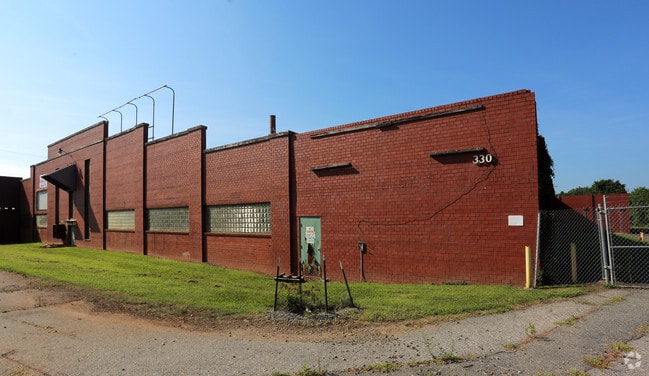
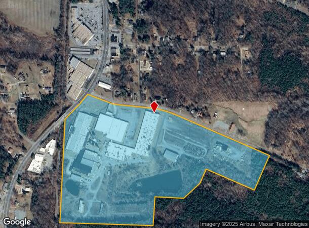
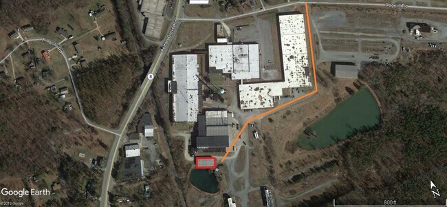
Property Record
3301 Cotton Grove Rd, Lexington, NC 27292
NEARBY LISTINGS FOR SALE OR LEASE
Property Detail
3301 Cotton Grove Rd
06-009-0-000-0017-0-0-0
PB52-9 BK1997-892 COTTON GR RD
Publicstorage
Davidson
X
North Carolina
3710672300J
62.20 AC
2025
South Davidson County
2025
Greensboro/Winston-Salem
061803
Winston-Salem, NC
104,230 SF
DEMOGRAPHICS near 3301 Cotton Grove Rd
1 Mile
3 Mile
5 Mile
2024 Total Population
962
12,154
34,658
2029 Population
1,009
12,853
36,729
Pop Growth 2024-2029
+ 4.89%
+ 5.75%
+ 5.98%
Average Age
41
41
41
2024 Total Households
376
4,910
13,959
HH Growth 2024-2029
+ 4.79%
+ 5.66%
+ 5.90%
Median Household Inc
$54,051
$41,935
$42,076
Avg Household Size
2.40
2.40
2.40
2024 Avg HH Vehicles
2.00
2.00
2.00
Median Home Value
$142,500
$154,402
$158,186
Median Year Built
1977
1978
1977
Nearby Places
Map Layers
Map Styles
 Street
 Aerial
- Restaurants
- Banks
- Shops
- Fitness
- Groceries
PUBLIC TRANSPORTATION
AIRPORT
Piedmont Triad International
DRIVE
WALK
Distance
Piedmont Triad International
52 min
41.0 mi
Freight Ports
Port of Wilmington
DRIVE
WALK
Distance
Port of Wilmington
257 min
214.5 mi
SALE & LEASE HISTORY
LISTING DATE
SALE/LEASE

Nov 03, 2023
For Lease
Mar 09, 2020
For Lease
Jun 05, 2019
For Lease
Nearby Properties
Address
Land Use
TOTAL SIZE
Lot Size
Zoning
Address
Land Use
TOTAL SIZE
Lot Size
Zoning
4,622 SF
246.40 AC
I
Address
Land Use
TOTAL SIZE
Lot Size
Zoning
943,340 SF
202.76 AC
RA1
Address
Land Use
TOTAL SIZE
Lot Size
Zoning
22,560 SF
204.19 AC
I
Address
Land Use
TOTAL SIZE
Lot Size
Zoning
3,156 SF
332.28 AC
HI
Address
Land Use
TOTAL SIZE
Lot Size
Zoning
207,185 SF
29.84 AC
B
Address
Land Use
TOTAL SIZE
Lot Size
Zoning
43,008 SF
25.21 AC
B
Address
Land Use
TOTAL SIZE
Lot Size
Zoning
142,700 SF
18.21 AC
B
Address
Land Use
TOTAL SIZE
Lot Size
Zoning
101,475 SF
108.36 AC
I
Address
Land Use
TOTAL SIZE
Lot Size
Zoning
15,192 SF
117.89 AC
SN
Address
Land Use
TOTAL SIZE
Lot Size
Zoning
29,313 SF
27.73 AC
RA2
Address
Land Use
TOTAL SIZE
Lot Size
Zoning
90,678 SF
39.70 AC
RA1
Address
Land Use
TOTAL SIZE
Lot Size
Zoning
46,562 SF
1.73 AC
B
Address
Land Use
TOTAL SIZE
Lot Size
Zoning
5,490 SF
212.79 AC
RA1
Address
Land Use
TOTAL SIZE
Lot Size
Zoning
1,160 SF
28.40 AC
TN
Address
Land Use
TOTAL SIZE
Lot Size
Zoning
49,578 SF
7.74 AC
I
Address
Land Use
TOTAL SIZE
Lot Size
Zoning
14,148 SF
3.34 AC
B
Address
Land Use
TOTAL SIZE
Lot Size
Zoning
201,600 SF
9.90 AC
I
Address
Land Use
TOTAL SIZE
Lot Size
Zoning
59,281 SF
4.34 AC
B
Address
Land Use
TOTAL SIZE
Lot Size
Zoning
313,535 SF
107.06 AC
I
Address
Land Use
TOTAL SIZE
Lot Size
Zoning
8,248 SF
10.29 AC
TN
Address
Land Use
TOTAL SIZE
Lot Size
Zoning
49,552 SF
3.33 AC
B
Address
Land Use
TOTAL SIZE
Lot Size
Zoning
19,137 SF
2.01 AC
B
Address
Land Use
TOTAL SIZE
Lot Size
Zoning
32,272 SF
10 AC
TN
Address
Land Use
TOTAL SIZE
Lot Size
Zoning
91,618 SF
23.25 AC
RA2
Address
Land Use
TOTAL SIZE
Lot Size
Zoning
11,316 SF
9.83 AC
TN
Address
Land Use
TOTAL SIZE
Lot Size
Zoning
115,838 SF
57.83 AC
I
Address
Land Use
TOTAL SIZE
Lot Size
Zoning
19,536 SF
4 AC
B
Address
Land Use
TOTAL SIZE
Lot Size
Zoning
18,073 SF
1.73 AC
B
Address
Land Use
TOTAL SIZE
Lot Size
Zoning
18,330 SF
2.28 AC
B
The World's #1 Commercial Real Estate Marketplace
Connect with us
© 2026 CoStar Group
The information above has been obtained from sources believed reliable. While we do not doubt its accuracy we have not verified it and make no guarantee, warranty or representation about it. It is your responsibility to independently confirm its accuracy and completeness. Any projections, opinions, assumptions, or estimates used are for example only and do not represent the current or future performance of the property. The value of this transaction to you depends on tax and other factors which should be evaluated by your tax, financial, and legal advisors. You and your advisors should conduct a careful, independent investigation of the property to determine to your satisfaction the suitability of the property for your needs.