Property Record
3301 Homestead Rd, Santa Clara, CA 95051


NEARBY LISTINGS FOR SALE OR LEASE
Property Detail
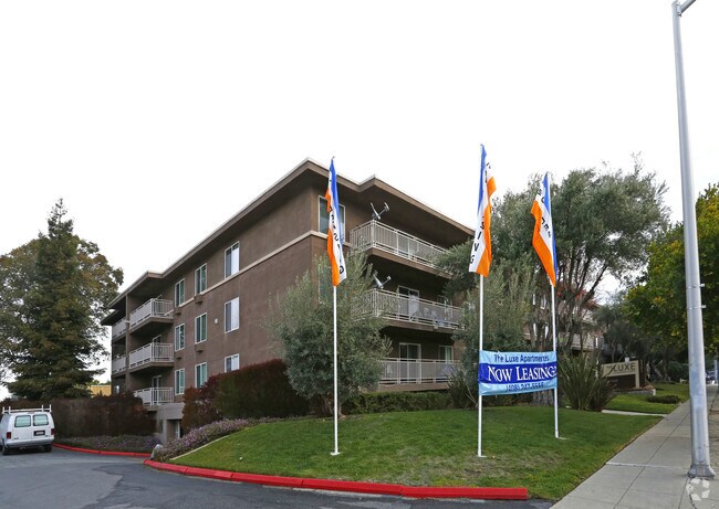
3301 Homestead Rd
290-23-048
Santa Clara Homestead Associat
Multifamilydwelling
Santa Clara
X
California
06085C0228H
1.14 AC
2024
Outer Santa Clara
2025
South Bay/San Jose
505403
San Jose-Sunnyvale-Santa Clara, CA
36,505 SF
DEMOGRAPHICS near 3301 Homestead Rd
1 Mile
3 Mile
5 Mile
2024 Total Population
31,468
250,876
573,976
2029 Population
30,389
242,832
554,713
Pop Growth 2024-2029
(3.43%)
(3.21%)
(3.36%)
Average Age
38
39
39
2024 Total Households
11,512
91,705
212,428
HH Growth 2024-2029
(3.70%)
(3.41%)
(3.55%)
Median Household Inc
$169,360
$155,424
$156,434
Avg Household Size
2.70
2.70
2.60
2024 Avg HH Vehicles
2.00
2.00
2.00
Median Home Value
$1,127,597
$1,126,319
$1,119,414
Median Year Built
1968
1970
1971
Nearby Places
Map Layers
Map Styles
 Street
 Aerial
- Restaurants
- Banks
- Shops
- Fitness
- Groceries
PUBLIC TRANSPORTATION
COMMUTER RAIL
Lawrence (Caltrain - Caltrain (Caltrain))
DRIVE
WALK
Distance
Lawrence (Caltrain - Caltrain (Caltrain))
6 min
3.2 mi
Santa Clara (Caltrain - Caltrain (Caltrain))
DRIVE
WALK
Distance
Santa Clara (Caltrain - Caltrain (Caltrain))
7 min
3.3 mi
AIRPORT
Norman Y Mineta San Jose International
DRIVE
WALK
Distance
Norman Y Mineta San Jose International
9 min
4.0 mi
San Francisco International
DRIVE
WALK
Distance
San Francisco International
42 min
32.8 mi
Metro Oakland International
DRIVE
WALK
Distance
Metro Oakland International
51 min
39.1 mi
Nearby Properties
Address
Land Use
TOTAL SIZE
Lot Size
Zoning
Address
Land Use
TOTAL SIZE
Lot Size
Zoning
2,819,800 SF
91.85 AC
CU
Address
Land Use
TOTAL SIZE
Lot Size
Zoning
57,096 SF
58.04 AC
PM0
Address
Land Use
TOTAL SIZE
Lot Size
Zoning
0.06 AC
PD
Address
Land Use
TOTAL SIZE
Lot Size
Zoning
424,316 SF
22.37 AC
SU
Address
Land Use
TOTAL SIZE
Lot Size
Zoning
107,203 SF
21.74 AC
MXD2
Address
Land Use
TOTAL SIZE
Lot Size
Zoning
238,239 SF
24.67 AC
PD
Address
Land Use
TOTAL SIZE
Lot Size
Zoning
111,585 SF
6.69 AC
ML
Address
Land Use
TOTAL SIZE
Lot Size
Zoning
16.72 AC
MSLSP
Address
Land Use
TOTAL SIZE
Lot Size
Zoning
196,100 SF
1.32 AC
PCMR
Address
Land Use
TOTAL SIZE
Lot Size
Zoning
360,000 SF
18.81 AC
MH
Address
Land Use
TOTAL SIZE
Lot Size
Zoning
9.11 AC
ML
Address
Land Use
TOTAL SIZE
Lot Size
Zoning
1,121,228 SF
7.68 AC
RM(PD
Address
Land Use
TOTAL SIZE
Lot Size
Zoning
2.99 AC
MH
Address
Land Use
TOTAL SIZE
Lot Size
Zoning
180,846 SF
12.19 AC
ML
Address
Land Use
TOTAL SIZE
Lot Size
Zoning
833,956 SF
55.15 AC
PD
Address
Land Use
TOTAL SIZE
Lot Size
Zoning
531,132 SF
21.33 AC
R4PD
Address
Land Use
TOTAL SIZE
Lot Size
Zoning
304,000 SF
6.79 AC
PM0
Address
Land Use
TOTAL SIZE
Lot Size
Zoning
146,390 SF
9.04 AC
MP
Address
Land Use
TOTAL SIZE
Lot Size
Zoning
162,205 SF
18.69 AC
MS
Address
Land Use
TOTAL SIZE
Lot Size
Zoning
211,024 SF
9.92 AC
P
Address
Land Use
TOTAL SIZE
Lot Size
Zoning
8.22 AC
PD
Address
Land Use
TOTAL SIZE
Lot Size
Zoning
50,774 SF
3.84 AC
MP
Address
Land Use
TOTAL SIZE
Lot Size
Zoning
897,944 SF
7.40 AC
PD
Address
Land Use
TOTAL SIZE
Lot Size
Zoning
32.93 AC
PC
Address
Land Use
TOTAL SIZE
Lot Size
Zoning
1,016,763 SF
7.63 AC
CC
Address
Land Use
TOTAL SIZE
Lot Size
Zoning
2.99 AC
MH
Address
Land Use
TOTAL SIZE
Lot Size
Zoning
381,064 SF
20.42 AC
R322
Address
Land Use
TOTAL SIZE
Lot Size
Zoning
457,162 SF
3.97 AC
A(PD)
Address
Land Use
TOTAL SIZE
Lot Size
Zoning
473,849 SF
6 AC
ML
The World's #1 Commercial Real Estate Marketplace
Connect with us
© 2025 CoStar Group
The information above has been obtained from sources believed reliable. While we do not doubt its accuracy we have not verified it and make no guarantee, warranty or representation about it. It is your responsibility to independently confirm its accuracy and completeness. Any projections, opinions, assumptions, or estimates used are for example only and do not represent the current or future performance of the property. The value of this transaction to you depends on tax and other factors which should be evaluated by your tax, financial, and legal advisors. You and your advisors should conduct a careful, independent investigation of the property to determine to your satisfaction the suitability of the property for your needs.