Property Record
3301 Kecoughtan Rd, Hampton, VA 23661
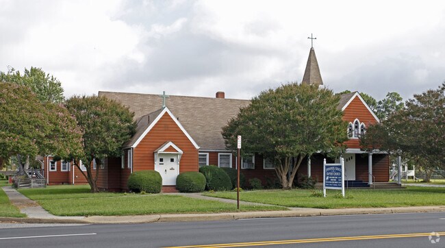

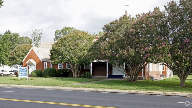
Property Detail
3301 Kecoughtan Rd
1006544
EMMANUEL GRACE CHURCH PC1A - FKA HAMPTON ROADS B37 400X200
Religious
Hampton City
5 R-13 ONE
Virginia
B and X Area of moderate flood hazard, usually the area between the limits of the 100-year and 500-year floods.
0.92 AC
2025
Downtown Hampton
2025
Hampton Roads
011800
Virginia Beach-Chesapeake-Norfolk, VA-NC
6,230 SF
NEARBY LISTINGS FOR SALE OR LEASE
-
-
View all Hampton listings for sale on LoopNet.com
DEMOGRAPHICS near 3301 Kecoughtan Rd
1 mile
3 mile
5 mile
2024 Total Population
11,196
60,358
154,493
2029 Population
11,146
60,480
154,364
Pop Growth 2024-2029
(0.45%)
+ 0.20%
(0.08%)
Average Age
40
39
39
2024 Total Households
4,781
25,341
63,754
HH Growth 2024-2029
(0.54%)
+ 0.19%
(0.06%)
Median Household Inc
$71,507
$56,421
$60,951
Avg Household Size
2.30
2.20
2.20
2024 Avg HH Vehicles
2.00
2.00
2.00
Median Home Value
$227,177
$221,283
$226,406
Median Year Built
1957
1966
1970
Nearby Places
Map Layers
Map Styles
 Street
 Aerial
Transit
 Traffic
 Biking
Places
Listings with unknown addresses are not visible on the map
- Restaurants
- Banks
- Shops
- Fitness
- Groceries
PUBLIC TRANSPORTATION
AIRPORT
Newport News/Williamsburg International
Drive
Walk
Distance
Newport News/Williamsburg International
23 min
14.0 mi
Norfolk International
Drive
Walk
Distance
Norfolk International
30 min
18.6 mi
Freight Ports
Virginia Port Authority - Newport News
Drive
Walk
Distance
Virginia Port Authority - Newport News
10 min
5.7 mi
Nearby Properties
Address
Land Use
TOTAL SIZE
Lot Size
Zoning
Address
Land Use
TOTAL SIZE
Lot Size
Zoning
1 SF
92.67 AC
5 R-13 ONE
Address
Land Use
TOTAL SIZE
Lot Size
Zoning
83.50 AC
5 R-13 ONE
Address
Land Use
TOTAL SIZE
Lot Size
Zoning
347,560 SF
31.84 AC
14 C-2 LIM
Address
Land Use
TOTAL SIZE
Lot Size
Zoning
112,089 SF
11.95 AC
30 DT-3 DO
Address
Land Use
TOTAL SIZE
Lot Size
Zoning
199,364 SF
22.12 AC
6 R-11 ONE
Address
Land Use
TOTAL SIZE
Lot Size
Zoning
45,076 SF
9.53 AC
11 MD-4 MU
Address
Land Use
TOTAL SIZE
Lot Size
Zoning
540,444 SF
33.66 AC
32 M-2 LIG
Address
Land Use
TOTAL SIZE
Lot Size
Zoning
230,974 SF
42.68 AC
5 R-13 ONE
Address
Land Use
TOTAL SIZE
Lot Size
Zoning
88,941 SF
29.32 AC
11 MD-4 MU
Address
Land Use
TOTAL SIZE
Lot Size
Zoning
260,228 SF
37.04 AC
M1
Address
Land Use
TOTAL SIZE
Lot Size
Zoning
17,368 SF
7.08 AC
11 MD-4 MU
Address
Land Use
TOTAL SIZE
Lot Size
Zoning
7,053 SF
12.28 AC
14 C-2 LIM
Address
Land Use
TOTAL SIZE
Lot Size
Zoning
60,350 SF
27.53 AC
M1
Address
Land Use
TOTAL SIZE
Lot Size
Zoning
34,222 SF
2.11 AC
14 C-2 LIM
Address
Land Use
TOTAL SIZE
Lot Size
Zoning
355,300 SF
19.03 AC
9 R-M MULT
Address
Land Use
TOTAL SIZE
Lot Size
Zoning
73,668 SF
3.24 AC
30 DT-3 DO
Address
Land Use
TOTAL SIZE
Lot Size
Zoning
51,372 SF
5.99 AC
14 C-2 LIM
Address
Land Use
TOTAL SIZE
Lot Size
Zoning
110,080 SF
2.21 AC
29 DT-2 DO
Address
Land Use
TOTAL SIZE
Lot Size
Zoning
458,744 SF
28.01 AC
17 M-3 HEA
Address
Land Use
TOTAL SIZE
Lot Size
Zoning
168,850 SF
1.02 AC
14 C-2 LIM
Address
Land Use
TOTAL SIZE
Lot Size
Zoning
4.99 AC
47 PH-2 PH
Address
Land Use
TOTAL SIZE
Lot Size
Zoning
53,551 SF
9.87 AC
P1
Address
Land Use
TOTAL SIZE
Lot Size
Zoning
114,040 SF
1.46 AC
28 DT-1 DO
Address
Land Use
TOTAL SIZE
Lot Size
Zoning
124,050 SF
26.31 AC
19 PO-1 GE
Address
Land Use
TOTAL SIZE
Lot Size
Zoning
35,856 SF
20.25 AC
14 C-2 LIM
Address
Land Use
TOTAL SIZE
Lot Size
Zoning
123,752 SF
10.19 AC
14 C-2 LIM
Address
Land Use
TOTAL SIZE
Lot Size
Zoning
233,296 SF
11.83 AC
14 C-2 LIM
Address
Land Use
TOTAL SIZE
Lot Size
Zoning
253,896 SF
13.32 AC
9 R-M MULT
Address
Land Use
TOTAL SIZE
Lot Size
Zoning
273,494 SF
5.48 AC
14 C-2 LIM
Address
Land Use
TOTAL SIZE
Lot Size
Zoning
123,459 SF
29.58 AC
13 C-1 NEI
The World's #1 Commercial Real Estate Marketplace
Connect with us
© 2026 CoStar Group
The information above has been obtained from sources believed reliable. While we do not doubt its accuracy we have not verified it and make no guarantee, warranty or representation about it. It is your responsibility to independently confirm its accuracy and completeness. Any projections, opinions, assumptions, or estimates used are for example only and do not represent the current or future performance of the property. The value of this transaction to you depends on tax and other factors which should be evaluated by your tax, financial, and legal advisors. You and your advisors should conduct a careful, independent investigation of the property to determine to your satisfaction the suitability of the property for your needs.