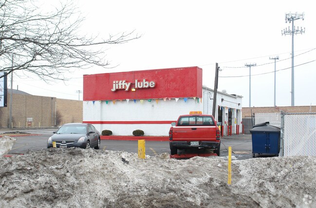
Property Record
3301 Mannheim Rd, Franklin Park, IL 60131


Property Detail
3301 Mannheim Rd
Chicago-Naperville-Elgin, IL-IN
(THIRD) ADD TO (FRANKLIN)(PARK) SUB SW SEC21 EX MANNH EIM & W10ACS OF PT SW LYING N RW C M & STP RR & E MANNHEIM & EX RW DEPO
12-21-314-031-0000
Cook
Parkingstructure
Illinois
B and X Area of moderate flood hazard, usually the area between the limits of the 100-year and 500-year floods.
38,39
2023
0.61 AC
2025
O'Hare
811500
Chicago
1,770 SF
NEARBY LISTINGS FOR SALE OR LEASE
-
-
-
-
-
-
-
-
No Photo
-
-
-
-
-
View all Franklin Park listings for sale on LoopNet.com
DEMOGRAPHICS near 3301 Mannheim Rd
1 mile
3 mile
5 mile
2025 Total Population
17,359
99,236
359,229
2030 Population
17,446
99,479
359,826
Pop Growth 2025-2030
+ 0.50%
+ 0.24%
+ 0.17%
Average Age
40
40
41
2025 Total Households
5,737
34,557
127,754
HH Growth 2025-2030
+ 0.33%
+ 0.09%
(0.01%)
Median Household Inc
$76,223
$74,462
$86,423
Avg Household Size
2.90
2.80
2.70
2025 Avg HH Vehicles
2.00
2.00
2.00
Median Home Value
$270,538
$269,150
$317,813
Median Year Built
1957
1959
1958
Nearby Places
Map Layers
Map Styles
 Street
 Aerial
Layers
 Traffic
 Biking
Places
Listings with unknown addresses are not visible on the map
- Restaurants
- Banks
- Shops
- Fitness
- Groceries
PUBLIC TRANSPORTATION
COMMUTER RAIL
Mannheim Station (Milwaukee District West Line - Northeast Illinois Regional Commuter Railroad (Metra))
Drive
Walk
Distance
Mannheim Station (Milwaukee District West Line - Northeast Illinois Regional Commuter Railroad (Metra))
3 min
20 min
1.1 mi
Franklin Park Station (Md-W) (Milwaukee District West Line - Northeast Illinois Regional Commuter Railroad (Metra))
Drive
Walk
Distance
Franklin Park Station (Md-W) (Milwaukee District West Line - Northeast Illinois Regional Commuter Railroad (Metra))
4 min
1.4 mi
AIRPORT
Chicago O'Hare International
Drive
Walk
Distance
Chicago O'Hare International
10 min
5.5 mi
Chicago Midway International
Drive
Walk
Distance
Chicago Midway International
30 min
16.0 mi
Freight Ports
Port Milwaukee
Drive
Walk
Distance
Port Milwaukee
95 min
79.0 mi
Nearby Properties
Address
Land Use
TOTAL SIZE
Lot Size
Zoning
Address
Land Use
TOTAL SIZE
Lot Size
Zoning
820,106 SF
14.78 AC
Address
Land Use
TOTAL SIZE
Lot Size
Zoning
Address
Land Use
TOTAL SIZE
Lot Size
Zoning
1,089,750 SF
59.83 AC
I
Address
Land Use
TOTAL SIZE
Lot Size
Zoning
733,433 SF
10.93 AC
Address
Land Use
TOTAL SIZE
Lot Size
Zoning
86.63 AC
Address
Land Use
TOTAL SIZE
Lot Size
Zoning
250,870 SF
19.23 AC
Address
Land Use
TOTAL SIZE
Lot Size
Zoning
Address
Land Use
TOTAL SIZE
Lot Size
Zoning
2.62 AC
Address
Land Use
TOTAL SIZE
Lot Size
Zoning
595,800 SF
9.40 AC
Address
Land Use
TOTAL SIZE
Lot Size
Zoning
Address
Land Use
TOTAL SIZE
Lot Size
Zoning
4,100 SF
PD 0
Address
Land Use
TOTAL SIZE
Lot Size
Zoning
969,696 SF
44.30 AC
Address
Land Use
TOTAL SIZE
Lot Size
Zoning
249,433 SF
4.57 AC
Address
Land Use
TOTAL SIZE
Lot Size
Zoning
1,160,629 SF
Address
Land Use
TOTAL SIZE
Lot Size
Zoning
372,935 SF
7.34 AC
Address
Land Use
TOTAL SIZE
Lot Size
Zoning
28.36 AC
Address
Land Use
TOTAL SIZE
Lot Size
Zoning
396,650 SF
19.12 AC
Address
Land Use
TOTAL SIZE
Lot Size
Zoning
Address
Land Use
TOTAL SIZE
Lot Size
Zoning
4,100 SF
PD 0
Address
Land Use
TOTAL SIZE
Lot Size
Zoning
403,815 SF
0.77 AC
Address
Land Use
TOTAL SIZE
Lot Size
Zoning
668,072 SF
4.19 AC
Address
Land Use
TOTAL SIZE
Lot Size
Zoning
334,000 SF
Address
Land Use
TOTAL SIZE
Lot Size
Zoning
548,206 SF
21.13 AC
Address
Land Use
TOTAL SIZE
Lot Size
Zoning
Address
Land Use
TOTAL SIZE
Lot Size
Zoning
121,117 SF
3.09 AC
Address
Land Use
TOTAL SIZE
Lot Size
Zoning
790,000 SF
31.71 AC
Address
Land Use
TOTAL SIZE
Lot Size
Zoning
531,227 SF
18.32 AC
Address
Land Use
TOTAL SIZE
Lot Size
Zoning
520,000 SF
2.96 AC
Address
Land Use
TOTAL SIZE
Lot Size
Zoning
186,486 SF
2.43 AC
A
Address
Land Use
TOTAL SIZE
Lot Size
Zoning
6.26 AC
The World's #1 Commercial Real Estate Marketplace
Connect with us
© 2026 CoStar Group
The information above has been obtained from sources believed reliable. While we do not doubt its accuracy we have not verified it and make no guarantee, warranty or representation about it. It is your responsibility to independently confirm its accuracy and completeness. Any projections, opinions, assumptions, or estimates used are for example only and do not represent the current or future performance of the property. The value of this transaction to you depends on tax and other factors which should be evaluated by your tax, financial, and legal advisors. You and your advisors should conduct a careful, independent investigation of the property to determine to your satisfaction the suitability of the property for your needs.