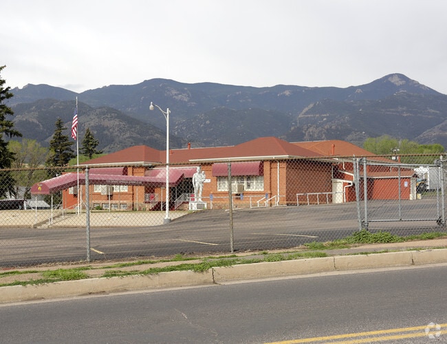
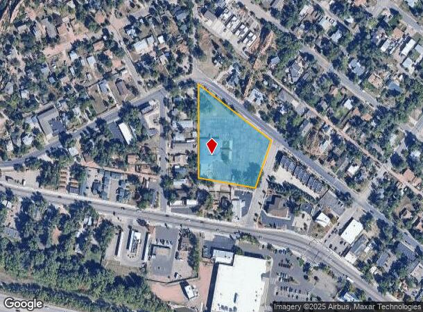
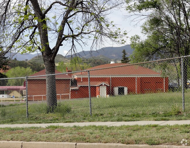
Property Record
3301 W Pikes Peak Ave, Colorado Springs, CO 80904
NEARBY LISTINGS FOR SALE OR LEASE
Property Detail
3301 W Pikes Peak Ave
74034-15-001
Grand View & Love & Quinbys Add To Colo
Charitableorganization
BLK 1 GRAND VIEW AND LOVE & QUINBYS ADD TO COLO CITY, EX SLY 170 FT
X
El Paso
08041C0707G
Colorado
0
2.12 AC
2025
Northwest
006600
Colorado Springs
11,452 SF
Colorado Springs, CO
DEMOGRAPHICS near 3301 W Pikes Peak Ave
1 Mile
3 Mile
5 Mile
2024 Total Population
7,353
45,054
117,282
2029 Population
7,681
47,108
122,556
Pop Growth 2024-2029
+ 4.46%
+ 4.56%
+ 4.50%
Average Age
46
44
42
2024 Total Households
3,527
20,942
54,087
HH Growth 2024-2029
+ 4.71%
+ 4.87%
+ 4.75%
Median Household Inc
$66,315
$70,182
$65,621
Avg Household Size
2.00
2.00
2.10
2024 Avg HH Vehicles
2.00
2.00
2.00
Median Home Value
$439,770
$465,433
$430,961
Median Year Built
1968
1974
1969
Nearby Places
Map Layers
Map Styles
 Street
 Aerial
- Restaurants
- Banks
- Shops
- Fitness
- Groceries
PUBLIC TRANSPORTATION
AIRPORT
City of Colorado Springs Municipal
DRIVE
WALK
Distance
City of Colorado Springs Municipal
27 min
14.2 mi
Nearby Properties
Address
Land Use
TOTAL SIZE
Lot Size
Zoning
Address
Land Use
TOTAL SIZE
Lot Size
Zoning
107,247 SF
56.98 AC
R-E PF
Address
Land Use
TOTAL SIZE
Lot Size
Zoning
662,208 SF
14.96 AC
BP
Address
Land Use
TOTAL SIZE
Lot Size
Zoning
198,916 SF
31.69 AC
PF/CR SS
Address
Land Use
TOTAL SIZE
Lot Size
Zoning
139,621 SF
403.34 AC
A R-E HS
Address
Land Use
TOTAL SIZE
Lot Size
Zoning
2,422 SF
616.19 AC
PK MX-I PD
Address
Land Use
TOTAL SIZE
Lot Size
Zoning
99,488 SF
13.01 AC
PDZ
Address
Land Use
TOTAL SIZE
Lot Size
Zoning
31,369 SF
4.87 AC
PF
Address
Land Use
TOTAL SIZE
Lot Size
Zoning
52,302 SF
1.74 AC
R-1 9 CU H
Address
Land Use
TOTAL SIZE
Lot Size
Zoning
57,183 SF
1.83 AC
MX-T
Address
Land Use
TOTAL SIZE
Lot Size
Zoning
62,919 SF
3.40 AC
MX-N SS
Address
Land Use
TOTAL SIZE
Lot Size
Zoning
75,349 SF
27.75 AC
EPC
Address
Land Use
TOTAL SIZE
Lot Size
Zoning
41,015 SF
0.62 AC
BP
Address
Land Use
TOTAL SIZE
Lot Size
Zoning
24,420 SF
2.79 AC
PK
Address
Land Use
TOTAL SIZE
Lot Size
Zoning
45,268 SF
8.37 AC
PDZ UV
Address
Land Use
TOTAL SIZE
Lot Size
Zoning
37,196 SF
3 AC
PDZ
Address
Land Use
TOTAL SIZE
Lot Size
Zoning
99,085 SF
6.85 AC
R-1 6
Address
Land Use
TOTAL SIZE
Lot Size
Zoning
40,763 SF
3.14 AC
FBZ-CEN SS
Address
Land Use
TOTAL SIZE
Lot Size
Zoning
331,438 SF
14.63 AC
PDZ
Address
Land Use
TOTAL SIZE
Lot Size
Zoning
45,716 SF
Address
Land Use
TOTAL SIZE
Lot Size
Zoning
116,635 SF
2.93 AC
MX-T
Address
Land Use
TOTAL SIZE
Lot Size
Zoning
282,722 SF
11.15 AC
PDZ HS SS
Address
Land Use
TOTAL SIZE
Lot Size
Zoning
88,582 SF
5.49 AC
C6
Address
Land Use
TOTAL SIZE
Lot Size
Zoning
296,778 SF
14.67 AC
MX-M HS CU
Address
Land Use
TOTAL SIZE
Lot Size
Zoning
509,867 SF
21.96 AC
BP
Address
Land Use
TOTAL SIZE
Lot Size
Zoning
184,424 SF
15.83 AC
BP
Address
Land Use
TOTAL SIZE
Lot Size
Zoning
34,126 SF
1.37 AC
Address
Land Use
TOTAL SIZE
Lot Size
Zoning
129,525 SF
9 AC
PDZ SS
Address
Land Use
TOTAL SIZE
Lot Size
Zoning
212,439 SF
12.67 AC
R-5 UV
Address
Land Use
TOTAL SIZE
Lot Size
Zoning
1,017 SF
77 AC
PK HS SS
Address
Land Use
TOTAL SIZE
Lot Size
Zoning
100,020 SF
3.87 AC
C6 C6/CR
The World's #1 Commercial Real Estate Marketplace
Connect with us
© 2026 CoStar Group
The information above has been obtained from sources believed reliable. While we do not doubt its accuracy we have not verified it and make no guarantee, warranty or representation about it. It is your responsibility to independently confirm its accuracy and completeness. Any projections, opinions, assumptions, or estimates used are for example only and do not represent the current or future performance of the property. The value of this transaction to you depends on tax and other factors which should be evaluated by your tax, financial, and legal advisors. You and your advisors should conduct a careful, independent investigation of the property to determine to your satisfaction the suitability of the property for your needs.