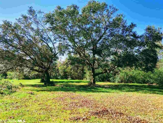
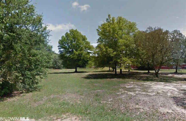
Property Record
33019 Us Highway 98, Lillian, AL 36549


Property Detail
33019 Us Highway 98
Daphne-Fairhope-Foley, AL
199.9' X 369.7' PT LOT 5 LILLIAN WOODLAND ESTATE MB9 PG93 DESC AS: BEG SW COR SD LOT, RUN N 369.7', TH NE'LY 215.1', THE 200'
52-05-22-0-001-010.000
Baldwin
Residentialacreage
Alabama
B and X Area of moderate flood hazard, usually the area between the limits of the 100-year and 500-year floods.
5
2025
2.80 AC
2025
Baldwin County
011603
Mobile
NEARBY LISTINGS FOR SALE OR LEASE
-
-
View all Lillian listings for sale on LoopNet.com
DEMOGRAPHICS near 33019 Us Highway 98
1 mile
3 mile
5 mile
2025 Total Population
1,025
5,953
10,513
2030 Population
1,117
6,543
11,464
Pop Growth 2025-2030
+ 8.98%
+ 9.91%
+ 9.05%
Average Age
53
53
50
2025 Total Households
464
2,744
4,573
HH Growth 2025-2030
+ 9.05%
+ 10.06%
+ 9.32%
Median Household Inc
$63,142
$67,021
$70,290
Avg Household Size
2.10
2.10
2.20
2025 Avg HH Vehicles
2.00
2.00
2.00
Median Home Value
$229,722
$227,893
$250,040
Median Year Built
1993
1994
1994
Nearby Places
Map Layers
Map Styles
 Street
 Aerial
Layers
 Traffic
 Biking
Places
Listings with unknown addresses are not visible on the map
- Restaurants
- Banks
- Shops
- Fitness
- Groceries
PUBLIC TRANSPORTATION
AIRPORT
Pensacola International
Drive
Walk
Distance
Pensacola International
35 min
19.1 mi
Freight Ports
Port of Mobile
Drive
Walk
Distance
Port of Mobile
65 min
50.8 mi
SALE & LEASE HISTORY
LISTING DATE
SALE/LEASE

Sep 24, 2016
For Sale
May 01, 2017
For Sale
Mar 06, 2017
For Sale
Nearby Properties
Address
Land Use
TOTAL SIZE
Lot Size
Zoning
Address
Land Use
TOTAL SIZE
Lot Size
Zoning
2,758 SF
9.90 AC
Address
Land Use
TOTAL SIZE
Lot Size
Zoning
8,320 SF
0.37 AC
Address
Land Use
TOTAL SIZE
Lot Size
Zoning
9,200 SF
1.08 AC
LDR
Address
Land Use
TOTAL SIZE
Lot Size
Zoning
7,115 SF
6.20 AC
Address
Land Use
TOTAL SIZE
Lot Size
Zoning
3,808 SF
0.88 AC
LDR
Address
Land Use
TOTAL SIZE
Lot Size
Zoning
9,470 SF
3.02 AC
Address
Land Use
TOTAL SIZE
Lot Size
Zoning
5,087 SF
2.08 AC
HDMU,MDR
Address
Land Use
TOTAL SIZE
Lot Size
Zoning
9,010 SF
2.09 AC
Address
Land Use
TOTAL SIZE
Lot Size
Zoning
7,781 SF
14 AC
Address
Land Use
TOTAL SIZE
Lot Size
Zoning
1.57 AC
Address
Land Use
TOTAL SIZE
Lot Size
Zoning
3,623 SF
5.90 AC
Address
Land Use
TOTAL SIZE
Lot Size
Zoning
5,637 SF
3.56 AC
Address
Land Use
TOTAL SIZE
Lot Size
Zoning
Address
Land Use
TOTAL SIZE
Lot Size
Zoning
3,285 SF
6.50 AC
Address
Land Use
TOTAL SIZE
Lot Size
Zoning
1.62 AC
LDR
Address
Land Use
TOTAL SIZE
Lot Size
Zoning
3,182 SF
1.15 AC
MDR
Address
Land Use
TOTAL SIZE
Lot Size
Zoning
5,214 SF
0.83 AC
Address
Land Use
TOTAL SIZE
Lot Size
Zoning
2,470 SF
2.47 AC
Address
Land Use
TOTAL SIZE
Lot Size
Zoning
Address
Land Use
TOTAL SIZE
Lot Size
Zoning
3,600 SF
2.54 AC
Address
Land Use
TOTAL SIZE
Lot Size
Zoning
7,877 SF
5.50 AC
Address
Land Use
TOTAL SIZE
Lot Size
Zoning
8,359 SF
0.57 AC
Address
Land Use
TOTAL SIZE
Lot Size
Zoning
4,357 SF
17 AC
Address
Land Use
TOTAL SIZE
Lot Size
Zoning
2.38 AC
Address
Land Use
TOTAL SIZE
Lot Size
Zoning
1,140 SF
85.94 AC
HDMU
Address
Land Use
TOTAL SIZE
Lot Size
Zoning
9,030 SF
1.06 AC
Address
Land Use
TOTAL SIZE
Lot Size
Zoning
7,500 SF
8 AC
Address
Land Use
TOTAL SIZE
Lot Size
Zoning
1.86 AC
LDR,REC
Address
Land Use
TOTAL SIZE
Lot Size
Zoning
864 SF
5.70 AC
Address
Land Use
TOTAL SIZE
Lot Size
Zoning
8,429 SF
2.50 AC
The World's #1 Commercial Real Estate Marketplace
Connect with us
© 2026 CoStar Group
The information above has been obtained from sources believed reliable. While we do not doubt its accuracy we have not verified it and make no guarantee, warranty or representation about it. It is your responsibility to independently confirm its accuracy and completeness. Any projections, opinions, assumptions, or estimates used are for example only and do not represent the current or future performance of the property. The value of this transaction to you depends on tax and other factors which should be evaluated by your tax, financial, and legal advisors. You and your advisors should conduct a careful, independent investigation of the property to determine to your satisfaction the suitability of the property for your needs.