Property Record
3302 Vollmer Rd, Olympia Fields, IL 60461

Property Detail
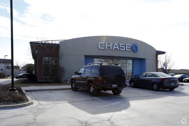
3302 Vollmer Rd
31-14-201-033-0000
Cook
Commercialbuilding
Illinois
B and X Area of moderate flood hazard, usually the area between the limits of the 100-year and 500-year floods.
1.31 AC
2023
Far South
2025
Chicago
830005
Chicago-Naperville-Elgin, IL-IN
4,249 SF
NEARBY LISTINGS FOR SALE OR LEASE
DEMOGRAPHICS near 3302 Vollmer Rd
1 mile
3 mile
5 mile
2025 Total Population
6,259
87,072
193,603
2030 Population
6,422
88,337
197,147
Pop Growth 2025-2030
+ 2.60%
+ 1.45%
+ 1.83%
Average Age
48
42
41
2025 Total Households
2,300
31,438
71,378
HH Growth 2025-2030
+ 2.61%
+ 1.24%
+ 1.59%
Median Household Inc
$114,022
$87,898
$73,302
Avg Household Size
2.60
2.70
2.60
2025 Avg HH Vehicles
2.00
2.00
2.00
Median Home Value
$311,684
$209,119
$193,069
Median Year Built
1975
1968
1969
Nearby Places
Map Layers
Map Styles
 Street
 Aerial
Layers
 Traffic
 Biking
Places
Listings with unknown addresses are not visible on the map
- Restaurants
- Banks
- Shops
- Fitness
- Groceries
PUBLIC TRANSPORTATION
TRANSIT/SUBWAY
Olympia Fields Station (Metra Electric Line - Northeast Illinois Regional Commuter Railroad (Metra))
Drive
Walk
Distance
Olympia Fields Station (Metra Electric Line - Northeast Illinois Regional Commuter Railroad (Metra))
2 min
15 min
0.8 mi
COMMUTER RAIL
Olympia Fields Station (Metra Electric Line - Northeast Illinois Regional Commuter Railroad (Metra))
Drive
Walk
Distance
Olympia Fields Station (Metra Electric Line - Northeast Illinois Regional Commuter Railroad (Metra))
7 min
15 min
0.8 mi
Flossmoor Station (Metra Electric Line - Northeast Illinois Regional Commuter Railroad (Metra))
Drive
Walk
Distance
Flossmoor Station (Metra Electric Line - Northeast Illinois Regional Commuter Railroad (Metra))
5 min
1.8 mi
AIRPORT
Chicago Midway International
Drive
Walk
Distance
Chicago Midway International
35 min
20.9 mi
Chicago O'Hare International
Drive
Walk
Distance
Chicago O'Hare International
60 min
44.1 mi
SALE & LEASE HISTORY
LISTING DATE
SALE/LEASE

Oct 25, 2018
For Sale
Nearby Properties
Address
Land Use
TOTAL SIZE
Lot Size
Zoning
Address
Land Use
TOTAL SIZE
Lot Size
Zoning
Address
Land Use
TOTAL SIZE
Lot Size
Zoning
37.62 AC
Address
Land Use
TOTAL SIZE
Lot Size
Zoning
Address
Land Use
TOTAL SIZE
Lot Size
Zoning
Address
Land Use
TOTAL SIZE
Lot Size
Zoning
Address
Land Use
TOTAL SIZE
Lot Size
Zoning
194,292 SF
21.10 AC
Address
Land Use
TOTAL SIZE
Lot Size
Zoning
300,399 SF
26.50 AC
Address
Land Use
TOTAL SIZE
Lot Size
Zoning
11.84 AC
Address
Land Use
TOTAL SIZE
Lot Size
Zoning
Address
Land Use
TOTAL SIZE
Lot Size
Zoning
150,289 SF
16.40 AC
Address
Land Use
TOTAL SIZE
Lot Size
Zoning
1,201 SF
3.65 AC
Address
Land Use
TOTAL SIZE
Lot Size
Zoning
224,611 SF
0.90 AC
Address
Land Use
TOTAL SIZE
Lot Size
Zoning
31,952 SF
4.03 AC
Address
Land Use
TOTAL SIZE
Lot Size
Zoning
2.94 AC
Address
Land Use
TOTAL SIZE
Lot Size
Zoning
15.65 AC
Address
Land Use
TOTAL SIZE
Lot Size
Zoning
2.04 AC
Address
Land Use
TOTAL SIZE
Lot Size
Zoning
Address
Land Use
TOTAL SIZE
Lot Size
Zoning
183,041 SF
18.71 AC
Address
Land Use
TOTAL SIZE
Lot Size
Zoning
3.65 AC
Address
Land Use
TOTAL SIZE
Lot Size
Zoning
130,753 SF
8.12 AC
Address
Land Use
TOTAL SIZE
Lot Size
Zoning
37,522 SF
2.78 AC
Address
Land Use
TOTAL SIZE
Lot Size
Zoning
133,342 SF
11.63 AC
Address
Land Use
TOTAL SIZE
Lot Size
Zoning
96,255 SF
12.01 AC
Address
Land Use
TOTAL SIZE
Lot Size
Zoning
Address
Land Use
TOTAL SIZE
Lot Size
Zoning
37,309 SF
1.50 AC
Address
Land Use
TOTAL SIZE
Lot Size
Zoning
16.24 AC
Address
Land Use
TOTAL SIZE
Lot Size
Zoning
44,000 SF
1.44 AC
Address
Land Use
TOTAL SIZE
Lot Size
Zoning
137,684 SF
6.93 AC
Address
Land Use
TOTAL SIZE
Lot Size
Zoning
6.58 AC
Address
Land Use
TOTAL SIZE
Lot Size
Zoning
49,800 SF
4.42 AC
The World's #1 Commercial Real Estate Marketplace
Connect with us
© 2026 CoStar Group
The information above has been obtained from sources believed reliable. While we do not doubt its accuracy we have not verified it and make no guarantee, warranty or representation about it. It is your responsibility to independently confirm its accuracy and completeness. Any projections, opinions, assumptions, or estimates used are for example only and do not represent the current or future performance of the property. The value of this transaction to you depends on tax and other factors which should be evaluated by your tax, financial, and legal advisors. You and your advisors should conduct a careful, independent investigation of the property to determine to your satisfaction the suitability of the property for your needs.