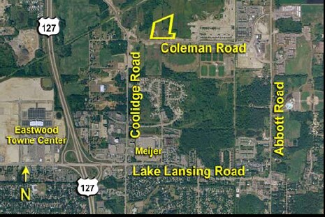
Property Record
3203 E Coleman Rd, East Lansing, MI 48823
NEARBY LISTINGS FOR SALE OR LEASE
Property Detail
3203 E Coleman Rd
Lansing-East Lansing, MI
Grayson Village Condominium
19-20-50-36-300-015
LOT 261, CITY OF DEWITT DE 1017 (1997 BECOMES -110-000-112-00)
Residentialacreage
Clinton
AE
Michigan
26065C0020D
261
2024
10 AC
2025
East Lansing
010104
West Michigan
DEMOGRAPHICS near 3203 E Coleman Rd
1 Mile
3 Mile
5 Mile
2024 Total Population
6,794
59,189
130,489
2029 Population
6,887
59,560
131,294
Pop Growth 2024-2029
+ 1.37%
+ 0.63%
+ 0.62%
Average Age
34
35
36
2024 Total Households
3,187
25,134
56,555
HH Growth 2024-2029
+ 1.22%
+ 0.66%
+ 0.59%
Median Household Inc
$36,117
$48,300
$48,617
Avg Household Size
2.10
2.10
2.10
2024 Avg HH Vehicles
2.00
2.00
2.00
Median Home Value
$238,461
$175,767
$168,194
Median Year Built
1998
1974
1970
Nearby Places
- Restaurants
- Banks
- Shops
- Fitness
- Groceries
PUBLIC TRANSPORTATION
COMMUTER RAIL
East Lansing Amtrak Station (Blue Water - Amtrak)
DRIVE
WALK
Distance
East Lansing Amtrak Station (Blue Water - Amtrak)
10 min
5.4 mi
AIRPORT
Capital Region International
DRIVE
WALK
Distance
Capital Region International
15 min
6.9 mi
Freight Ports
Port of Toledo
DRIVE
WALK
Distance
Port of Toledo
148 min
116.6 mi
Nearby Properties
Address
Land Use
TOTAL SIZE
Lot Size
Zoning
Address
Land Use
TOTAL SIZE
Lot Size
Zoning
42,875 SF
35 AC
PD
Address
Land Use
TOTAL SIZE
Lot Size
Zoning
7,579 SF
83.53 AC
PD
Address
Land Use
TOTAL SIZE
Lot Size
Zoning
42,875 SF
28.77 AC
Address
Land Use
TOTAL SIZE
Lot Size
Zoning
14,304 SF
3.37 AC
MIXED Z
Address
Land Use
TOTAL SIZE
Lot Size
Zoning
222,869 SF
0.10 AC
B3
Address
Land Use
TOTAL SIZE
Lot Size
Zoning
274,720 SF
10.55 AC
Address
Land Use
TOTAL SIZE
Lot Size
Zoning
73,179 SF
58.17 AC
RM14
Address
Land Use
TOTAL SIZE
Lot Size
Zoning
12,435 SF
0.52 AC
B3
Address
Land Use
TOTAL SIZE
Lot Size
Zoning
63,461 SF
32 AC
F COMM
Address
Land Use
TOTAL SIZE
Lot Size
Zoning
13.13 AC
Address
Land Use
TOTAL SIZE
Lot Size
Zoning
66.43 AC
Address
Land Use
TOTAL SIZE
Lot Size
Zoning
16,466 SF
14.82 AC
DEVELOPMEN
Address
Land Use
TOTAL SIZE
Lot Size
Zoning
195,094 SF
1.89 AC
Address
Land Use
TOTAL SIZE
Lot Size
Zoning
19,035 SF
12.32 AC
RM08
Address
Land Use
TOTAL SIZE
Lot Size
Zoning
20,438 SF
17.81 AC
DEVELOPMEN
Address
Land Use
TOTAL SIZE
Lot Size
Zoning
300,760 SF
27.22 AC
RM08
Address
Land Use
TOTAL SIZE
Lot Size
Zoning
183,047 SF
24.36 AC
B4
Address
Land Use
TOTAL SIZE
Lot Size
Zoning
9,628 SF
1.86 AC
B2
Address
Land Use
TOTAL SIZE
Lot Size
Zoning
142,152 SF
47.56 AC
B4
Address
Land Use
TOTAL SIZE
Lot Size
Zoning
9,280 SF
24.38 AC
RC
Address
Land Use
TOTAL SIZE
Lot Size
Zoning
141,026 SF
0.45 AC
B3
Address
Land Use
TOTAL SIZE
Lot Size
Zoning
118,415 SF
4.74 AC
RM22
Address
Land Use
TOTAL SIZE
Lot Size
Zoning
63.94 AC
Address
Land Use
TOTAL SIZE
Lot Size
Zoning
8,834 SF
17.46 AC
DEVELOPMEN
Address
Land Use
TOTAL SIZE
Lot Size
Zoning
19,035 SF
11.98 AC
RM08
Address
Land Use
TOTAL SIZE
Lot Size
Zoning
112,248 SF
3.70 AC
B2
Address
Land Use
TOTAL SIZE
Lot Size
Zoning
15,864 SF
18.35 AC
Address
Land Use
TOTAL SIZE
Lot Size
Zoning
61,194 SF
0.55 AC
F COMME
Address
Land Use
TOTAL SIZE
Lot Size
Zoning
131,040 SF
2.36 AC
Address
Land Use
TOTAL SIZE
Lot Size
Zoning
29,292 SF
8.21 AC
DEVELOPMEN
The World's #1 Commercial Real Estate Marketplace
Connect with us
© 2025 CoStar Group
The information above has been obtained from sources believed reliable. While we do not doubt its accuracy we have not verified it and make no guarantee, warranty or representation about it. It is your responsibility to independently confirm its accuracy and completeness. Any projections, opinions, assumptions, or estimates used are for example only and do not represent the current or future performance of the property. The value of this transaction to you depends on tax and other factors which should be evaluated by your tax, financial, and legal advisors. You and your advisors should conduct a careful, independent investigation of the property to determine to your satisfaction the suitability of the property for your needs.