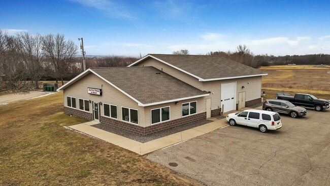
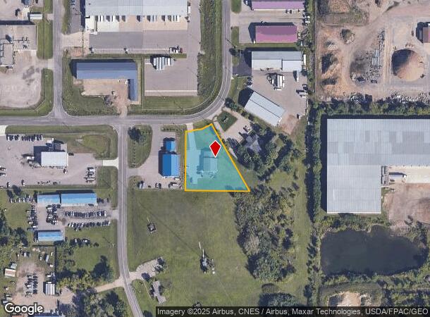
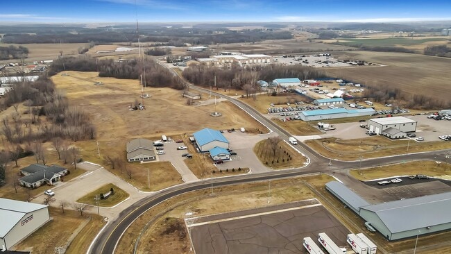
Property Record
3308 5Th St S, Waite Park, MN 56387
NEARBY LISTINGS FOR SALE OR LEASE
Property Detail
3308 5Th St S
St. Cloud, MN
Industries West
98.60672.0675
LOT 026 BLK 001 INDUSTRIES WEST SECTION 24 TOWNSHIP 124 RANGE 029 SECTION 24 TOWNSHIP 124 RANGE 029
Autorepair
Stearns
X
Minnesota
27145C0620E
26
2024
1 AC
2025
Stearns County
011308
Minneapolis/St Paul
3,750 SF
DEMOGRAPHICS near 3308 5Th St S
1 Mile
3 Mile
5 Mile
2024 Total Population
129
24,238
70,294
2029 Population
134
25,183
72,839
Pop Growth 2024-2029
+ 3.88%
+ 3.90%
+ 3.62%
Average Age
38
38
38
2024 Total Households
59
9,791
27,954
HH Growth 2024-2029
+ 3.39%
+ 4.05%
+ 3.75%
Median Household Inc
$47,500
$57,406
$58,281
Avg Household Size
2.20
2.30
2.40
2024 Avg HH Vehicles
2.00
2.00
2.00
Median Home Value
$130,769
$214,941
$199,288
Median Year Built
1987
1995
1986
Nearby Places
Map Layers
Map Styles
 Street
 Aerial
- Restaurants
- Banks
- Shops
- Fitness
- Groceries
PUBLIC TRANSPORTATION
COMMUTER RAIL
St. Cloud Amtrak Station (Empire Builder - Amtrak)
DRIVE
WALK
Distance
St. Cloud Amtrak Station (Empire Builder - Amtrak)
15 min
6.8 mi
Freight Ports
Port Milwaukee
DRIVE
WALK
Distance
Port Milwaukee
452 min
408.5 mi
SALE & LEASE HISTORY
LISTING DATE
SALE/LEASE

Jun 10, 2024
For Lease
Jan 26, 2024
For Sale
Nearby Properties
Address
Land Use
TOTAL SIZE
Lot Size
Zoning
Address
Land Use
TOTAL SIZE
Lot Size
Zoning
38.97 AC
Address
Land Use
TOTAL SIZE
Lot Size
Zoning
639,000 SF
216.67 AC
PUD28
Address
Land Use
TOTAL SIZE
Lot Size
Zoning
113,316 SF
31.99 AC
Address
Land Use
TOTAL SIZE
Lot Size
Zoning
52,983 SF
22 AC
Address
Land Use
TOTAL SIZE
Lot Size
Zoning
148,150 SF
71.46 AC
Address
Land Use
TOTAL SIZE
Lot Size
Zoning
19.06 AC
Address
Land Use
TOTAL SIZE
Lot Size
Zoning
125,278 SF
11.01 AC
C5
Address
Land Use
TOTAL SIZE
Lot Size
Zoning
628,000 SF
40.51 AC
PUD16
Address
Land Use
TOTAL SIZE
Lot Size
Zoning
115,298 SF
8.50 AC
R5
Address
Land Use
TOTAL SIZE
Lot Size
Zoning
5.34 AC
Address
Land Use
TOTAL SIZE
Lot Size
Zoning
233,354 SF
7.30 AC
R5
Address
Land Use
TOTAL SIZE
Lot Size
Zoning
113,268 SF
12 AC
PUD32
Address
Land Use
TOTAL SIZE
Lot Size
Zoning
269,390 SF
15.77 AC
Address
Land Use
TOTAL SIZE
Lot Size
Zoning
146,285 SF
19.10 AC
Address
Land Use
TOTAL SIZE
Lot Size
Zoning
51.70 AC
PL20B2
Address
Land Use
TOTAL SIZE
Lot Size
Zoning
555,652 SF
26.04 AC
PUD16
Address
Land Use
TOTAL SIZE
Lot Size
Zoning
83,317 SF
6.43 AC
C5
Address
Land Use
TOTAL SIZE
Lot Size
Zoning
289,470 SF
23 AC
I3
Address
Land Use
TOTAL SIZE
Lot Size
Zoning
44,223 SF
12.31 AC
Address
Land Use
TOTAL SIZE
Lot Size
Zoning
288,861 SF
30.27 AC
I3
Address
Land Use
TOTAL SIZE
Lot Size
Zoning
165,878 SF
11.17 AC
PUD56
Address
Land Use
TOTAL SIZE
Lot Size
Zoning
7.70 AC
Address
Land Use
TOTAL SIZE
Lot Size
Zoning
11,700 SF
71.99 AC
Address
Land Use
TOTAL SIZE
Lot Size
Zoning
157,351 SF
14.16 AC
C5
Address
Land Use
TOTAL SIZE
Lot Size
Zoning
9,448 SF
5.10 AC
Address
Land Use
TOTAL SIZE
Lot Size
Zoning
5.89 AC
Address
Land Use
TOTAL SIZE
Lot Size
Zoning
80,210 SF
4.54 AC
C5
Address
Land Use
TOTAL SIZE
Lot Size
Zoning
Address
Land Use
TOTAL SIZE
Lot Size
Zoning
320,450 SF
26.20 AC
I3
Address
Land Use
TOTAL SIZE
Lot Size
Zoning
4.91 AC
The World's #1 Commercial Real Estate Marketplace
Connect with us
© 2025 CoStar Group
The information above has been obtained from sources believed reliable. While we do not doubt its accuracy we have not verified it and make no guarantee, warranty or representation about it. It is your responsibility to independently confirm its accuracy and completeness. Any projections, opinions, assumptions, or estimates used are for example only and do not represent the current or future performance of the property. The value of this transaction to you depends on tax and other factors which should be evaluated by your tax, financial, and legal advisors. You and your advisors should conduct a careful, independent investigation of the property to determine to your satisfaction the suitability of the property for your needs.