Property Record
3308 E Nc 54 Hwy E, Durham, NC 27713

Property Detail
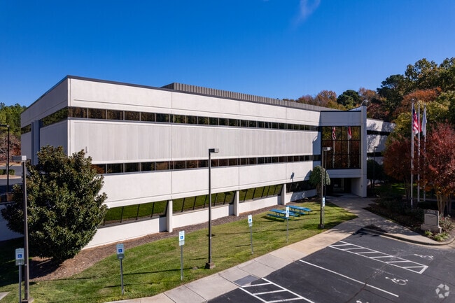
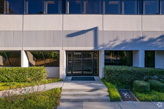
3308 E Nc 54 Hwy E
154112
PROP-HIGHWOODS/FORSYTH LI MITED PARTNERSHIP DBA/SE PL:000000-000000
Officebuilding
DURHAM
SRP
North Carolina
AE The base floodplain where base flood elevations are provided. AE Zones are now used on new format FIRMs instead of A1-A30 Zones.
17.91 AC
2025
Research Triangle
2025
Raleigh/Durham
980100
Durham-Chapel Hill, NC
113,008 SF
NEARBY LISTINGS FOR SALE OR LEASE
DEMOGRAPHICS near 3308 E Nc 54 Hwy E
1 mile
3 mile
5 mile
2025 Total Population
1,511
36,654
146,305
2030 Population
1,652
39,056
156,767
Pop Growth 2025-2030
+ 9.33%
+ 6.55%
+ 7.15%
Average Age
35
37
37
2025 Total Households
773
16,513
62,480
HH Growth 2025-2030
+ 9.31%
+ 6.76%
+ 7.34%
Median Household Inc
$65,989
$97,791
$112,679
Avg Household Size
1.90
2.20
2.30
2025 Avg HH Vehicles
1.00
2.00
2.00
Median Home Value
$363,252
$447,829
$469,132
Median Year Built
2010
2008
2006
Nearby Places
Map Layers
Map Styles
 Street
 Aerial
Transit
 Traffic
 Biking
Places
Listings with unknown addresses are not visible on the map
- Restaurants
- Banks
- Shops
- Fitness
- Groceries
PUBLIC TRANSPORTATION
AIRPORT
Raleigh-Durham International
Drive
Walk
Distance
Raleigh-Durham International
13 min
6.6 mi
Nearby Properties
Address
Land Use
TOTAL SIZE
Lot Size
Zoning
Address
Land Use
TOTAL SIZE
Lot Size
Zoning
2,436,024 SF
SRP
Address
Land Use
TOTAL SIZE
Lot Size
Zoning
896,802 SF
86.14 AC
RA
Address
Land Use
TOTAL SIZE
Lot Size
Zoning
1,080,486 SF
61.68 AC
SRP
Address
Land Use
TOTAL SIZE
Lot Size
Zoning
677,504 SF
60.32 AC
SRP
Address
Land Use
TOTAL SIZE
Lot Size
Zoning
1,272,163 SF
117.61 AC
OI,SRP
Address
Land Use
TOTAL SIZE
Lot Size
Zoning
1,378,965 SF
183.46 AC
SRP
Address
Land Use
TOTAL SIZE
Lot Size
Zoning
868,283 SF
56.23 AC
SRP
Address
Land Use
TOTAL SIZE
Lot Size
Zoning
491,701 SF
124.48 AC
SRP
Address
Land Use
TOTAL SIZE
Lot Size
Zoning
507,119 SF
118.85 AC
SRP
Address
Land Use
TOTAL SIZE
Lot Size
Zoning
799,818 SF
84.58 AC
IL
Address
Land Use
TOTAL SIZE
Lot Size
Zoning
168,660 SF
15.49 AC
CG(D)
Address
Land Use
TOTAL SIZE
Lot Size
Zoning
444,254 SF
58.71 AC
SRP
Address
Land Use
TOTAL SIZE
Lot Size
Zoning
8,418 SF
22.17 AC
MU(D)
Address
Land Use
TOTAL SIZE
Lot Size
Zoning
122,544 SF
8.04 AC
MU(D)
Address
Land Use
TOTAL SIZE
Lot Size
Zoning
624,324 SF
81.65 AC
RA
Address
Land Use
TOTAL SIZE
Lot Size
Zoning
35.03 AC
RS-M(D)
Address
Land Use
TOTAL SIZE
Lot Size
Zoning
627,566 SF
37.83 AC
RA
Address
Land Use
TOTAL SIZE
Lot Size
Zoning
449,992 SF
25.16 AC
IP
Address
Land Use
TOTAL SIZE
Lot Size
Zoning
597,624 SF
53.04 AC
RA
Address
Land Use
TOTAL SIZE
Lot Size
Zoning
373,099 SF
14.08 AC
GCM
Address
Land Use
TOTAL SIZE
Lot Size
Zoning
47,376 SF
11.86 AC
OI(D)
Address
Land Use
TOTAL SIZE
Lot Size
Zoning
319,275 SF
50.52 AC
SRP
Address
Land Use
TOTAL SIZE
Lot Size
Zoning
353,339 SF
25.95 AC
SRP
Address
Land Use
TOTAL SIZE
Lot Size
Zoning
477,384 SF
37.07 AC
RMFM
Address
Land Use
TOTAL SIZE
Lot Size
Zoning
2.82 AC
SRP-C
Address
Land Use
TOTAL SIZE
Lot Size
Zoning
23,889 SF
50.95 AC
OI
Address
Land Use
TOTAL SIZE
Lot Size
Zoning
441,280 SF
48.43 AC
IL
Address
Land Use
TOTAL SIZE
Lot Size
Zoning
7,080 SF
30.67 AC
OI,RS-M
Address
Land Use
TOTAL SIZE
Lot Size
Zoning
6,948 SF
21.22 AC
RS-M(D)
Address
Land Use
TOTAL SIZE
Lot Size
Zoning
529,439 SF
29.84 AC
IL
The World's #1 Commercial Real Estate Marketplace
Connect with us
© 2026 CoStar Group
The information above has been obtained from sources believed reliable. While we do not doubt its accuracy we have not verified it and make no guarantee, warranty or representation about it. It is your responsibility to independently confirm its accuracy and completeness. Any projections, opinions, assumptions, or estimates used are for example only and do not represent the current or future performance of the property. The value of this transaction to you depends on tax and other factors which should be evaluated by your tax, financial, and legal advisors. You and your advisors should conduct a careful, independent investigation of the property to determine to your satisfaction the suitability of the property for your needs.