Property Record
331 19Th St E, Jasper, AL 35501
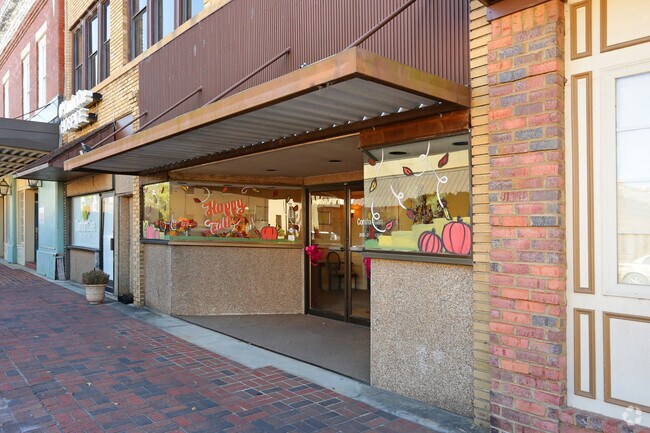

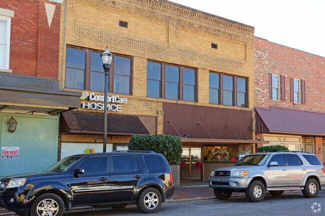
Property Detail
331 19Th St E
17-05-16-2-205-011-0000
PO BLK 216 COM @ NW COR E ON S ROW 19TH ST 72 TO POB CONT ON ROW 39 S 88 TO N ROW ALLEY W ON ROW 39 N 88 TO POB MAP OF JASPER
Officebuilding
WALKER
MF
Alabama
B and X Area of moderate flood hazard, usually the area between the limits of the 100-year and 500-year floods.
0.10 AC
2025
Walker County
2024
Birmingham
020400
Birmingham, AL
6,630 SF
NEARBY LISTINGS FOR SALE OR LEASE
DEMOGRAPHICS near 331 19Th St E
1 mile
3 mile
5 mile
2025 Total Population
4,647
10,429
19,298
2030 Population
4,688
10,499
19,432
Pop Growth 2025-2030
+ 0.88%
+ 0.67%
+ 0.69%
Average Age
41
42
42
2025 Total Households
1,837
4,218
7,595
HH Growth 2025-2030
+ 0.87%
+ 0.57%
+ 0.58%
Median Household Inc
$51,077
$53,725
$58,701
Avg Household Size
2.30
2.30
2.40
2025 Avg HH Vehicles
2.00
2.00
2.00
Median Home Value
$180,637
$185,228
$191,752
Median Year Built
1972
1975
1979
Nearby Places
Map Layers
Map Styles
 Street
 Aerial
Transit
 Traffic
 Biking
Places
Listings with unknown addresses are not visible on the map
- Restaurants
- Banks
- Shops
- Fitness
- Groceries
PUBLIC TRANSPORTATION
AIRPORT
Birmingham-Shuttlesworth International
Drive
Walk
Distance
Birmingham-Shuttlesworth International
53 min
45.4 mi
Nearby Properties
Address
Land Use
TOTAL SIZE
Lot Size
Zoning
Address
Land Use
TOTAL SIZE
Lot Size
Zoning
258,084 SF
49 AC
O
Address
Land Use
TOTAL SIZE
Lot Size
Zoning
146,360 SF
51 AC
O
Address
Land Use
TOTAL SIZE
Lot Size
Zoning
86,928 SF
19 AC
OT
Address
Land Use
TOTAL SIZE
Lot Size
Zoning
55,188 SF
4.80 AC
OT
Address
Land Use
TOTAL SIZE
Lot Size
Zoning
42,149 SF
2 AC
O
Address
Land Use
TOTAL SIZE
Lot Size
Zoning
8,932 SF
7.50 AC
CO
Address
Land Use
TOTAL SIZE
Lot Size
Zoning
32,815 SF
4.70 AC
O
Address
Land Use
TOTAL SIZE
Lot Size
Zoning
60,200 SF
5.60 AC
OT
Address
Land Use
TOTAL SIZE
Lot Size
Zoning
846 SF
11 AC
SF
Address
Land Use
TOTAL SIZE
Lot Size
Zoning
44,601 SF
3.80 AC
OT
Address
Land Use
TOTAL SIZE
Lot Size
Zoning
38,770 SF
180 AC
CO
Address
Land Use
TOTAL SIZE
Lot Size
Zoning
33,863 SF
2.50 AC
S
Address
Land Use
TOTAL SIZE
Lot Size
Zoning
26,446 SF
43 AC
CO
Address
Land Use
TOTAL SIZE
Lot Size
Zoning
37,813 SF
2 AC
O
Address
Land Use
TOTAL SIZE
Lot Size
Zoning
5,640 SF
19 AC
O
Address
Land Use
TOTAL SIZE
Lot Size
Zoning
4,830 SF
6.10 AC
OT
Address
Land Use
TOTAL SIZE
Lot Size
Zoning
30,981 SF
3.90 AC
S
Address
Land Use
TOTAL SIZE
Lot Size
Zoning
100 SF
20 AC
OT
Address
Land Use
TOTAL SIZE
Lot Size
Zoning
81,668 SF
9.80 AC
O
Address
Land Use
TOTAL SIZE
Lot Size
Zoning
53,413 SF
14 AC
O
The World's #1 Commercial Real Estate Marketplace
Connect with us
© 2026 CoStar Group
The information above has been obtained from sources believed reliable. While we do not doubt its accuracy we have not verified it and make no guarantee, warranty or representation about it. It is your responsibility to independently confirm its accuracy and completeness. Any projections, opinions, assumptions, or estimates used are for example only and do not represent the current or future performance of the property. The value of this transaction to you depends on tax and other factors which should be evaluated by your tax, financial, and legal advisors. You and your advisors should conduct a careful, independent investigation of the property to determine to your satisfaction the suitability of the property for your needs.