Property Record
331 Cotuit Rd, Sandwich, MA 02563
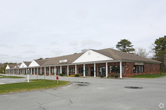

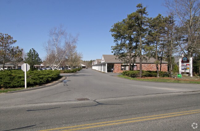
Property Detail
331 Cotuit Rd
SAND-000022-000185
Barnstable
Commercialnec
Massachusetts
BUSINE
8.13 AC
B and X Area of moderate flood hazard, usually the area between the limits of the 100-year and 500-year floods.
Cape Cod
2025
Other Market Areas
2025
Barnstable Town, MA
013600
NEARBY LISTINGS FOR SALE OR LEASE
-
-
View all Sandwich listings for lease on LoopNet.com
DEMOGRAPHICS near 331 Cotuit Rd
1 mile
3 mile
5 mile
2025 Total Population
1,760
10,898
24,824
2030 Population
1,653
10,308
23,662
Pop Growth 2025-2030
(6.08%)
(5.41%)
(4.68%)
Average Age
44
45
47
2025 Total Households
649
4,071
9,778
HH Growth 2025-2030
(6.47%)
(5.80%)
(5.04%)
Median Household Inc
$108,742
$116,092
$109,741
Avg Household Size
2.70
2.60
2.50
2025 Avg HH Vehicles
2.00
2.00
2.00
Median Home Value
$502,669
$590,201
$611,642
Median Year Built
1986
1986
1984
Nearby Places
Map Layers
Map Styles
 Street
 Aerial
Layers
 Traffic
 Biking
Places
Listings with unknown addresses are not visible on the map
- Restaurants
- Banks
- Shops
- Fitness
- Groceries
PUBLIC TRANSPORTATION
COMMUTER RAIL
Bourne (CapeFLYER - Cape Cod Regional Transit Authority)
Drive
Walk
Distance
Bourne (CapeFLYER - Cape Cod Regional Transit Authority)
19 min
9.9 mi
AIRPORT
Martha's Vineyard
Drive
Walk
Distance
Martha's Vineyard
100 min
33.9 mi
Freight Ports
Port of New Bedford Harbor
Drive
Walk
Distance
Port of New Bedford Harbor
54 min
37.6 mi
SALE & LEASE HISTORY
LISTING DATE
SALE/LEASE

May 14, 2018
For Lease
Aug 30, 2019
For Lease
Nearby Properties
Address
Land Use
TOTAL SIZE
Lot Size
Zoning
Address
Land Use
TOTAL SIZE
Lot Size
Zoning
270,790 SF
62.90 AC
R-2
Address
Land Use
TOTAL SIZE
Lot Size
Zoning
125,550 SF
45.57 AC
RIDGE
Address
Land Use
TOTAL SIZE
Lot Size
Zoning
128,833 SF
77.46 AC
RIDGE
Address
Land Use
TOTAL SIZE
Lot Size
Zoning
73.40 AC
R-2
Address
Land Use
TOTAL SIZE
Lot Size
Zoning
8,000 SF
256.70 AC
RIDGE
Address
Land Use
TOTAL SIZE
Lot Size
Zoning
47.35 AC
R-2
Address
Land Use
TOTAL SIZE
Lot Size
Zoning
12.60 AC
BUSINE
Address
Land Use
TOTAL SIZE
Lot Size
Zoning
46.68 AC
R-1
Address
Land Use
TOTAL SIZE
Lot Size
Zoning
38.35 AC
RIDGE
Address
Land Use
TOTAL SIZE
Lot Size
Zoning
7,241 SF
209.72 AC
GD
Address
Land Use
TOTAL SIZE
Lot Size
Zoning
5,466 SF
131.61 AC
R-2
Address
Land Use
TOTAL SIZE
Lot Size
Zoning
40,968 SF
9 AC
RIDGE
Address
Land Use
TOTAL SIZE
Lot Size
Zoning
14,704 SF
Address
Land Use
TOTAL SIZE
Lot Size
Zoning
7,513 SF
168.71 AC
R-2
Address
Land Use
TOTAL SIZE
Lot Size
Zoning
54,044 SF
8.61 AC
BUSINE
Address
Land Use
TOTAL SIZE
Lot Size
Zoning
83.01 AC
R-2
Address
Land Use
TOTAL SIZE
Lot Size
Zoning
10 AC
BUSINE
Address
Land Use
TOTAL SIZE
Lot Size
Zoning
60,820 SF
9.11 AC
FLEX
Address
Land Use
TOTAL SIZE
Lot Size
Zoning
23,621 SF
R-2
Address
Land Use
TOTAL SIZE
Lot Size
Zoning
4.25 AC
BUSINE
Address
Land Use
TOTAL SIZE
Lot Size
Zoning
136.85 AC
R-2
Address
Land Use
TOTAL SIZE
Lot Size
Zoning
95.35 AC
RIDGE
Address
Land Use
TOTAL SIZE
Lot Size
Zoning
1,673 SF
75.20 AC
R-2
Address
Land Use
TOTAL SIZE
Lot Size
Zoning
231 SF
50.83 AC
R-2
Address
Land Use
TOTAL SIZE
Lot Size
Zoning
6.77 AC
Address
Land Use
TOTAL SIZE
Lot Size
Zoning
12,912 SF
1.81 AC
BUSINE
Address
Land Use
TOTAL SIZE
Lot Size
Zoning
16,344 SF
Address
Land Use
TOTAL SIZE
Lot Size
Zoning
3 AC
BUSINE
Address
Land Use
TOTAL SIZE
Lot Size
Zoning
3.32 AC
FLEX
The World's #1 Commercial Real Estate Marketplace
Connect with us
© 2026 CoStar Group
The information above has been obtained from sources believed reliable. While we do not doubt its accuracy we have not verified it and make no guarantee, warranty or representation about it. It is your responsibility to independently confirm its accuracy and completeness. Any projections, opinions, assumptions, or estimates used are for example only and do not represent the current or future performance of the property. The value of this transaction to you depends on tax and other factors which should be evaluated by your tax, financial, and legal advisors. You and your advisors should conduct a careful, independent investigation of the property to determine to your satisfaction the suitability of the property for your needs.