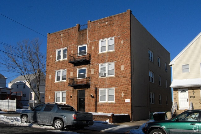
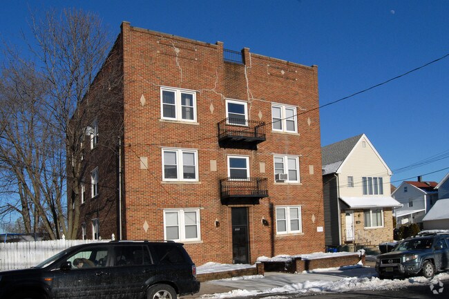
Property Record
331 Fern Ave, Lyndhurst, NJ 07071
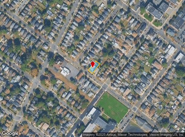
NEARBY LISTINGS FOR SALE OR LEASE
Property Detail
331 Fern Ave
32-00069-0000-00023
X
Apartment
Bergen
X
New Jersey
34003C0245H
23
2024
0.13 AC
2025
Greater Bergen County
031200
Northern New Jersey
5,928 SF
New York-Jersey City-White Plains, NY-NJ
DEMOGRAPHICS near 331 Fern Ave
1 Mile
3 Mile
5 Mile
2024 Total Population
27,773
186,065
575,022
2029 Population
27,022
180,748
557,170
Pop Growth 2024-2029
(2.70%)
(2.86%)
(3.10%)
Average Age
42
40
39
2024 Total Households
11,032
69,068
209,980
HH Growth 2024-2029
(2.82%)
(3.05%)
(3.23%)
Median Household Inc
$97,239
$90,364
$77,051
Avg Household Size
2.50
2.60
2.60
2024 Avg HH Vehicles
2.00
2.00
2.00
Median Home Value
$450,046
$425,180
$431,254
Median Year Built
1955
1951
1953
Nearby Places
Map Layers
Map Styles
 Street
 Aerial
- Restaurants
- Banks
- Shops
- Fitness
- Groceries
PUBLIC TRANSPORTATION
COMMUTER RAIL
Lyndhurst (Main/Port Jervis Line - NJ Transit Commuter Rail (NJ Transit))
DRIVE
WALK
Distance
Lyndhurst (Main/Port Jervis Line - NJ Transit Commuter Rail (NJ Transit))
2 min
10 min
0.5 mi
Kingsland (Main/Port Jervis Line - NJ Transit Commuter Rail (NJ Transit))
DRIVE
WALK
Distance
Kingsland (Main/Port Jervis Line - NJ Transit Commuter Rail (NJ Transit))
2 min
13 min
0.7 mi
AIRPORT
Newark Liberty International
DRIVE
WALK
Distance
Newark Liberty International
17 min
12.8 mi
LaGuardia
DRIVE
WALK
Distance
LaGuardia
37 min
19.3 mi
John F Kennedy International
DRIVE
WALK
Distance
John F Kennedy International
45 min
27.4 mi
Freight Ports
Port Newark Container Terminal
DRIVE
WALK
Distance
Port Newark Container Terminal
22 min
11.8 mi
Nearby Properties
Address
Land Use
TOTAL SIZE
Lot Size
Zoning
Address
Land Use
TOTAL SIZE
Lot Size
Zoning
Address
Land Use
TOTAL SIZE
Lot Size
Zoning
Address
Land Use
TOTAL SIZE
Lot Size
Zoning
4,014 SF
21 AC
Address
Land Use
TOTAL SIZE
Lot Size
Zoning
612 AC
SEA
Address
Land Use
TOTAL SIZE
Lot Size
Zoning
9.57 AC
I2
Address
Land Use
TOTAL SIZE
Lot Size
Zoning
3,956 SF
250 AC
C2
Address
Land Use
TOTAL SIZE
Lot Size
Zoning
2,500 SF
43.35 AC
Address
Land Use
TOTAL SIZE
Lot Size
Zoning
Address
Land Use
TOTAL SIZE
Lot Size
Zoning
602,220 SF
25.91 AC
Address
Land Use
TOTAL SIZE
Lot Size
Zoning
5.80 AC
CGI
Address
Land Use
TOTAL SIZE
Lot Size
Zoning
416,340 SF
10.49 AC
Address
Land Use
TOTAL SIZE
Lot Size
Zoning
8.88 AC
ORD
Address
Land Use
TOTAL SIZE
Lot Size
Zoning
1,218 SF
41.30 AC
RB
Address
Land Use
TOTAL SIZE
Lot Size
Zoning
100,014 SF
8.80 AC
M2
Address
Land Use
TOTAL SIZE
Lot Size
Zoning
1.12 AC
M-O
Address
Land Use
TOTAL SIZE
Lot Size
Zoning
4.80 AC
Address
Land Use
TOTAL SIZE
Lot Size
Zoning
Address
Land Use
TOTAL SIZE
Lot Size
Zoning
275,260 SF
11.88 AC
Address
Land Use
TOTAL SIZE
Lot Size
Zoning
144,024 SF
1 AC
LM
Address
Land Use
TOTAL SIZE
Lot Size
Zoning
24.29 AC
Address
Land Use
TOTAL SIZE
Lot Size
Zoning
71,634 SF
12.31 AC
M1
Address
Land Use
TOTAL SIZE
Lot Size
Zoning
87,032 SF
6.67 AC
Address
Land Use
TOTAL SIZE
Lot Size
Zoning
860 SF
0.96 AC
R100
Address
Land Use
TOTAL SIZE
Lot Size
Zoning
267,069 SF
6.15 AC
Address
Land Use
TOTAL SIZE
Lot Size
Zoning
Address
Land Use
TOTAL SIZE
Lot Size
Zoning
11.30 AC
Address
Land Use
TOTAL SIZE
Lot Size
Zoning
150,018 SF
4.17 AC
B
Address
Land Use
TOTAL SIZE
Lot Size
Zoning
7.65 AC
Address
Land Use
TOTAL SIZE
Lot Size
Zoning
329,464 SF
15.82 AC
Address
Land Use
TOTAL SIZE
Lot Size
Zoning
9.98 AC
R-1
The World's #1 Commercial Real Estate Marketplace
Connect with us
© 2025 CoStar Group
The information above has been obtained from sources believed reliable. While we do not doubt its accuracy we have not verified it and make no guarantee, warranty or representation about it. It is your responsibility to independently confirm its accuracy and completeness. Any projections, opinions, assumptions, or estimates used are for example only and do not represent the current or future performance of the property. The value of this transaction to you depends on tax and other factors which should be evaluated by your tax, financial, and legal advisors. You and your advisors should conduct a careful, independent investigation of the property to determine to your satisfaction the suitability of the property for your needs.