Property Record
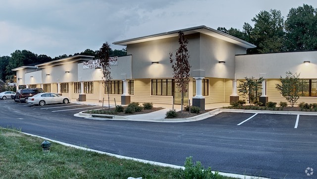
331 Gambrills Rd, Gambrills, MD 21054


Property Detail
331 Gambrills Rd
04-000-90052348
LT 1 KAUFMAN EDWARD PROP
Regionalshoppingcenterormallwithanchorstore
Anne Arundel
C3
Maryland
B and X Area of moderate flood hazard, usually the area between the limits of the 100-year and 500-year floods.
1
2024
2.27 AC
2025
I-97/Crain Hwy Corridor
740800
Baltimore
26,200 SF
Baltimore-Columbia-Towson, MD
NEARBY LISTINGS FOR SALE OR LEASE
DEMOGRAPHICS near 331 Gambrills Rd
1 mile
3 mile
5 mile
2025 Total Population
1,890
40,891
153,834
2030 Population
1,915
41,113
155,183
Pop Growth 2025-2030
+ 1.32%
+ 0.54%
+ 0.88%
Average Age
42
39
39
2025 Total Households
699
15,386
56,733
HH Growth 2025-2030
+ 1.29%
+ 0.70%
+ 0.92%
Median Household Inc
$133,949
$133,216
$122,220
Avg Household Size
2.70
2.60
2.60
2025 Avg HH Vehicles
2.00
2.00
2.00
Median Home Value
$646,723
$479,956
$479,541
Median Year Built
1985
1994
1990
Nearby Places
Map Layers
Map Styles
 Street
 Aerial
Layers
 Traffic
 Biking
Places
Listings with unknown addresses are not visible on the map
- Restaurants
- Banks
- Shops
- Fitness
- Groceries
PUBLIC TRANSPORTATION
COMMUTER RAIL
Odenton (Penn Line - Maryland Area Regional Commuter Trains (The MARC))
Drive
Walk
Distance
Odenton (Penn Line - Maryland Area Regional Commuter Trains (The MARC))
7 min
2.9 mi
Jessup (Camden Line - Maryland Area Regional Commuter Trains (The MARC))
Drive
Walk
Distance
Jessup (Camden Line - Maryland Area Regional Commuter Trains (The MARC))
19 min
9.1 mi
AIRPORT
Baltimore/Washington International Thurgood Marshall
Drive
Walk
Distance
Baltimore/Washington International Thurgood Marshall
21 min
11.0 mi
Ronald Reagan Washington Ntl
Drive
Walk
Distance
Ronald Reagan Washington Ntl
51 min
32.4 mi
Freight Ports
Port of Baltimore
Drive
Walk
Distance
Port of Baltimore
29 min
17.1 mi
SALE & LEASE HISTORY
LISTING DATE
SALE/LEASE

Sep 25, 2016
For Lease
Sep 24, 2016
For Sale
Jan 06, 2026
For Lease
Aug 10, 2017
For Lease
Apr 13, 2020
For Lease
Nearby Properties
Address
Land Use
TOTAL SIZE
Lot Size
Zoning
Address
Land Use
TOTAL SIZE
Lot Size
Zoning
472,057 SF
15.16 AC
OCOR
Address
Land Use
TOTAL SIZE
Lot Size
Zoning
360,354 SF
7.36 AC
MXD-C
Address
Land Use
TOTAL SIZE
Lot Size
Zoning
432,928 SF
6.33 AC
O-COR
Address
Land Use
TOTAL SIZE
Lot Size
Zoning
14.65 AC
R15
Address
Land Use
TOTAL SIZE
Lot Size
Zoning
499,471 SF
10.10 AC
O-COR
Address
Land Use
TOTAL SIZE
Lot Size
Zoning
311,870 SF
10.03 AC
Address
Land Use
TOTAL SIZE
Lot Size
Zoning
237,377 SF
9.86 AC
R15
Address
Land Use
TOTAL SIZE
Lot Size
Zoning
265,645 SF
12.79 AC
R15
Address
Land Use
TOTAL SIZE
Lot Size
Zoning
125.95 AC
R5
Address
Land Use
TOTAL SIZE
Lot Size
Zoning
185,440 SF
3.53 AC
W2
Address
Land Use
TOTAL SIZE
Lot Size
Zoning
155,269 SF
13.27 AC
O-EOD
Address
Land Use
TOTAL SIZE
Lot Size
Zoning
342,464 SF
22.95 AC
O-IND
Address
Land Use
TOTAL SIZE
Lot Size
Zoning
37,320 SF
18.76 AC
O-COR
Address
Land Use
TOTAL SIZE
Lot Size
Zoning
43,842 SF
27.74 AC
C4
Address
Land Use
TOTAL SIZE
Lot Size
Zoning
10.95 AC
O-EOD
Address
Land Use
TOTAL SIZE
Lot Size
Zoning
128,466 SF
18.70 AC
W1
Address
Land Use
TOTAL SIZE
Lot Size
Zoning
134,923 SF
8.35 AC
MXD-C
Address
Land Use
TOTAL SIZE
Lot Size
Zoning
86,496 SF
6.86 AC
R5
Address
Land Use
TOTAL SIZE
Lot Size
Zoning
112,028 SF
40.41 AC
R1
Address
Land Use
TOTAL SIZE
Lot Size
Zoning
63,000 SF
22.90 AC
R1
Address
Land Use
TOTAL SIZE
Lot Size
Zoning
98,109 SF
5.33 AC
C2
Address
Land Use
TOTAL SIZE
Lot Size
Zoning
29,161 SF
3.98 AC
MXD-C
Address
Land Use
TOTAL SIZE
Lot Size
Zoning
87,878 SF
3.91 AC
C4
Address
Land Use
TOTAL SIZE
Lot Size
Zoning
58,512 SF
3.91 AC
O-EOD
Address
Land Use
TOTAL SIZE
Lot Size
Zoning
78,930 SF
9.24 AC
R5
Address
Land Use
TOTAL SIZE
Lot Size
Zoning
74,054 SF
1.40 AC
R1
Address
Land Use
TOTAL SIZE
Lot Size
Zoning
67,727 SF
4.65 AC
C4
Address
Land Use
TOTAL SIZE
Lot Size
Zoning
48,979 SF
1.64 AC
R1
Address
Land Use
TOTAL SIZE
Lot Size
Zoning
220,680 SF
14.26 AC
O-IND
Address
Land Use
TOTAL SIZE
Lot Size
Zoning
208,000 SF
13.86 AC
W2
The World's #1 Commercial Real Estate Marketplace
Connect with us
© 2026 CoStar Group
The information above has been obtained from sources believed reliable. While we do not doubt its accuracy we have not verified it and make no guarantee, warranty or representation about it. It is your responsibility to independently confirm its accuracy and completeness. Any projections, opinions, assumptions, or estimates used are for example only and do not represent the current or future performance of the property. The value of this transaction to you depends on tax and other factors which should be evaluated by your tax, financial, and legal advisors. You and your advisors should conduct a careful, independent investigation of the property to determine to your satisfaction the suitability of the property for your needs.