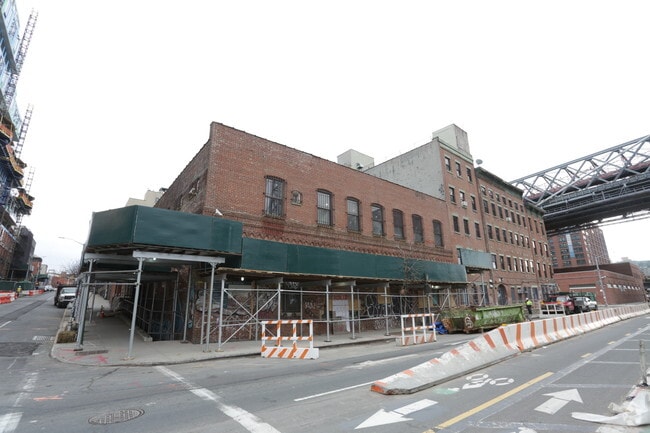
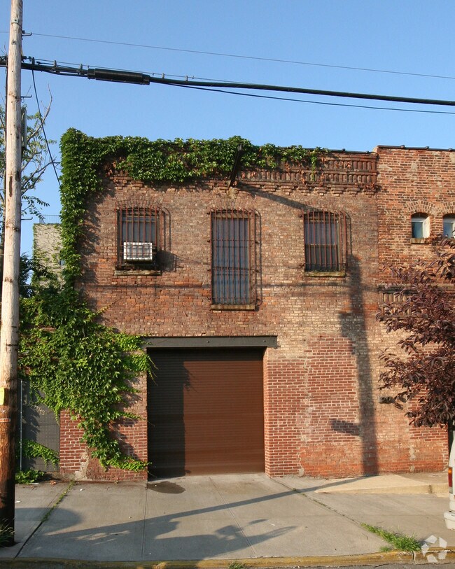
Property Record
331 Kent Ave, Brooklyn, NY 11249


Save to a Folder
{{folder.Name}}
{{folder.ListingIds.length}} Properties
{{folder.ListingIds.length}} Property
Create a New Folder
Property Detail
331 Kent Ave
02441-0008
DOCID-2022033000629001
Storebuilding
KINGS
M12R6
New York
B and X Area of moderate flood hazard, usually the area between the limits of the 100-year and 500-year floods.
8
2025
0.15 AC
2026
North Brooklyn
055100
Long Island (New York)
17,066 SF
New York-Jersey City-White Plains, NY-NJ
NEARBY LISTINGS FOR SALE OR LEASE
DEMOGRAPHICS near 331 Kent Ave
1 mile
3 mile
5 mile
2025 Total Population
148,399
1,365,476
3,128,018
2030 Population
152,812
1,406,102
3,200,738
Pop Growth 2025-2030
+ 2.97%
+ 2.98%
+ 2.32%
Average Age
37
38
39
2025 Total Households
60,936
617,218
1,366,064
HH Growth 2025-2030
+ 3.14%
+ 3.19%
+ 2.72%
Median Household Inc
$83,789
$118,731
$107,151
Avg Household Size
2.30
2.10
2.20
2025 Avg HH Vehicles
.00
.00
.00
Median Home Value
$941,215
$1,027,938
$979,259
Median Year Built
1964
1952
1953
Nearby Places
Map Layers
Map Styles
 Street
 Aerial
Layers
 Traffic
 Biking
Places
Listings with unknown addresses are not visible on the map
- Restaurants
- Banks
- Shops
- Fitness
- Groceries
Nearby Properties
Address
Land Use
TOTAL SIZE
Lot Size
Zoning
Address
Land Use
TOTAL SIZE
Lot Size
Zoning
8,462,176 SF
61.41 AC
R7-2
Address
Land Use
TOTAL SIZE
Lot Size
Zoning
940,000 SF
1.44 AC
C6-2
Address
Land Use
TOTAL SIZE
Lot Size
Zoning
2,161,994 SF
3.79 AC
M1-5
Address
Land Use
TOTAL SIZE
Lot Size
Zoning
1,678,135 SF
1.01 AC
C5-3
Address
Land Use
TOTAL SIZE
Lot Size
Zoning
2,354,289 SF
3.96 AC
C6-4
Address
Land Use
TOTAL SIZE
Lot Size
Zoning
2,812,739 SF
2.10 AC
C5-3
Address
Land Use
TOTAL SIZE
Lot Size
Zoning
1,048,620 SF
5.67 AC
C6-4
Address
Land Use
TOTAL SIZE
Lot Size
Zoning
1,586,876 SF
1.87 AC
C5-3
Address
Land Use
TOTAL SIZE
Lot Size
Zoning
2,535,958 SF
2.94 AC
C6-4
Address
Land Use
TOTAL SIZE
Lot Size
Zoning
2,157,862 SF
2.23 AC
BPC
Address
Land Use
TOTAL SIZE
Lot Size
Zoning
2,255,659 SF
4.58 AC
BPC
Address
Land Use
TOTAL SIZE
Lot Size
Zoning
2,400,000 SF
15.14 AC
C5-2
Address
Land Use
TOTAL SIZE
Lot Size
Zoning
1,009,855 SF
4.90 AC
C6-3
Address
Land Use
TOTAL SIZE
Lot Size
Zoning
1,104,184 SF
1.12 AC
C5-5
Address
Land Use
TOTAL SIZE
Lot Size
Zoning
2,124,441 SF
17.29 AC
R8
Address
Land Use
TOTAL SIZE
Lot Size
Zoning
1,233,394 SF
1.78 AC
C5-3
Address
Land Use
TOTAL SIZE
Lot Size
Zoning
1,009,855 SF
3.25 AC
C6-3
Address
Land Use
TOTAL SIZE
Lot Size
Zoning
2,233,692 SF
1.90 AC
BPC
Address
Land Use
TOTAL SIZE
Lot Size
Zoning
1,134,017 SF
1.05 AC
C5-3
Address
Land Use
TOTAL SIZE
Lot Size
Zoning
1,104,505 SF
2.32 AC
C4-7
Address
Land Use
TOTAL SIZE
Lot Size
Zoning
1,560,607 SF
2.69 AC
C6-6
Address
Land Use
TOTAL SIZE
Lot Size
Zoning
916,553 SF
1.39 AC
C5-3
Address
Land Use
TOTAL SIZE
Lot Size
Zoning
1,636,000 SF
1.09 AC
C6-4
Address
Land Use
TOTAL SIZE
Lot Size
Zoning
1,909,502 SF
2.37 AC
BPC
Address
Land Use
TOTAL SIZE
Lot Size
Zoning
1,174,988 SF
0.99 AC
C5-3
Address
Land Use
TOTAL SIZE
Lot Size
Zoning
1,050,990 SF
1.21 AC
C52.5
Address
Land Use
TOTAL SIZE
Lot Size
Zoning
7,058,736 SF
147.61 AC
M3-1
Address
Land Use
TOTAL SIZE
Lot Size
Zoning
910,736 SF
1.44 AC
C6-2
Address
Land Use
TOTAL SIZE
Lot Size
Zoning
693,256 SF
1.18 AC
C5-3
Address
Land Use
TOTAL SIZE
Lot Size
Zoning
802,000 SF
1.20 AC
C62A
The World's #1 Commercial Real Estate Marketplace
Connect with us
© 2026 CoStar Group
The information above has been obtained from sources believed reliable. While we do not doubt its accuracy we have not verified it and make no guarantee, warranty or representation about it. It is your responsibility to independently confirm its accuracy and completeness. Any projections, opinions, assumptions, or estimates used are for example only and do not represent the current or future performance of the property. The value of this transaction to you depends on tax and other factors which should be evaluated by your tax, financial, and legal advisors. You and your advisors should conduct a careful, independent investigation of the property to determine to your satisfaction the suitability of the property for your needs.